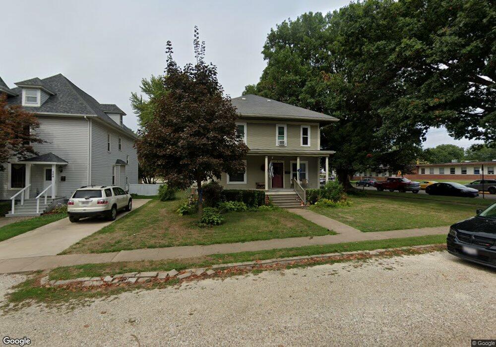
306 N Swarts Ave Abingdon, IL 61410
Estimated Value: $127,000 - $157,663
--
Bed
--
Bath
2,214
Sq Ft
$65/Sq Ft
Est. Value
About This Home
This home is located at 306 N Swarts Ave, Abingdon, IL 61410 and is currently estimated at $142,916, approximately $64 per square foot. 306 N Swarts Ave is a home located in Knox County with nearby schools including Hedding Grade School, Avon Elementary School, and Abingdon-Avon Middle School.
Ownership History
Date
Name
Owned For
Owner Type
Purchase Details
Closed on
Apr 8, 2016
Sold by
Stegall Roger H and Stegall Annette M
Bought by
Haase Aaron R
Current Estimated Value
Home Financials for this Owner
Home Financials are based on the most recent Mortgage that was taken out on this home.
Original Mortgage
$97,375
Outstanding Balance
$77,206
Interest Rate
3.62%
Mortgage Type
New Conventional
Estimated Equity
$65,710
Create a Home Valuation Report for This Property
The Home Valuation Report is an in-depth analysis detailing your home's value as well as a comparison with similar homes in the area
Home Values in the Area
Average Home Value in this Area
Purchase History
| Date | Buyer | Sale Price | Title Company |
|---|---|---|---|
| Haase Aaron R | $102,167 | Attorney Only |
Source: Public Records
Mortgage History
| Date | Status | Borrower | Loan Amount |
|---|---|---|---|
| Open | Haase Aaron R | $97,375 |
Source: Public Records
Tax History Compared to Growth
Tax History
| Year | Tax Paid | Tax Assessment Tax Assessment Total Assessment is a certain percentage of the fair market value that is determined by local assessors to be the total taxable value of land and additions on the property. | Land | Improvement |
|---|---|---|---|---|
| 2024 | $3,255 | $45,940 | $2,560 | $43,380 |
| 2023 | $3,255 | $41,460 | $2,310 | $39,150 |
| 2022 | $2,938 | $39,410 | $2,200 | $37,210 |
| 2021 | $2,863 | $37,900 | $2,120 | $35,780 |
| 2020 | $2,745 | $36,440 | $2,040 | $34,400 |
| 2019 | $2,817 | $36,080 | $2,020 | $34,060 |
| 2018 | $2,724 | $35,030 | $1,960 | $33,070 |
| 2017 | $2,688 | $34,340 | $1,920 | $32,420 |
| 2015 | -- | $22,010 | $1,880 | $20,130 |
| 2013 | $929 | $21,790 | $1,860 | $19,930 |
Source: Public Records
Map
Nearby Homes
- 103 N Swarts St
- 500 N Monroe St
- 108 W Jackson St
- 407 W Martin St
- 106 E Jackson St
- 204 S Washington St
- 214 S Main St
- 204 E Adams St
- 306 N Harshbarger St
- 405 W Memorial Dr
- 206 W Lower St
- 704 N Cherry St
- 211 S Froelich Ln
- 205 N Austin Ave
- 103 W Givens St
- 403 1/2 E Jared St
- 369 Knox Highway 23
- 1196 160th St
- 1077 Knox Road 500 E
- 572 Knox Highway 26
- 304 N Swarts Ave
- 302 N Swarts Ave
- 406 W Latimer St
- 300 N Swarts Ave
- 408 W Latimer St
- 303 N Pennsylvania St
- 308 W Latimer St
- 305 N Swarts Ave
- 409 W Pearl St
- 303 N Swarts Ave
- 309 W Pearl St
- 301 N Pennsylvania St
- 307 W Pearl St
- 206 N Swarts Ave
- 206 N Swarts St
- 207 N Pennsylvania St
- 400 N Pennsylvania St
- 306 N Monroe St
- 500 W Latimer St
- 306 N Pennsylvania St