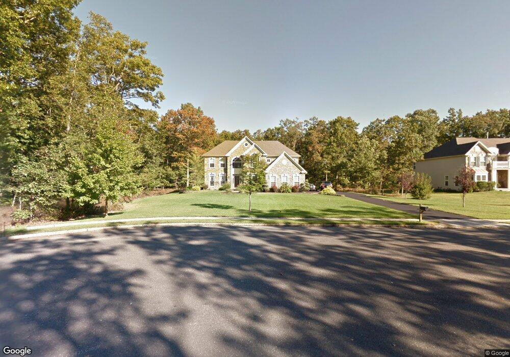
306 Pear Tree Ct Franklinville, NJ 08322
Franklin Township NeighborhoodEstimated Value: $460,000 - $701,000
--
Bed
--
Bath
3,592
Sq Ft
$172/Sq Ft
Est. Value
About This Home
This home is located at 306 Pear Tree Ct, Franklinville, NJ 08322 and is currently estimated at $618,843, approximately $172 per square foot. 306 Pear Tree Ct is a home located in Gloucester County with nearby schools including Delsea Regional Middle School and Delsea Regional High School.
Ownership History
Date
Name
Owned For
Owner Type
Purchase Details
Closed on
Oct 31, 2007
Sold by
Richmond American Homes Pennsylvania Inc
Bought by
Sparks Patrick M and Sparks Mary Ann
Current Estimated Value
Home Financials for this Owner
Home Financials are based on the most recent Mortgage that was taken out on this home.
Original Mortgage
$285,000
Outstanding Balance
$180,601
Interest Rate
6.41%
Mortgage Type
Purchase Money Mortgage
Estimated Equity
$438,242
Create a Home Valuation Report for This Property
The Home Valuation Report is an in-depth analysis detailing your home's value as well as a comparison with similar homes in the area
Home Values in the Area
Average Home Value in this Area
Purchase History
| Date | Buyer | Sale Price | Title Company |
|---|---|---|---|
| Sparks Patrick M | $552,810 | Title America Agency Corp |
Source: Public Records
Mortgage History
| Date | Status | Borrower | Loan Amount |
|---|---|---|---|
| Open | Sparks Patrick M | $285,000 |
Source: Public Records
Tax History Compared to Growth
Tax History
| Year | Tax Paid | Tax Assessment Tax Assessment Total Assessment is a certain percentage of the fair market value that is determined by local assessors to be the total taxable value of land and additions on the property. | Land | Improvement |
|---|---|---|---|---|
| 2025 | $14,550 | $384,400 | $50,100 | $334,300 |
| 2024 | $13,376 | $384,400 | $50,100 | $334,300 |
| 2023 | $13,376 | $362,900 | $50,100 | $312,800 |
| 2022 | $13,028 | $362,900 | $50,100 | $312,800 |
| 2021 | $12,847 | $362,900 | $50,100 | $312,800 |
| 2020 | $12,709 | $362,900 | $50,100 | $312,800 |
| 2019 | $12,542 | $362,900 | $50,100 | $312,800 |
| 2018 | $12,375 | $362,900 | $50,100 | $312,800 |
| 2017 | $12,082 | $361,100 | $50,100 | $311,000 |
| 2016 | $12,028 | $361,100 | $50,100 | $311,000 |
| 2015 | $11,544 | $361,100 | $50,100 | $311,000 |
| 2014 | $11,115 | $361,100 | $50,100 | $311,000 |
Source: Public Records
Map
Nearby Homes
- 2323 Sheridan Ave
- 3653 Tuckahoe Rd
- 0 Tuckahoe & Coles Mill Rd
- 2243 Stanton Ave
- 3292 Tuckahoe Rd
- 0 E Grant Ave
- 18 Crysta Ct
- 3050 Tuckahoe Rd
- 61 Howard Ave
- 4516 Tuckahoe Rd
- 2803 Tuckahoe Rd
- 1606 Marshall Mill Rd
- 3060 Williamstown Rd
- 148 Trimmel Ave
- 1503 Marshall Mill Rd
- 893 Fries Mill Rd
- 0 Fries Mill Rd
- 0 Marshall Mill Rd Back
- 236 S Tuckahoe Rd
- 664 Scotland Run Ave
- 304 Pear Tree Ct
- 302 Pear Tree Ct
- 212 Cherry Tree Ct
- 210 Cherry Tree Ct
- 128 Stephanie Dr
- 142 Stephanie Dr
- 114 Stephanie Dr
- 3051 Coles Mill Rd
- 100 Stephanie Dr
- 156 Stephanie Dr
- 214 Cherry Tree Ct
- 208 Cherry Tree Ct
- 170 Stephanie Ct
- 211 Cherry Tree Ct
- 206 Cherry Tree Ct
- 184 Stephanie Ct
- 6 Kirsten Dr
- 209 Cherry Tree Ct
- 213 Cherry Tree Ct
- 88 Stephanie Dr