Estimated Value: $627,000 - $778,000
3
Beds
2
Baths
1,492
Sq Ft
$453/Sq Ft
Est. Value
About This Home
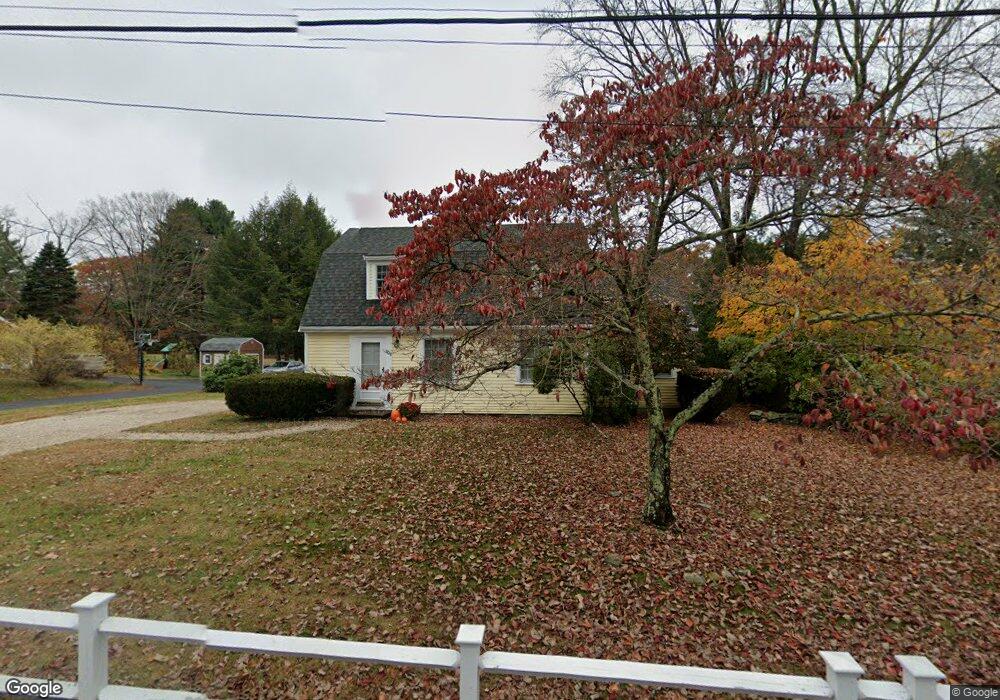
This home is located at 306 Red Acre Rd, Stow, MA 01775 and is currently estimated at $676,010, approximately $453 per square foot. 306 Red Acre Rd is a home located in Middlesex County with nearby schools including Center School, Hale Middle School, and Nashoba Regional High School.
Ownership History
Date
Name
Owned For
Owner Type
Purchase Details
Closed on
May 13, 2004
Sold by
Ahlquist David A and Ahlquist Julia A
Bought by
Straface Gregory R and Riordon Megan E
Current Estimated Value
Home Financials for this Owner
Home Financials are based on the most recent Mortgage that was taken out on this home.
Original Mortgage
$333,675
Outstanding Balance
$156,116
Interest Rate
5.47%
Mortgage Type
Purchase Money Mortgage
Estimated Equity
$519,894
Purchase Details
Closed on
Jul 24, 1998
Sold by
Downing Michael A and Dearborn Dawn A
Bought by
Ahlquist David A and Santo Julie A
Home Financials for this Owner
Home Financials are based on the most recent Mortgage that was taken out on this home.
Original Mortgage
$209,000
Interest Rate
6.99%
Mortgage Type
Purchase Money Mortgage
Purchase Details
Closed on
Nov 27, 1991
Sold by
Hallowell David S and Hallowell Robbin M
Bought by
Downing Michael A and Dearborn Dawn A
Create a Home Valuation Report for This Property
The Home Valuation Report is an in-depth analysis detailing your home's value as well as a comparison with similar homes in the area
Home Values in the Area
Average Home Value in this Area
Purchase History
| Date | Buyer | Sale Price | Title Company |
|---|---|---|---|
| Straface Gregory R | $435,000 | -- | |
| Ahlquist David A | $249,000 | -- | |
| Downing Michael A | $187,500 | -- |
Source: Public Records
Mortgage History
| Date | Status | Borrower | Loan Amount |
|---|---|---|---|
| Open | Straface Gregory R | $333,675 | |
| Previous Owner | Downing Michael A | $209,000 | |
| Previous Owner | Downing Michael A | $150,000 | |
| Previous Owner | Downing Michael A | $150,000 |
Source: Public Records
Tax History Compared to Growth
Tax History
| Year | Tax Paid | Tax Assessment Tax Assessment Total Assessment is a certain percentage of the fair market value that is determined by local assessors to be the total taxable value of land and additions on the property. | Land | Improvement |
|---|---|---|---|---|
| 2025 | $9,196 | $527,900 | $321,000 | $206,900 |
| 2024 | $8,867 | $522,500 | $309,600 | $212,900 |
| 2023 | $9,794 | $540,200 | $295,500 | $244,700 |
| 2022 | $8,454 | $432,200 | $246,300 | $185,900 |
| 2021 | $8,400 | $420,400 | $246,300 | $174,100 |
| 2020 | $8,108 | $393,400 | $223,400 | $170,000 |
| 2019 | $7,933 | $394,100 | $223,400 | $170,700 |
| 2018 | $7,704 | $367,200 | $223,400 | $143,800 |
| 2017 | $7,165 | $348,000 | $210,300 | $137,700 |
| 2016 | $7,149 | $357,800 | $210,300 | $147,500 |
| 2015 | $6,861 | $343,400 | $191,100 | $152,300 |
Source: Public Records
Map
Nearby Homes
- 79 Robbins St
- 4 Loring Ave
- 25 Main St
- 5 Main St
- 19 Marble Farm Rd Unit 19
- 154 Summer St
- 35 Faulkner Hill Rd
- 19 Railroad St Unit B1
- 19 Railroad St Unit B2
- 19 Railroad St Unit E2
- 84 Central St
- 131 Main St
- 129 Main St
- 129 Main St Unit 129
- 32 Howard Rd
- 40 High St
- 8 Macleod Ln
- 4,7,8 Crestwood Ln
- 49 Summer Hill Rd
- 21 Linden St Unit 21
- 312 Red Acre Rd
- 302 Red Acre Rd
- 303 Red Acre Rd
- 309 Red Acre Rd
- 316 Red Acre Rd
- 313 Red Acre Rd
- 296 Red Acre Rd
- 288 Red Acre Rd
- 284 Red Acre Rd
- 334 Red Acre Rd
- 333 Red Acre Rd
- 278 Red Acre Rd
- 341 Red Acre Rd
- 87 Liberty St
- 267 Red Acre Rd
- 83 Liberty St
- 85 Liberty St
- 81 Liberty St
- 254 Red Acre Rd
- 86 Liberty St