Estimated Value: $76,357 - $162,000
--
Bed
1
Bath
1,020
Sq Ft
$121/Sq Ft
Est. Value
About This Home
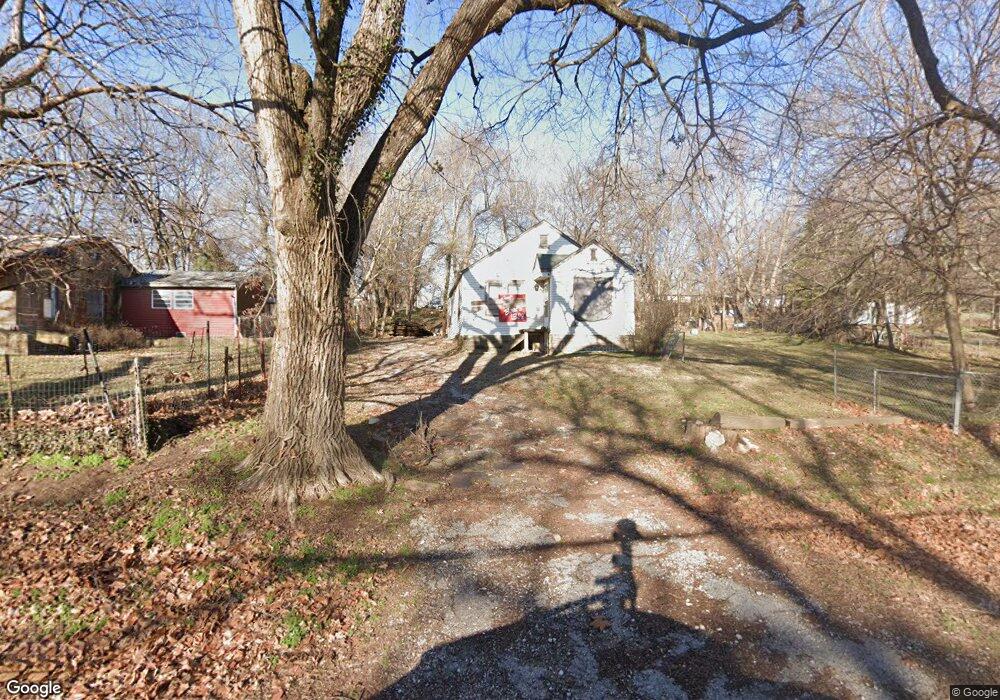
This home is located at 306 S 71st West Ave, Tulsa, OK 74127 and is currently estimated at $123,589, approximately $121 per square foot. 306 S 71st West Ave is a home located in Tulsa County with nearby schools including Northwoods Fine Arts Academy, Garfield STEAM Academy, and Clyde Boyd Middle School.
Ownership History
Date
Name
Owned For
Owner Type
Purchase Details
Closed on
Sep 5, 2025
Sold by
Lopez Jannie
Bought by
Owens Robert
Current Estimated Value
Purchase Details
Closed on
May 18, 2021
Sold by
Phillips Jessie Eugene and Phillips Cynthia Jean
Bought by
Lopez Jannie Sue
Purchase Details
Closed on
Apr 17, 2021
Sold by
Phillips Cassandra Jean and Disney Brent Leon
Bought by
Phillips Jessie Eugene and Phillips Cynthia Jean
Purchase Details
Closed on
Nov 14, 2006
Sold by
Phillips Jessie J
Bought by
Disney Brent Leon and Phillips Cassandra Jean
Home Financials for this Owner
Home Financials are based on the most recent Mortgage that was taken out on this home.
Original Mortgage
$25,000
Interest Rate
3%
Mortgage Type
Seller Take Back
Create a Home Valuation Report for This Property
The Home Valuation Report is an in-depth analysis detailing your home's value as well as a comparison with similar homes in the area
Home Values in the Area
Average Home Value in this Area
Purchase History
| Date | Buyer | Sale Price | Title Company |
|---|---|---|---|
| Owens Robert | $32,000 | None Listed On Document | |
| Lopez Jannie Sue | $5,000 | -- | |
| Phillips Jessie Eugene | -- | None Available | |
| Disney Brent Leon | $25,000 | None Available |
Source: Public Records
Mortgage History
| Date | Status | Borrower | Loan Amount |
|---|---|---|---|
| Previous Owner | Disney Brent Leon | $25,000 |
Source: Public Records
Tax History Compared to Growth
Tax History
| Year | Tax Paid | Tax Assessment Tax Assessment Total Assessment is a certain percentage of the fair market value that is determined by local assessors to be the total taxable value of land and additions on the property. | Land | Improvement |
|---|---|---|---|---|
| 2024 | $326 | $2,860 | $1,579 | $1,281 |
| 2023 | $326 | $2,860 | $1,579 | $1,281 |
| 2022 | $320 | $2,860 | $1,579 | $1,281 |
| 2021 | $312 | $2,750 | $1,518 | $1,232 |
| 2020 | $317 | $2,750 | $1,518 | $1,232 |
| 2019 | $320 | $2,750 | $1,518 | $1,232 |
| 2018 | $318 | $2,750 | $1,518 | $1,232 |
| 2017 | $315 | $2,750 | $1,518 | $1,232 |
| 2016 | $314 | $2,750 | $1,518 | $1,232 |
| 2015 | $316 | $2,750 | $1,518 | $1,232 |
| 2014 | $317 | $2,750 | $1,518 | $1,232 |
Source: Public Records
Map
Nearby Homes
- 302 S 71st West Ave
- 104 S 65th West Ave
- 110 N 70th West Ave
- 30 S 64th Ave W
- 6508 W Cameron St
- 6540 W Edison St
- 5779 W 2nd St
- 5909 W 10th St
- 5677 W 3rd St
- 914 Ivy Ln
- 889 Ivy Ln
- 5330 W 2nd St
- 1601 Holly Ave
- 1539 E Fir Dr
- 1589 Lakeside Ridge Dr
- 1529 S 81st West Ave
- 1409 N 53rd West Ave
- 5134 Charles Page Blvd
- 207 Fairway Cir
- 5128 Charles Page Blvd
- 308 S 71st West Ave
- 304 S 71st West Ave
- 402 S 71st West Ave
- 307 S 71st West Ave
- 311 S 72nd West Ave
- 411 S 72nd West Ave
- 305 S 72nd West Ave
- 309 S 71st West Ave
- 302 S 71st Ave W
- 303 S 71st West Ave
- 303 S 72nd West Ave
- 415 S 72nd West Ave
- 301 S 72nd West Ave
- 407 S 71st West Ave
- 430 S 71st West Ave
- 301 S 71st West Ave
- 501 S 72nd West Ave
- 432 S 71st West Ave
- 402 S 72nd West Ave
- 433 S 71st West Ave