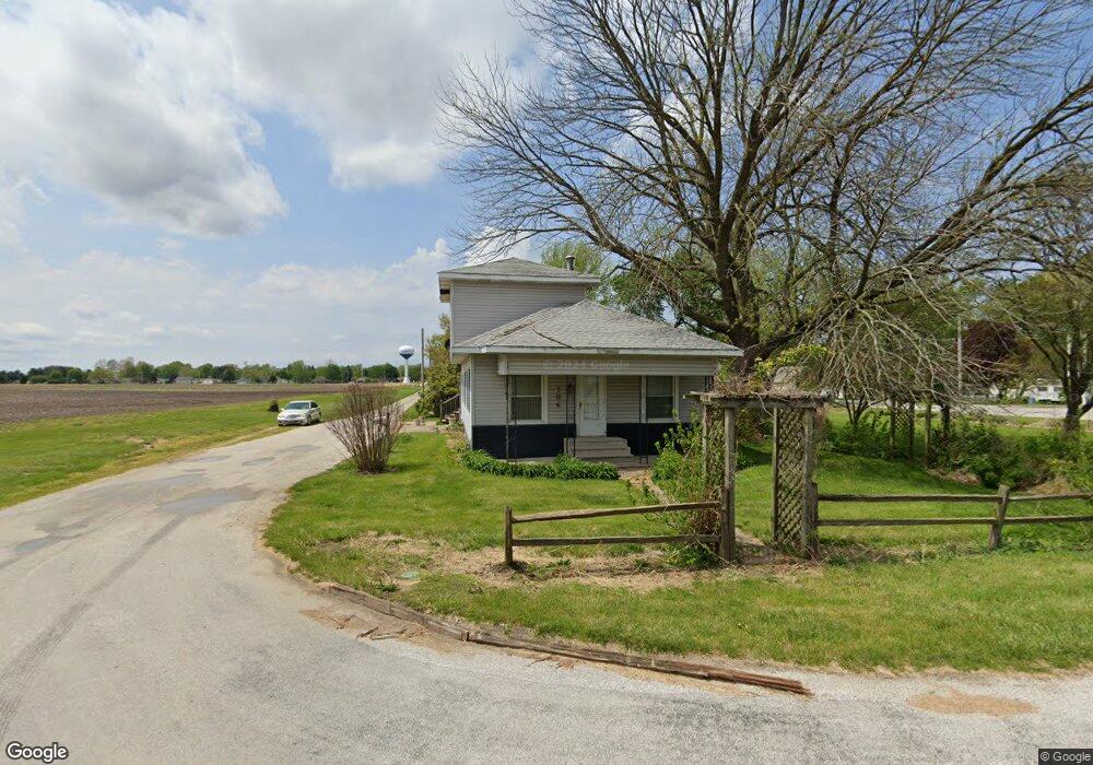
306 S Harris St Auburn, IL 62615
Estimated Value: $123,723 - $169,000
--
Bed
--
Bath
--
Sq Ft
0.38
Acres
About This Home
This home is located at 306 S Harris St, Auburn, IL 62615 and is currently estimated at $148,681. 306 S Harris St is a home with nearby schools including Auburn Elementary School, Auburn Middle School, and Auburn Junior High School.
Ownership History
Date
Name
Owned For
Owner Type
Purchase Details
Closed on
Dec 30, 2021
Sold by
Robert Landers H
Bought by
Landers Thomas Lee
Current Estimated Value
Purchase Details
Closed on
Nov 6, 2017
Sold by
Landers Thomas L
Bought by
Landers H R H and Landers Joseph
Purchase Details
Closed on
Dec 11, 2012
Purchase Details
Closed on
Jul 14, 2009
Purchase Details
Closed on
Dec 12, 2007
Purchase Details
Closed on
Mar 7, 2007
Purchase Details
Closed on
Sep 16, 2004
Create a Home Valuation Report for This Property
The Home Valuation Report is an in-depth analysis detailing your home's value as well as a comparison with similar homes in the area
Home Values in the Area
Average Home Value in this Area
Purchase History
| Date | Buyer | Sale Price | Title Company |
|---|---|---|---|
| Landers Thomas Lee | -- | Delano Law Offices Llc | |
| Landers Thomas Lee | -- | Delano Law Offices Llc | |
| Landers H R H | -- | Delano Law Offices Llc | |
| -- | $37,600 | -- | |
| -- | -- | -- | |
| -- | -- | -- | |
| -- | -- | -- | |
| -- | -- | -- |
Source: Public Records
Tax History Compared to Growth
Tax History
| Year | Tax Paid | Tax Assessment Tax Assessment Total Assessment is a certain percentage of the fair market value that is determined by local assessors to be the total taxable value of land and additions on the property. | Land | Improvement |
|---|---|---|---|---|
| 2024 | $2,005 | $34,565 | $10,364 | $24,201 |
| 2023 | $1,941 | $31,610 | $9,478 | $22,132 |
| 2022 | $1,819 | $29,928 | $8,974 | $20,954 |
| 2021 | $1,403 | $28,741 | $8,618 | $20,123 |
| 2020 | $1,401 | $28,641 | $8,588 | $20,053 |
| 2019 | $1,363 | $27,931 | $8,375 | $19,556 |
| 2018 | $1,706 | $27,354 | $8,202 | $19,152 |
| 2017 | $1,321 | $26,340 | $7,898 | $18,442 |
| 2016 | $1,268 | $26,176 | $7,849 | $18,327 |
| 2015 | $1,283 | $25,870 | $7,757 | $18,113 |
| 2014 | $1,287 | $26,272 | $7,878 | $18,394 |
| 2013 | $1,162 | $25,408 | $7,619 | $17,789 |
Source: Public Records
Map
Nearby Homes
- 158 E Monroe St
- 109 N Violet Dr Unit 1
- 0 Illinois 104
- 206 S 8th St Unit 1
- 446 N 7th St Unit 1
- 3926 Circle Dr Unit 1
- 1224 Commanche Rd Unit 1
- 207 W Elm St
- 10553 S Main St Unit 1
- 233 W South St Unit 1
- 6716 Tower Heights Rd
- 1 Henrietta
- 512 High School St Unit 1
- 11520 Wayside Meadows Rd
- 108 Kodiak Dr
- 0 State Route 4
- 34 Buckingham Rd Unit 1
- 448 Wintergreen Dr
- 530 S Grand Ave
- 26 Circle
- 309 E Jackson St
- 301 E Jackson St
- 223 S Springfield St
- 400 E Jackson St
- 219 S Springfield St Unit 1
- 215 S Harris St
- 211 S Springfield St Unit 1
- 404 E Jackson St
- 274 E Jackson St Unit 1
- 271 E Jackson St Unit 1
- 209 S Springfield St Unit 1
- 210 S Harris St
- 211 S Harris St Unit 1
- 270 E Jackson St
- 208 S Sangamon St Unit 1
- 267 E Jackson St Unit 1
- 120 S Harris St
- 206 S Sangamon St Unit 1
- 263 E Jackson St Unit 1