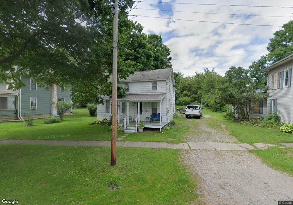
306 W Main St Addison, MI 49220
Estimated Value: $128,000 - $170,000
3
Beds
2
Baths
1,582
Sq Ft
$96/Sq Ft
Est. Value
About This Home
This home is located at 306 W Main St, Addison, MI 49220 and is currently estimated at $152,415, approximately $96 per square foot. 306 W Main St is a home located in Lenawee County with nearby schools including Addison Elementary School, Addison Middle School, and Addison High School.
Ownership History
Date
Name
Owned For
Owner Type
Purchase Details
Closed on
Mar 1, 2019
Sold by
Lenawee County Of
Bought by
Roberts Bradley E
Current Estimated Value
Purchase Details
Closed on
Feb 26, 2009
Sold by
Bank Of New York
Bought by
Roberts Bradley E
Purchase Details
Closed on
Sep 14, 2007
Sold by
Mortgage Electronic Registration Systems
Bought by
Bank Of New York and Certificateholder S Cwabs Inc
Purchase Details
Closed on
Aug 30, 2007
Sold by
Belknap Michael and Belknap Janer
Bought by
Mortgage Electrnoic Registration Systems
Purchase Details
Closed on
Jan 27, 2004
Bought by
Roberts Bradley E
Create a Home Valuation Report for This Property
The Home Valuation Report is an in-depth analysis detailing your home's value as well as a comparison with similar homes in the area
Purchase History
| Date | Buyer | Sale Price | Title Company |
|---|---|---|---|
| Roberts Bradley E | $1,767 | None Available | |
| Roberts Bradley E | $7,700 | Bell Title Company | |
| Bank Of New York | -- | None Available | |
| Mortgage Electrnoic Registration Systems | $47,031 | None Available | |
| Roberts Bradley E | $43,000 | -- |
Source: Public Records
Tax History
| Year | Tax Paid | Tax Assessment Tax Assessment Total Assessment is a certain percentage of the fair market value that is determined by local assessors to be the total taxable value of land and additions on the property. | Land | Improvement |
|---|---|---|---|---|
| 2025 | $596 | $67,300 | $0 | $0 |
| 2024 | $14 | $58,600 | $0 | $0 |
| 2023 | -- | $46,500 | $0 | $0 |
| 2022 | $532 | $47,000 | $0 | $0 |
| 2021 | $1,547 | $39,700 | $0 | $0 |
| 2020 | $1,526 | $42,300 | $0 | $0 |
| 2019 | $58,584 | $42,300 | $0 | $0 |
| 2018 | $1,471 | $40,936 | $0 | $0 |
| 2017 | $682 | $41,204 | $0 | $0 |
| 2016 | $1,440 | $40,441 | $0 | $0 |
| 2014 | -- | $58,544 | $0 | $0 |
Source: Public Records
Map
Nearby Homes
- 16001 Addison Rd
- 6482 Sorby Hwy
- 4955 N Somerset Rd
- 13840 N Adams Rd
- 13820 N Adams Rd
- 0
- VL Manitou Beach Road Proposed
- 360 Park St
- 348 Lenawee St
- 9265 Devils Lake Hwy
- 8676 Cherry Point Dr
- 8164 Clarks Cove
- 17475 U S 223
- 2951 N Meridian Rd
- 7841 Devils Lake Hwy
- 6820 Devils Lake Hwy
- 10911 Devils Lake Hwy
- 4276 Echo Cove
- Lots 4 & 5 Elm Park Dr
- 11698 Elm Park Dr
- 318 W Main St
- 312 W Main St
- 324 W Main St
- 326 W Main St
- 302 W Main St Unit 300 & 304
- 300 W Main St Unit BLK
- 315 W Main St
- 321 W Main St
- 319 W Main St
- 309 W Main St
- 0 Mill Rd
- 252 W Main St St N
- 300 E Main St Unit BLK
- 252 W West Main St St N
- 117 Mill St
- 15000 Heath Rd
- 200 Saunders St Unit BLK
- 259 W Main St
- 255 W Main St
- 255 W Main St
Your Personal Tour Guide
Ask me questions while you tour the home.