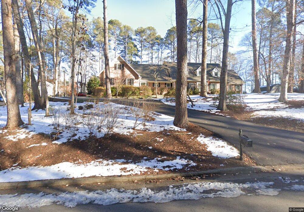
3060 Cameron Dr Henderson, NC 27536
Estimated Value: $604,000 - $801,000
5
Beds
5
Baths
7,349
Sq Ft
$92/Sq Ft
Est. Value
About This Home
This home is located at 3060 Cameron Dr, Henderson, NC 27536 and is currently estimated at $672,632, approximately $91 per square foot. 3060 Cameron Dr is a home located in Vance County with nearby schools including E.M. Rollins Elementary School, Vance County Middle School, and Vance County High School.
Ownership History
Date
Name
Owned For
Owner Type
Purchase Details
Closed on
Nov 8, 2019
Sold by
Holland Charles S
Bought by
Cloninger David Randall and Gloninger Jane Harrison
Current Estimated Value
Home Financials for this Owner
Home Financials are based on the most recent Mortgage that was taken out on this home.
Original Mortgage
$240,000
Outstanding Balance
$186,789
Interest Rate
3.6%
Mortgage Type
New Conventional
Estimated Equity
$485,843
Create a Home Valuation Report for This Property
The Home Valuation Report is an in-depth analysis detailing your home's value as well as a comparison with similar homes in the area
Home Values in the Area
Average Home Value in this Area
Purchase History
| Date | Buyer | Sale Price | Title Company |
|---|---|---|---|
| Cloninger David Randall | $340,000 | None Available |
Source: Public Records
Mortgage History
| Date | Status | Borrower | Loan Amount |
|---|---|---|---|
| Open | Cloninger David Randall | $240,000 |
Source: Public Records
Tax History Compared to Growth
Tax History
| Year | Tax Paid | Tax Assessment Tax Assessment Total Assessment is a certain percentage of the fair market value that is determined by local assessors to be the total taxable value of land and additions on the property. | Land | Improvement |
|---|---|---|---|---|
| 2025 | $7,354 | $539,575 | $55,350 | $484,225 |
| 2024 | $8,849 | $539,575 | $55,350 | $484,225 |
| 2023 | $5,902 | $352,581 | $51,610 | $300,971 |
| 2022 | $5,768 | $352,581 | $51,610 | $300,971 |
| 2021 | $5,648 | $352,581 | $51,610 | $300,971 |
| 2020 | $5,765 | $352,581 | $51,610 | $300,971 |
| 2019 | $5,760 | $352,581 | $51,610 | $300,971 |
| 2018 | $5,648 | $352,581 | $51,610 | $300,971 |
| 2017 | $5,753 | $352,581 | $51,610 | $300,971 |
| 2016 | $6,059 | $352,581 | $51,610 | $300,971 |
| 2015 | $5,806 | $475,480 | $90,744 | $384,736 |
| 2014 | $6,818 | $475,459 | $90,744 | $384,715 |
Source: Public Records
Map
Nearby Homes
- 3070 Cameron Dr
- 3203 Cameron Dr
- 2535 Fairway Dr Unit 3
- 105 Fernwood Creek Ct
- 415 Beechwood Trail
- 2118 N Woodland Rd
- 115 Red Bud Dr
- 106 Orchard Rd
- 1744 Parker Ln
- 3002 Sidney Hill
- Lot 5 Sidney Hill
- 409 Eagle Ct
- 404 Eagle Ct
- 407 Eagle Ct
- 00 Oxford Rd Southern Ave Rd
- 105 Sunset Cir
- 2315 Oxford Rd
- 1822 Ruin Creek Rd
- 65 Pine View Rd
- 1612 Lynne Ave
- 3030 Cameron Dr
- 3000 Cameron Dr
- 3101 Cameron Dr
- 3205 Cameron Dr
- 101 Pineview Dr
- Lot 2 Cameron Dr
- 3355 Cameron Dr
- Lot 2 Cameron Dr Unit 2
- Lot 4 Cameron Dr
- 0000 Cameron Dr
- 550 Deepwood Dr
- 3207 Cameron Dr
- 565 Deepwood Dr
- 107 Lattimore Wright Rd
- 112 Lattimore Wright Rd
- 418 S Woodland Rd
- 100 Pineview Dr
- 548 S Woodland Rd
- 116 Lattimore Wright Rd
- 555 Deepwood Dr