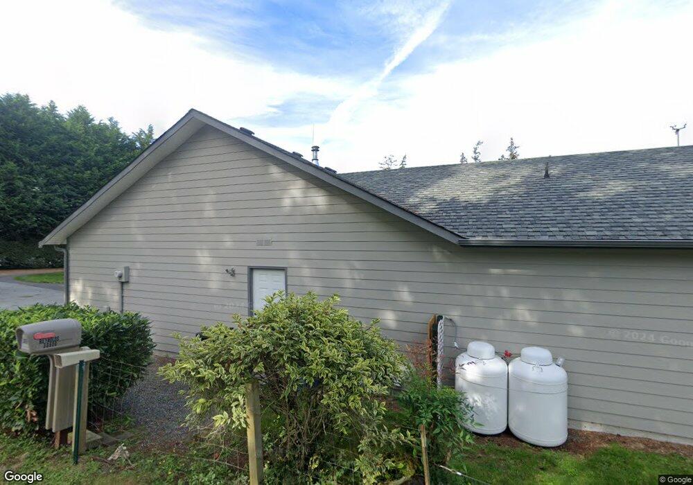
30600 State Route 20 Oak Harbor, WA 98277
Estimated Value: $566,492 - $650,000
3
Beds
2
Baths
1,976
Sq Ft
$307/Sq Ft
Est. Value
About This Home
This home is located at 30600 State Route 20, Oak Harbor, WA 98277 and is currently estimated at $605,873, approximately $306 per square foot. 30600 State Route 20 is a home with nearby schools including Oak Harbor Elementary School, North Whidbey Middle School, and Oak Harbor High School.
Ownership History
Date
Name
Owned For
Owner Type
Purchase Details
Closed on
Feb 13, 2004
Sold by
Feusier Jacqueline
Bought by
Reynolds Jay and Reynolds Lourdes
Current Estimated Value
Home Financials for this Owner
Home Financials are based on the most recent Mortgage that was taken out on this home.
Original Mortgage
$242,900
Interest Rate
5.82%
Mortgage Type
Construction
Create a Home Valuation Report for This Property
The Home Valuation Report is an in-depth analysis detailing your home's value as well as a comparison with similar homes in the area
Home Values in the Area
Average Home Value in this Area
Purchase History
| Date | Buyer | Sale Price | Title Company |
|---|---|---|---|
| Reynolds Jay | $57,000 | Chicago Title Co Island Div |
Source: Public Records
Mortgage History
| Date | Status | Borrower | Loan Amount |
|---|---|---|---|
| Closed | Reynolds Jay | $242,900 |
Source: Public Records
Tax History Compared to Growth
Tax History
| Year | Tax Paid | Tax Assessment Tax Assessment Total Assessment is a certain percentage of the fair market value that is determined by local assessors to be the total taxable value of land and additions on the property. | Land | Improvement |
|---|---|---|---|---|
| 2025 | $4,740 | $564,295 | $200,000 | $364,295 |
| 2024 | $4,667 | $558,779 | $190,000 | $368,779 |
| 2023 | $4,667 | $553,264 | $180,000 | $373,264 |
| 2022 | $4,673 | $522,064 | $180,000 | $342,064 |
| 2021 | $4,228 | $435,979 | $135,000 | $300,979 |
| 2020 | $4,036 | $393,139 | $100,000 | $293,139 |
| 2019 | $3,523 | $371,387 | $150,000 | $221,387 |
| 2018 | $4,283 | $352,021 | $130,000 | $222,021 |
| 2017 | $3,732 | $377,372 | $150,000 | $227,372 |
| 2016 | $3,577 | $349,958 | $120,000 | $229,958 |
| 2015 | $3,679 | $322,541 | $90,000 | $232,541 |
| 2013 | -- | $339,715 | $102,000 | $237,715 |
Source: Public Records
Map
Nearby Homes
- 2140 SW Vista Park Dr
- 960 Capital St
- 0 XXX State Route 20 (Lot 3)
- 2331 Freund St
- 0 XXX
- 2029 Baymont Dr
- 915 SW Kimball Dr Unit B3
- 2401 SW Ridgeway Dr
- 1850 SW Scenic Heights St Unit B304
- 30901 State Route 20 Unit D2
- The Huntington B Plan at Ridgeway Heights
- The Huntington A Plan at Ridgeway Heights
- The Springfield C Plan at Ridgeway Heights
- The Springfield B Plan at Ridgeway Heights
- The Springfield A Plan at Ridgeway Heights
- The Prescott A Plan at Ridgeway Heights
- The Claremont A Plan at Ridgeway Heights
- The Marietta B Plan at Ridgeway Heights
- The Marietta A Plan at Ridgeway Heights
- 2414 Ridgeway Dr
- 985 Capital St
- 30660 State Route 20
- 985 SW Capital St
- 977 Capital St
- 995 Capital St
- 30640 Sr 20
- 1040 SW Harbor Vista Cir
- 0 SW Capital St
- 30635 Sr 20
- 969 Capital St
- 1388 SW Harbor Vista Cir
- 1050 SW Harbor Vista Cir
- 966 Poppys Place
- 976 Olympia Way
- 966 W Poppys Place
- 965 Capital St
- 960 Poppys Place
- 1060 SW Harbor Vista Cir
- 1368 SW Harbor Vista Cir
- 1913 Olympia Way