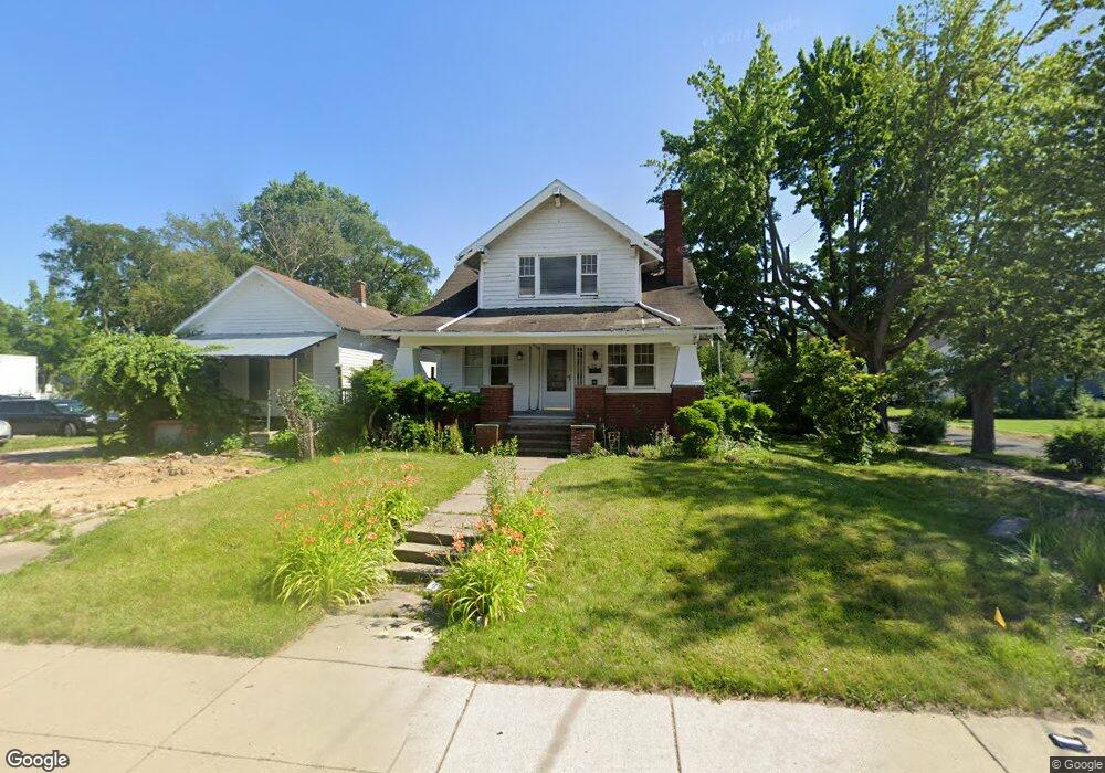
3063 Dorr St Toledo, OH 43607
Scott Park NeighborhoodEstimated Value: $130,000 - $773,599
3
Beds
1
Bath
2,364
Sq Ft
$129/Sq Ft
Est. Value
About This Home
This home is located at 3063 Dorr St, Toledo, OH 43607 and is currently estimated at $305,400, approximately $129 per square foot. 3063 Dorr St is a home located in Lucas County with nearby schools including Keyser Elementary School, Rogers High School, and Victory Academy of Toledo.
Ownership History
Date
Name
Owned For
Owner Type
Purchase Details
Closed on
Mar 22, 2024
Sold by
Timming Bradley D
Bought by
U T Foundation Real Estate Corp
Current Estimated Value
Purchase Details
Closed on
May 29, 2002
Sold by
Westhaven Group Llc
Bought by
Timming Bradley
Purchase Details
Closed on
Mar 12, 2002
Sold by
Powell Victoria L
Bought by
Westhaven Group Llc
Purchase Details
Closed on
Mar 6, 1999
Sold by
Freer Nancy C
Bought by
Freer Nancy C
Purchase Details
Closed on
Nov 17, 1997
Sold by
Estate Of Martha Wilhelm
Bought by
Freer Nancy C
Create a Home Valuation Report for This Property
The Home Valuation Report is an in-depth analysis detailing your home's value as well as a comparison with similar homes in the area
Home Values in the Area
Average Home Value in this Area
Purchase History
| Date | Buyer | Sale Price | Title Company |
|---|---|---|---|
| U T Foundation Real Estate Corp | $700,000 | None Listed On Document | |
| Timming Bradley | $52,000 | -- | |
| Westhaven Group Llc | $25,000 | Midland | |
| Freer Nancy C | -- | -- | |
| Freer Nancy C | -- | -- |
Source: Public Records
Tax History Compared to Growth
Tax History
| Year | Tax Paid | Tax Assessment Tax Assessment Total Assessment is a certain percentage of the fair market value that is determined by local assessors to be the total taxable value of land and additions on the property. | Land | Improvement |
|---|---|---|---|---|
| 2024 | -- | $5,390 | $5,390 | -- |
| 2023 | $2,247 | $32,060 | $3,045 | $29,015 |
| 2022 | $2,227 | $32,060 | $3,045 | $29,015 |
| 2021 | $2,276 | $32,060 | $3,045 | $29,015 |
| 2020 | $2,486 | $30,800 | $2,870 | $27,930 |
| 2019 | $2,401 | $30,800 | $2,870 | $27,930 |
| 2018 | $2,405 | $30,800 | $2,870 | $27,930 |
| 2017 | $8,569 | $30,100 | $2,800 | $27,300 |
| 2016 | $5,407 | $86,000 | $8,000 | $78,000 |
| 2015 | $2,457 | $86,000 | $8,000 | $78,000 |
| 2014 | $2,839 | $30,100 | $2,800 | $27,300 |
| 2013 | $1,893 | $30,100 | $2,800 | $27,300 |
Source: Public Records
Map
Nearby Homes
- 1117 Broer Ave
- 826 Ranch Dr
- 914 Turner Ave
- 1125 Secor Rd
- 2013 Bretton Place
- 615 Cuthbert Rd
- 3205 Kylemore Rd
- 3155 Kylemore Rd
- 1408 Roosevelt Ave
- 2666 Montebello Rd
- 3305 W Bancroft St
- 1809 Pilgrim Rd
- 1752 Pilgrim Rd
- 2221 Meadowwood Dr
- 1911 Kensington Rd
- 2235 Meadowwood Dr
- 2547 Greenbriar Rd
- 1702 Alvin St
- 1730 Alvin St
- 1901 Alvin St
- 3059 Dorr St
- 3103 Dorr St
- 1214 Underwood Ave
- 1206 Underwood Ave
- 3047 Dorr St
- 1213 Underwood Ave
- 1209 Underwood Ave
- 1202 Underwood Ave
- 1215 Brookley Blvd
- 1209 Brookley Blvd
- 1205 Underwood Ave
- 3043 Dorr St
- 1205 Brookley Blvd
- 1130 Underwood Ave
- 1201 Brookley Blvd
- 1129 Underwood Ave
- 1210 MacKow Dr
- 1124 Underwood Ave
- 1204 MacKow Dr
- 1127 Brookley Blvd