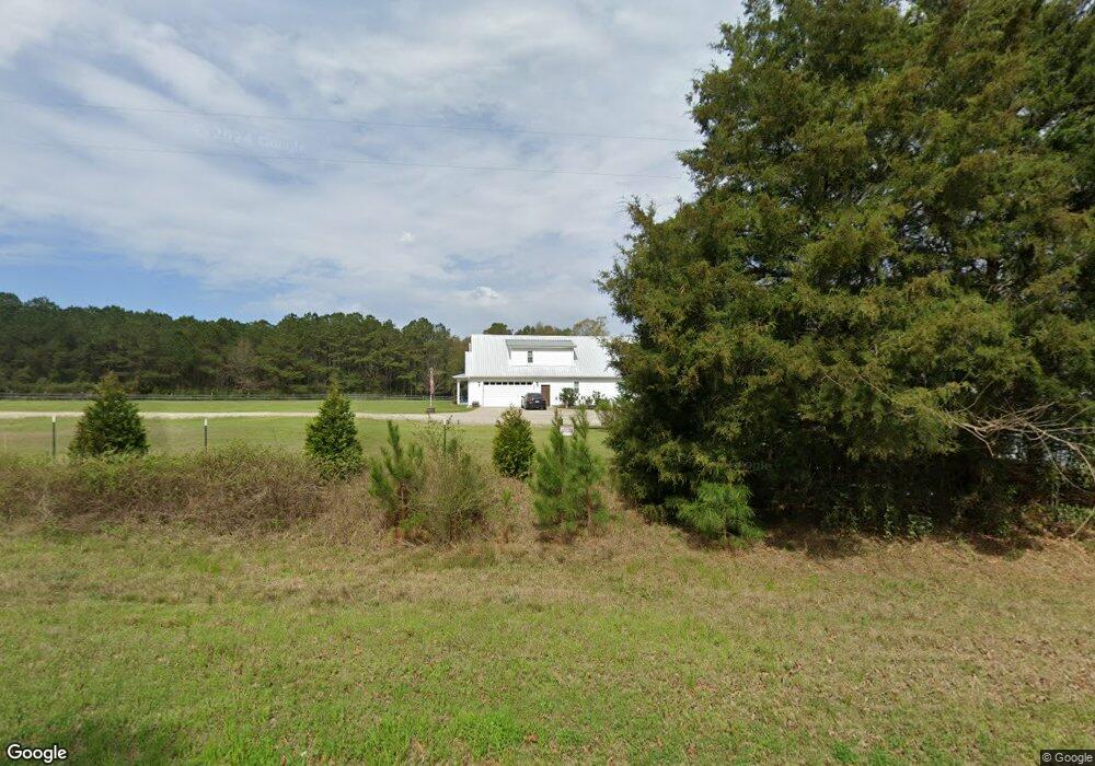
3065 Highway 602 Laurel Hill, FL 32567
Estimated Value: $463,000 - $682,740
4
Beds
4
Baths
2,696
Sq Ft
$196/Sq Ft
Est. Value
About This Home
This home is located at 3065 Highway 602, Laurel Hill, FL 32567 and is currently estimated at $528,935, approximately $196 per square foot. 3065 Highway 602 is a home with nearby schools including Laurel Hill School.
Ownership History
Date
Name
Owned For
Owner Type
Purchase Details
Closed on
Nov 20, 2023
Sold by
Gibbons David R and Gibbons Cary M
Bought by
Gibbons Cary M and Gibbons David R
Current Estimated Value
Purchase Details
Closed on
Dec 15, 2017
Sold by
Williams Tracy A
Bought by
Gibbons David R and Gibbons Cary M
Home Financials for this Owner
Home Financials are based on the most recent Mortgage that was taken out on this home.
Original Mortgage
$54,000
Interest Rate
3.95%
Mortgage Type
Commercial
Purchase Details
Closed on
Jan 19, 2016
Sold by
Williams Andrea L
Bought by
Williams Tracy A
Purchase Details
Closed on
May 1, 2012
Sold by
Williams Tracy A
Bought by
Williams Andrea L
Create a Home Valuation Report for This Property
The Home Valuation Report is an in-depth analysis detailing your home's value as well as a comparison with similar homes in the area
Home Values in the Area
Average Home Value in this Area
Purchase History
| Date | Buyer | Sale Price | Title Company |
|---|---|---|---|
| Gibbons Cary M | $100 | None Listed On Document | |
| Gibbons David R | $60,000 | Moulton Land Title Inc | |
| Williams Tracy A | -- | None Available | |
| Williams Andrea L | -- | None Available |
Source: Public Records
Mortgage History
| Date | Status | Borrower | Loan Amount |
|---|---|---|---|
| Previous Owner | Gibbons David R | $54,000 |
Source: Public Records
Tax History Compared to Growth
Tax History
| Year | Tax Paid | Tax Assessment Tax Assessment Total Assessment is a certain percentage of the fair market value that is determined by local assessors to be the total taxable value of land and additions on the property. | Land | Improvement |
|---|---|---|---|---|
| 2024 | $113 | $369,184 | -- | -- |
| 2023 | $113 | $358,431 | $0 | $0 |
| 2022 | $108 | $347,991 | $0 | $0 |
| 2021 | $103 | $337,855 | $0 | $0 |
| 2020 | $97 | $305,084 | $30,628 | $274,456 |
| 2019 | $321 | $30,628 | $30,628 | $0 |
| 2018 | $328 | $30,817 | $0 | $0 |
| 2017 | $335 | $30,817 | $0 | $0 |
| 2016 | $332 | $30,817 | $0 | $0 |
| 2015 | $334 | $29,920 | $0 | $0 |
| 2014 | $345 | $30,600 | $0 | $0 |
Source: Public Records
Map
Nearby Homes
- 6.12 AC Clary Rd
- 3183 Highway 602 Unit 73+/- AC
- 0 Newton Rd Unit 967796
- TBD Newton Rd
- Parcel B Yellow River Baptist Church Rd
- Parcel B&C Yellow River Baptist Church Rd
- Parcel C Yellow River Baptist Church Rd
- Parcel A Yellow River Baptist Church Rd Unit 22 AC+/-
- 79 Acres Bucking Up Rd
- 13 Acres Jack Rd
- 3501 Plympton Rd
- 8185 Creston Barrow Rd
- 0 Moores Mill Creek Rd
- 7350 Allen Rd
- 3611 Earl Campbell Rd
- 8175 Shooter Ln
- 8180 Shooter Ln
- 3714 Earl Campbell Rd
- 8645 Moores Mill Creek Unit LotWP001
- A and B Millside Road Parcel A & B
- 3017 Highway 602
- 2931 Highway 602
- 2929 Highway 602
- 3035 Highway 602
- 3034 Highway 602
- 3022 Highway 602
- 3016 Highway 602
- 3028 Highway 602
- 3047 Highway 602
- 3106 Ries Rd
- 3104 Corey Rd
- 5.23 AC Ries Rd
- 3131 Ries Rd
- 3088 Highway 602 Unit Parcel 9
- 3088 Highway 602
- 3055 Co Rd 602
- 00 Ries Rd
- 7834 Deana Ln
- 7782 Clary Rd
- 3077 Highway 602