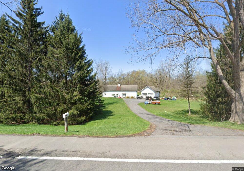
3069 State Route 31 Weedsport, NY 13166
Estimated Value: $208,000 - $247,000
3
Beds
1
Bath
1,560
Sq Ft
$144/Sq Ft
Est. Value
About This Home
This home is located at 3069 State Route 31, Weedsport, NY 13166 and is currently estimated at $224,169, approximately $143 per square foot. 3069 State Route 31 is a home located in Cayuga County with nearby schools including Weedsport Elementary School and Weedsport Junior/Senior High School.
Ownership History
Date
Name
Owned For
Owner Type
Purchase Details
Closed on
Dec 7, 2011
Sold by
Magill Timothy A and Magill Donna A
Bought by
Wingood Timothy P and Campbell Rebecca S
Current Estimated Value
Home Financials for this Owner
Home Financials are based on the most recent Mortgage that was taken out on this home.
Original Mortgage
$73,098
Outstanding Balance
$50,196
Interest Rate
4.09%
Mortgage Type
FHA
Estimated Equity
$173,973
Create a Home Valuation Report for This Property
The Home Valuation Report is an in-depth analysis detailing your home's value as well as a comparison with similar homes in the area
Home Values in the Area
Average Home Value in this Area
Purchase History
| Date | Buyer | Sale Price | Title Company |
|---|---|---|---|
| Wingood Timothy P | $75,000 | None Available |
Source: Public Records
Mortgage History
| Date | Status | Borrower | Loan Amount |
|---|---|---|---|
| Open | Wingood Timothy P | $73,098 |
Source: Public Records
Tax History Compared to Growth
Tax History
| Year | Tax Paid | Tax Assessment Tax Assessment Total Assessment is a certain percentage of the fair market value that is determined by local assessors to be the total taxable value of land and additions on the property. | Land | Improvement |
|---|---|---|---|---|
| 2024 | $4,162 | $116,300 | $19,600 | $96,700 |
| 2023 | $4,367 | $116,300 | $19,600 | $96,700 |
| 2022 | $4,173 | $116,300 | $19,600 | $96,700 |
| 2021 | $4,131 | $116,300 | $19,600 | $96,700 |
| 2020 | $3,491 | $116,300 | $19,600 | $96,700 |
| 2019 | $1,392 | $116,300 | $19,600 | $96,700 |
| 2018 | $3,270 | $116,300 | $19,600 | $96,700 |
| 2017 | $3,223 | $116,300 | $19,600 | $96,700 |
| 2016 | $3,080 | $116,300 | $19,600 | $96,700 |
| 2015 | -- | $116,300 | $19,600 | $96,700 |
| 2014 | -- | $116,300 | $19,600 | $96,700 |
Source: Public Records
Map
Nearby Homes
- 2 Hidden Greens Rd
- 00 Hickory Island
- 2919 E Brutus Street Rd
- 0 Clinton Rd
- 2757 Green St
- 2756 Green St
- 8914 Jackson St
- 2809 Sharon St
- 2808 Sharon St
- 2653 Washington St
- 2917 Ryan Rd
- 0 Route 31 Unit 11065957
- 210 Henderson Ln
- 13 Middle Dr
- 186 Henderson Ln
- 36 S Hamilton St
- 58 S Hamilton St
- 1 Clinton Terrace
- 114 4th Dr
- 30 S Main St
- 3079 Clinton Rd
- 3059 Clinton Rd
- 3023 State Route 31
- 3049 Clinton Rd
- 3039 Clinton Rd
- 3037 Clinton Rd
- 3101 Towpath Rd
- 3041 Towpath Rd
- 9054 Putnam Rd
- 3173 Bates Rd
- 3027 Towpath Rd
- 3129 Towpath Rd
- 9027 Putnam Rd
- 2982 Weller Rd
- 3153 Towpath Rd
- 2967 State Route 31
- 123 Clinton Rd
- 9014 Putnam Rd
- 3029 Towpath Rd
- 2995 Towpath Rd