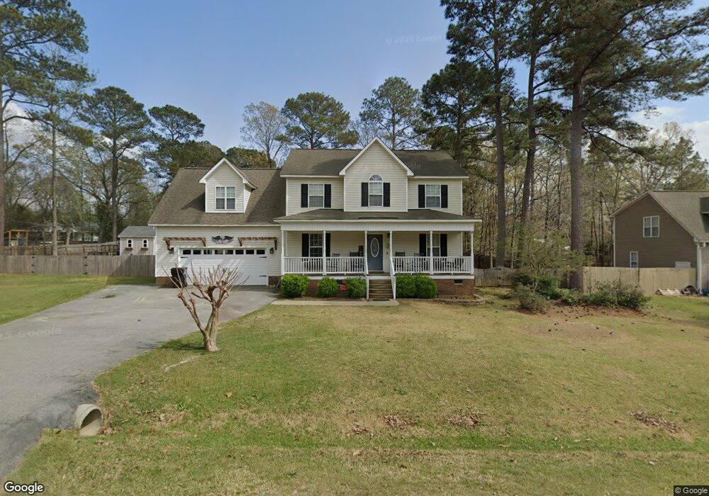
307 Cabin Grove Ct Angier, NC 27501
Pleasant Grove NeighborhoodEstimated Value: $364,000 - $389,000
3
Beds
3
Baths
2,136
Sq Ft
$177/Sq Ft
Est. Value
About This Home
This home is located at 307 Cabin Grove Ct, Angier, NC 27501 and is currently estimated at $377,835, approximately $176 per square foot. 307 Cabin Grove Ct is a home located in Johnston County with nearby schools including McGee's Crossroads Elementary School, McGee's Crossroads Middle School, and West Johnston High School.
Ownership History
Date
Name
Owned For
Owner Type
Purchase Details
Closed on
Aug 12, 2004
Sold by
Terrio Richard
Bought by
Ashley Turner Building Co Inc
Current Estimated Value
Purchase Details
Closed on
May 5, 2004
Sold by
Ashley Turner Building Co Inc
Bought by
Ashley Turner Enterprises Inc
Purchase Details
Closed on
Sep 20, 2002
Sold by
Ashley Turner Enterprises Inc
Bought by
Crossroads Development Corp
Create a Home Valuation Report for This Property
The Home Valuation Report is an in-depth analysis detailing your home's value as well as a comparison with similar homes in the area
Home Values in the Area
Average Home Value in this Area
Purchase History
| Date | Buyer | Sale Price | Title Company |
|---|---|---|---|
| Ashley Turner Building Co Inc | $156,000 | -- | |
| Ashley Turner Enterprises Inc | -- | -- | |
| Crossroads Development Corp | -- | -- |
Source: Public Records
Tax History
| Year | Tax Paid | Tax Assessment Tax Assessment Total Assessment is a certain percentage of the fair market value that is determined by local assessors to be the total taxable value of land and additions on the property. | Land | Improvement |
|---|---|---|---|---|
| 2025 | $2,193 | $345,400 | $80,000 | $265,400 |
| 2024 | $1,635 | $201,890 | $36,000 | $165,890 |
| 2023 | $1,585 | $201,890 | $36,000 | $165,890 |
| 2022 | $1,635 | $201,890 | $36,000 | $165,890 |
| 2021 | $1,635 | $201,890 | $36,000 | $165,890 |
| 2020 | $1,696 | $201,890 | $36,000 | $165,890 |
| 2019 | $1,655 | $201,890 | $36,000 | $165,890 |
| 2018 | $1,504 | $179,100 | $32,000 | $147,100 |
| 2017 | $1,504 | $179,100 | $32,000 | $147,100 |
| 2016 | $1,504 | $179,100 | $32,000 | $147,100 |
| 2015 | $1,504 | $179,100 | $32,000 | $147,100 |
| 2014 | $1,504 | $179,100 | $32,000 | $147,100 |
Source: Public Records
Map
Nearby Homes
- 71 Suzanne Dr
- 16622 N Carolina 210
- 810 | 850 Wiggins Rd
- 15973 N Carolina 210
- 105 Pinecrest Dr
- 40 Broadhead Ct
- 111 Old Mill Dr
- 197 Silverside Dr
- 506 Harbor Cove Dr
- 3002 Red Cir
- 336 Cedar Ridge Trail
- 1145 Landmark Rd
- 1139 Landmark Rd
- 264 Harbor Cove Dr
- 0 Massengill Pond Rd
- 216 Country Haven Ct
- 216 Cedar Ridge Trail
- 3361 Old Fairground Rd
- 369 Everland Pkwy
- 410 Penwood Rd
- 285 Cabin Grove Ct
- 333 Cabin Grove Ct
- 312 Cabin Grove Ct
- 284 Cabin Grove Ct
- 259 Cabin Grove Ct
- 361 Cabin Grove Ct
- 550 Black Pine Ln Unit A And B
- 550 Black Pine Ln
- 260 Cabin Grove Ct
- 354 Cabin Grove Ct
- (L-43) 376 Cabin Grove Ct
- 22 Clarke Ct
- 401 Cabin Grove Ct
- 236 Cabin Grove Ct
- 239 Old Cabin Ct
- 376 Cabin Grove Ct
- 219 Old Cabin Ct
- 259 Old Cabin Ct
- 64 Clarke Ct
- 199 Old Cabin Ct
Your Personal Tour Guide
Ask me questions while you tour the home.