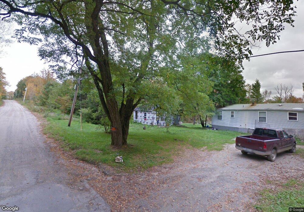
307 Chicken St Starks, ME 04911
Estimated Value: $116,307 - $194,000
3
Beds
1
Bath
1,124
Sq Ft
$137/Sq Ft
Est. Value
About This Home
This home is located at 307 Chicken St, Starks, ME 04911 and is currently estimated at $154,077, approximately $137 per square foot. 307 Chicken St is a home located in Somerset County with nearby schools including Madison Area Memorial High School.
Ownership History
Date
Name
Owned For
Owner Type
Purchase Details
Closed on
Mar 31, 2023
Sold by
Thompson Peter F
Bought by
Konopka Daniel E
Current Estimated Value
Home Financials for this Owner
Home Financials are based on the most recent Mortgage that was taken out on this home.
Original Mortgage
$45,000
Outstanding Balance
$43,749
Interest Rate
6.6%
Mortgage Type
Purchase Money Mortgage
Estimated Equity
$110,328
Purchase Details
Closed on
Sep 24, 2019
Sold by
Sweetser Karen and Sweetser Jeff A
Bought by
Welch Rose and Stuart Nathan A
Purchase Details
Closed on
Jul 31, 2009
Sold by
Howland Debra J
Bought by
Stanley Adam
Create a Home Valuation Report for This Property
The Home Valuation Report is an in-depth analysis detailing your home's value as well as a comparison with similar homes in the area
Home Values in the Area
Average Home Value in this Area
Purchase History
| Date | Buyer | Sale Price | Title Company |
|---|---|---|---|
| Konopka Daniel E | -- | None Available | |
| Welch Rose | -- | -- | |
| Stanley Adam | -- | -- |
Source: Public Records
Mortgage History
| Date | Status | Borrower | Loan Amount |
|---|---|---|---|
| Open | Konopka Daniel E | $45,000 |
Source: Public Records
Tax History Compared to Growth
Tax History
| Year | Tax Paid | Tax Assessment Tax Assessment Total Assessment is a certain percentage of the fair market value that is determined by local assessors to be the total taxable value of land and additions on the property. | Land | Improvement |
|---|---|---|---|---|
| 2024 | $760 | $52,800 | $12,000 | $40,800 |
| 2023 | $737 | $52,800 | $12,000 | $40,800 |
| 2022 | $671 | $52,800 | $12,000 | $40,800 |
| 2021 | $729 | $52,800 | $12,000 | $40,800 |
| 2020 | $1,089 | $69,120 | $12,000 | $57,120 |
| 2019 | $1,120 | $60,080 | $12,480 | $47,600 |
| 2018 | $1,057 | $60,080 | $12,480 | $47,600 |
| 2017 | $1,006 | $60,080 | $12,480 | $47,600 |
| 2016 | $938 | $48,100 | $10,020 | $38,080 |
Source: Public Records
Map
Nearby Homes
- 012-002 W Mills Rd
- 257 Sawyers Mills Rd
- 8 Magnolia Ln
- 2679 Industry Rd
- 0 Poor Farm Rd Unit 1637355
- 012-002 W Mill Rd
- 1550 New Sharon Rd
- Lot 33 Butterfield Rd
- 137 Butterfield Rd
- 510 Branns Mill Rd
- 862 Anson Rd
- 23 Heald Rd
- P/O M11 L45a Pease Hill Rd
- Lot 005 Greenwood Brook Rd
- 349 Elm St
- R1 37B O'Dell Rd
- 331 Beans Corner Rd
- M10 L12 Yeaton Island
- 25 Blue Rock Rd
- 113 Brown Hill Rd
- 288 Chicken St
- 272 Chicken St
- Map R3 Lot Chicken St
- 261 Chicken St
- Map R-4 Lo Chicken St
- 254 Chicken St
- 39 Freedom Way Ln
- 61 Freedom Way Ln
- 47 Freedom Way Ln
- 44 Emery Rd
- 23 Emery Rd
- 59 Homestead Rd
- 9 Locke Cemetery Rd
- 182 Chicken St
- 55 Cemetery Rd
- Lot 33.2 Sawyers Mills Rd
- R4 L14.3 Sawyers Mills Rd
- 9 Sawyers Mills Rd
- 87 Emery Rd
- 406 Sawyers Mills Rd