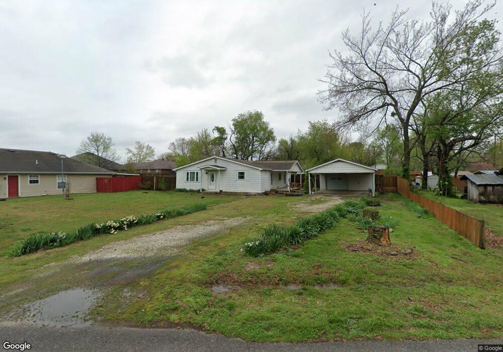
307 Commercial St Prairie Grove, AR 72753
Estimated Value: $193,000 - $247,000
3
Beds
1
Bath
1,490
Sq Ft
$144/Sq Ft
Est. Value
About This Home
This home is located at 307 Commercial St, Prairie Grove, AR 72753 and is currently estimated at $214,881, approximately $144 per square foot. 307 Commercial St is a home located in Washington County with nearby schools including Prairie Grove Elementary School, Prairie Grove Middle School, and Prairie Grove Junior High School.
Ownership History
Date
Name
Owned For
Owner Type
Purchase Details
Closed on
Jul 2, 2008
Sold by
Bottoms Harold L and Bottoms Allyne
Bought by
Pruiett John David and Pruiett Carol Ann
Current Estimated Value
Home Financials for this Owner
Home Financials are based on the most recent Mortgage that was taken out on this home.
Original Mortgage
$90,000
Outstanding Balance
$57,575
Interest Rate
5.99%
Mortgage Type
VA
Estimated Equity
$157,306
Purchase Details
Closed on
Jan 1, 1985
Bought by
Bottoms Henry and Bottoms Myrtle
Create a Home Valuation Report for This Property
The Home Valuation Report is an in-depth analysis detailing your home's value as well as a comparison with similar homes in the area
Home Values in the Area
Average Home Value in this Area
Purchase History
| Date | Buyer | Sale Price | Title Company |
|---|---|---|---|
| Pruiett John David | $90,000 | Waco Title Company | |
| Bottoms Henry | -- | -- |
Source: Public Records
Mortgage History
| Date | Status | Borrower | Loan Amount |
|---|---|---|---|
| Open | Pruiett John David | $90,000 |
Source: Public Records
Tax History Compared to Growth
Tax History
| Year | Tax Paid | Tax Assessment Tax Assessment Total Assessment is a certain percentage of the fair market value that is determined by local assessors to be the total taxable value of land and additions on the property. | Land | Improvement |
|---|---|---|---|---|
| 2025 | $244 | $39,080 | $11,900 | $27,180 |
| 2024 | $357 | $39,080 | $11,900 | $27,180 |
| 2023 | $465 | $39,080 | $11,900 | $27,180 |
| 2022 | $515 | $25,940 | $4,900 | $21,040 |
| 2021 | $512 | $25,940 | $4,900 | $21,040 |
| 2020 | $522 | $25,940 | $4,900 | $21,040 |
| 2019 | $522 | $17,150 | $4,000 | $13,150 |
| 2018 | $538 | $17,150 | $4,000 | $13,150 |
| 2017 | $538 | $17,150 | $4,000 | $13,150 |
| 2016 | $538 | $17,150 | $4,000 | $13,150 |
| 2015 | $538 | $17,150 | $4,000 | $13,150 |
| 2014 | $538 | $16,480 | $4,000 | $12,480 |
Source: Public Records
Map
Nearby Homes
- 211 Boston St
- 308 S Summit St
- 304 S Summit St
- 106 S Ozark St
- TBD Butler St
- 107 S Ozark St
- 600 Kendra St
- 621 Kendra St
- 740 Kendra St
- 610 Kendra St
- 4.66 +/- AC Tract 5 Hwy 62 & S Mock St
- 700 Marcella St
- 661 Marcella St
- 611 Marcella St
- 651 Marcella St
- 630 Marcella St
- 621 Marcella St
- 620 Marcella St
- 311 S Mock St
- 901 E Buchanan St
- 311 Commercial St
- 311 Commercial St
- 413 S Neal St
- 313 Commercial St
- 408 S Pittman St
- 412 S Pittman St
- 310 Commercial St
- 404 S Pittman St
- 306 Commercial St
- 321 S Neal St
- 416 S Pittman St
- 417 S Neal St
- 312 Commercial St
- 412 S Neal St
- 310 S Pittman St
- 0 Commercial St Unit 1118632
- 416 S Neal St
- 418 S Pittman St
- 507 S Neal St
- 401 S Pittman St