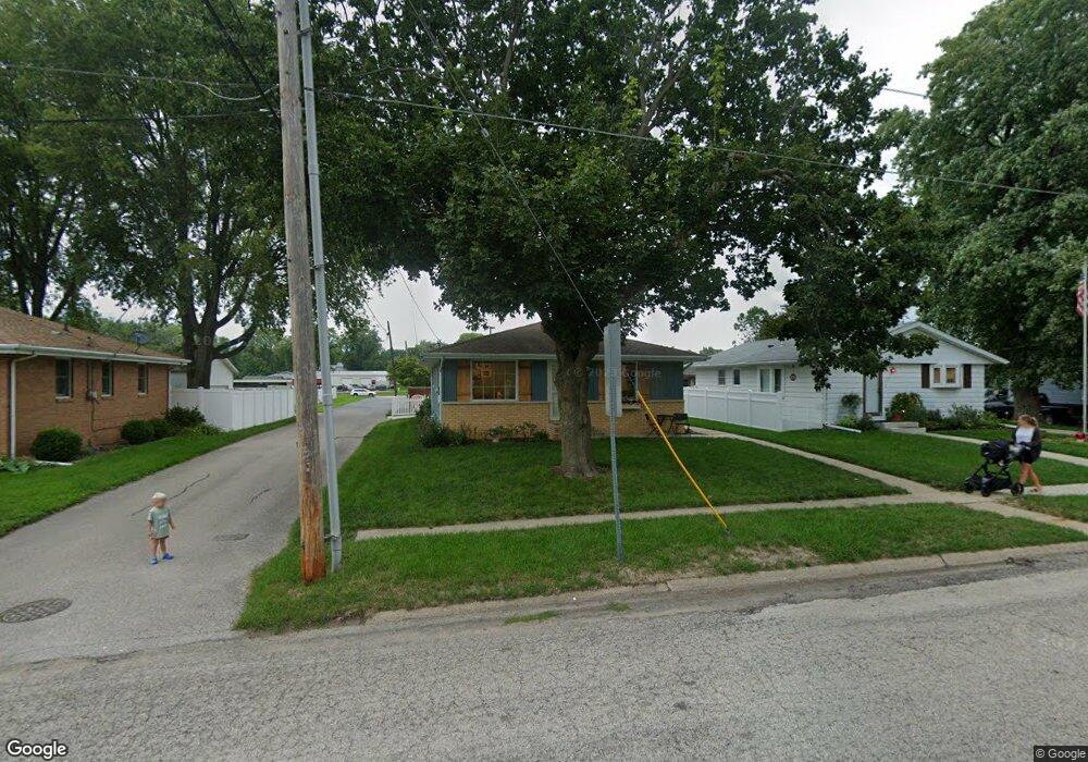
307 E Walnut St Tremont, IL 61568
Estimated Value: $181,695 - $196,000
3
Beds
2
Baths
1,120
Sq Ft
$168/Sq Ft
Est. Value
About This Home
This home is located at 307 E Walnut St, Tremont, IL 61568 and is currently estimated at $188,424, approximately $168 per square foot. 307 E Walnut St is a home located in Tazewell County with nearby schools including Tremont Elementary School, Tremont Middle School, and Tremont High School.
Ownership History
Date
Name
Owned For
Owner Type
Purchase Details
Closed on
Jun 12, 2017
Sold by
Green Dale and Green Michelle
Bought by
Koch Adam and Koch Kristen
Current Estimated Value
Home Financials for this Owner
Home Financials are based on the most recent Mortgage that was taken out on this home.
Original Mortgage
$105,600
Outstanding Balance
$87,837
Interest Rate
4.02%
Mortgage Type
New Conventional
Estimated Equity
$100,587
Create a Home Valuation Report for This Property
The Home Valuation Report is an in-depth analysis detailing your home's value as well as a comparison with similar homes in the area
Purchase History
| Date | Buyer | Sale Price | Title Company |
|---|---|---|---|
| Koch Adam | $132,000 | -- |
Source: Public Records
Mortgage History
| Date | Status | Borrower | Loan Amount |
|---|---|---|---|
| Open | Koch Adam | $105,600 |
Source: Public Records
Tax History
| Year | Tax Paid | Tax Assessment Tax Assessment Total Assessment is a certain percentage of the fair market value that is determined by local assessors to be the total taxable value of land and additions on the property. | Land | Improvement |
|---|---|---|---|---|
| 2024 | $3,257 | $52,420 | $7,530 | $44,890 |
| 2023 | $3,257 | $47,630 | $6,840 | $40,790 |
| 2022 | $3,047 | $43,290 | $6,220 | $37,070 |
| 2021 | $2,937 | $41,620 | $5,980 | $35,640 |
| 2020 | $2,835 | $40,020 | $5,750 | $34,270 |
| 2019 | $2,866 | $40,020 | $5,750 | $34,270 |
| 2018 | $2,217 | $32,690 | $5,750 | $26,940 |
| 2017 | $2,666 | $32,690 | $5,750 | $26,940 |
| 2016 | $2,637 | $32,040 | $5,630 | $26,410 |
| 2015 | $819 | $0 | $0 | $0 |
| 2013 | $812 | $38,560 | $5,480 | $33,080 |
Source: Public Records
Map
Nearby Homes
- 122 S Chestnut St
- 313 W South St
- 501 N Sampson St
- 604 Ivy Ln
- 608 Ivy Ln
- 700 S Hancock St
- 417 N Toepfer St
- 24845 Emanuel Ln
- 16810 Springfield Rd
- 1404 Downing Ct
- 201 Royal Point Ct
- 116 Lost Creek Ct
- 1920 - 1922 Mayflower Dr
- 1960-1962 Mayflower Dr
- 106 Royal Point Ct
- 107 Lost Creek Ct
- 105 Royal Point Ct
- 1960 Mayflower Dr
- 10109 Arrow Rd
- 10105 Hickory Rd
- 309 E Walnut St
- 305 E Walnut St
- 125 S Chestnut St
- 123 S Chestnut St
- 116 S Harris St
- 120 S Harris St
- 124 S Harris St
- 302 E Walnut St Unit 304
- 201 S Chestnut St
- 300 E Walnut St
- 112 S Harris St
- 204 S Harris St
- 124 S Chestnut St
- O Illinois 9
- 217 E Walnut St
- 108 S Harris St
- 113 S Harris St
- 213 S Chestnut St
- 408 E Walnut St
- 213 E Walnut St
Your Personal Tour Guide
Ask me questions while you tour the home.