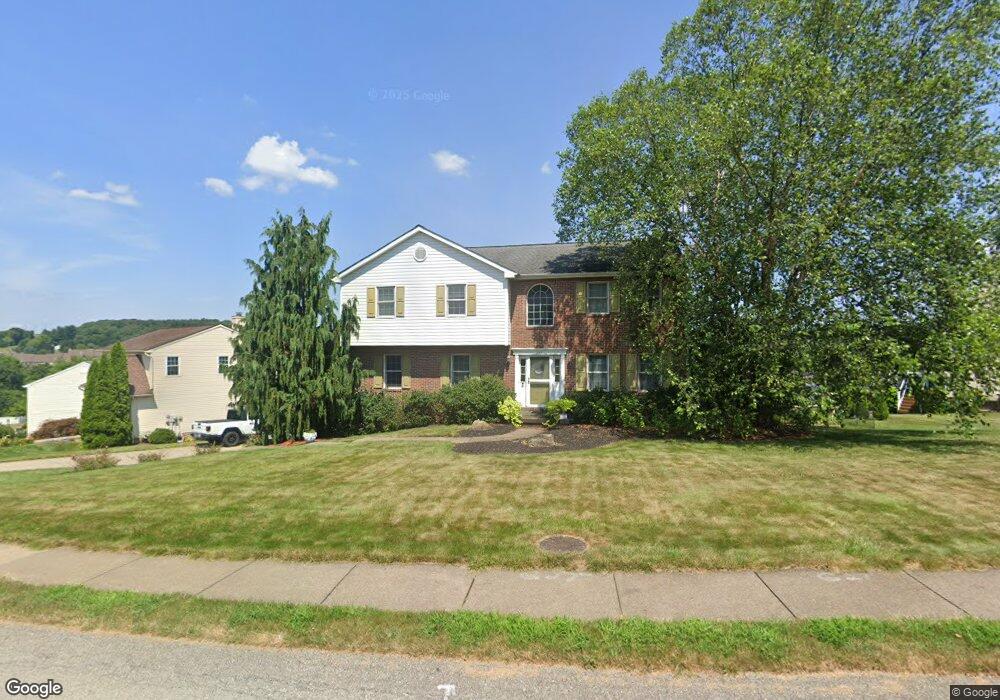
307 Green Fields Ct Cranberry Township, PA 16066
Estimated Value: $170,120 - $483,000
4
Beds
3
Baths
2,158
Sq Ft
$177/Sq Ft
Est. Value
About This Home
This home is located at 307 Green Fields Ct, Cranberry Township, PA 16066 and is currently estimated at $382,280, approximately $177 per square foot. 307 Green Fields Ct is a home located in Butler County with nearby schools including Haine Middle School, Rowan Elementary School, and Ryan Gloyer Middle School.
Ownership History
Date
Name
Owned For
Owner Type
Purchase Details
Closed on
Aug 12, 2009
Sold by
The Mackie Family Revoc
Bought by
Leschinsky Jessica A
Current Estimated Value
Home Financials for this Owner
Home Financials are based on the most recent Mortgage that was taken out on this home.
Original Mortgage
$198,000
Outstanding Balance
$128,965
Interest Rate
5.19%
Mortgage Type
New Conventional
Estimated Equity
$253,315
Create a Home Valuation Report for This Property
The Home Valuation Report is an in-depth analysis detailing your home's value as well as a comparison with similar homes in the area
Home Values in the Area
Average Home Value in this Area
Purchase History
| Date | Buyer | Sale Price | Title Company |
|---|---|---|---|
| Leschinsky Jessica A | $220,000 | -- |
Source: Public Records
Mortgage History
| Date | Status | Borrower | Loan Amount |
|---|---|---|---|
| Open | Leschinsky Jessica A | $198,000 |
Source: Public Records
Tax History Compared to Growth
Tax History
| Year | Tax Paid | Tax Assessment Tax Assessment Total Assessment is a certain percentage of the fair market value that is determined by local assessors to be the total taxable value of land and additions on the property. | Land | Improvement |
|---|---|---|---|---|
| 2025 | $5,478 | $30,570 | $2,970 | $27,600 |
| 2024 | $5,315 | $30,570 | $2,970 | $27,600 |
| 2023 | $5,237 | $30,570 | $2,970 | $27,600 |
| 2022 | $5,237 | $30,570 | $2,970 | $27,600 |
| 2021 | $4,933 | $29,230 | $0 | $0 |
| 2020 | $4,933 | $29,230 | $2,970 | $26,260 |
| 2019 | $4,878 | $29,230 | $2,970 | $26,260 |
| 2018 | $4,878 | $29,230 | $2,970 | $26,260 |
| 2017 | $4,790 | $29,230 | $2,970 | $26,260 |
| 2016 | $1,314 | $29,230 | $2,970 | $26,260 |
| 2015 | $593 | $29,230 | $2,970 | $26,260 |
| 2014 | $593 | $29,230 | $2,970 | $26,260 |
Source: Public Records
Map
Nearby Homes
- 109 Founders St
- 109 Foundry Pike
- 311 Palisade Way
- 227 Eagle Dr
- 319 Palisade Way
- 230 Eagle Dr
- Elgin Plan at Brookvue - Single Family
- Ellsworth Plan at Brookvue - Single Family
- Montclair Plan at Brookvue - Single Family
- Dundee Plan at Brookvue - Single Family
- 3500 Unionville Rd Unit Morrison
- Andover Plan at Brookvue - Single Family
- Bromley Plan at Brookvue - Single Family
- 3500 Unionville Rd Unit Dundee
- 3500 Unionville Rd Unit Arundel
- Helston Plan at Brookvue - Single Family
- 3500 Unionville Rd Unit Montclair
- Arundel Plan at Brookvue - Single Family
- 3500 Unionville Rd Unit Bromley
- 3500 Unionville Rd Unit Andover
- 309 Green Fields Ct
- 305 Green Fields Ct
- 311 Green Fields Ct
- 306 Green Fields Ct
- 500 Creekside Ct
- 304 Green Fields Ct
- 308 Green Fields Ct
- 302 Green Fields Ct
- 313 Green Fields Ct
- 310 Green Fields Ct
- 402 Summit Ct
- 502 Creekside Ct
- 312 Green Fields Ct
- 315 Green Fields Ct
- 403 Summit Ct
- 501 Creekside Ct
- 404 Summit Ct
- 314 Green Fields Ct
- 504 Creekside Ct
- 317 Green Fields Ct