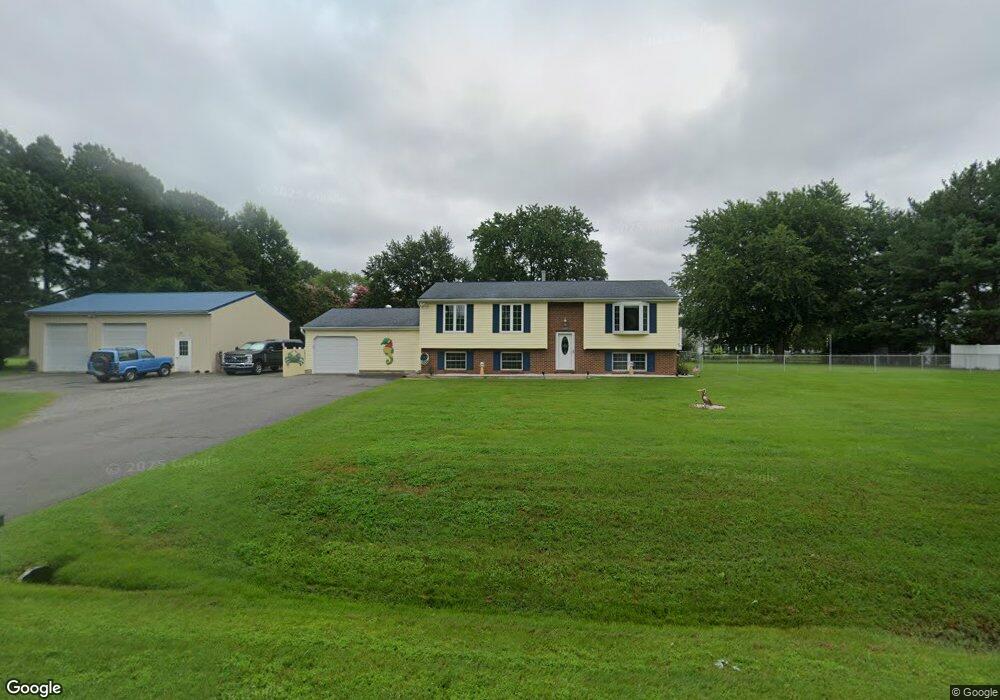
307 Oxbow Dr Stevensville, MD 21666
Estimated Value: $429,465 - $518,000
Studio
3
Baths
1,128
Sq Ft
$423/Sq Ft
Est. Value
About This Home
This home is located at 307 Oxbow Dr, Stevensville, MD 21666 and is currently estimated at $477,116, approximately $422 per square foot. 307 Oxbow Dr is a home located in Queen Anne's County with nearby schools including Matapeake Elementary School, Matapeake Middle School, and Kent Island High School.
Ownership History
Date
Name
Owned For
Owner Type
Purchase Details
Closed on
Mar 6, 2007
Sold by
Arkuszeski Joseph A
Bought by
Arkuszeski Joseph A and Arkuszeski Cherr'Ie M
Current Estimated Value
Purchase Details
Closed on
Feb 15, 2007
Sold by
Arkuszeski Joseph A
Bought by
Arkuszeski Joseph A and Arkuszeski Cherr'Ie M
Purchase Details
Closed on
Feb 24, 1995
Sold by
Arkuszeski John A and Arkuszeski Elizabeth T
Bought by
Arkuszeski John A and Elisabeth T Life Estate
Create a Home Valuation Report for This Property
The Home Valuation Report is an in-depth analysis detailing your home's value as well as a comparison with similar homes in the area
Purchase History
| Date | Buyer | Sale Price | Title Company |
|---|---|---|---|
| Arkuszeski Joseph A | -- | -- | |
| Arkuszeski Joseph A | -- | -- | |
| Arkuszeski Joseph A | -- | -- | |
| Arkuszeski Joseph A | -- | -- | |
| Arkuszeski John A | -- | -- |
Source: Public Records
Tax History
| Year | Tax Paid | Tax Assessment Tax Assessment Total Assessment is a certain percentage of the fair market value that is determined by local assessors to be the total taxable value of land and additions on the property. | Land | Improvement |
|---|---|---|---|---|
| 2025 | $3,263 | $368,567 | $0 | $0 |
| 2024 | $3,096 | $340,033 | $0 | $0 |
| 2023 | $2,934 | $311,500 | $153,800 | $157,700 |
| 2022 | $2,994 | $311,500 | $153,800 | $157,700 |
| 2020 | $3,076 | $314,500 | $149,800 | $164,700 |
| 2019 | $2,882 | $300,467 | $0 | $0 |
| 2018 | $2,804 | $286,433 | $0 | $0 |
| 2017 | $2,673 | $272,400 | $0 | $0 |
| 2016 | -- | $272,400 | $0 | $0 |
| 2015 | $3,031 | $272,400 | $0 | $0 |
| 2014 | $3,031 | $282,900 | $0 | $0 |
Source: Public Records
Map
Nearby Homes
- 312 S Lake Dr
- 208 Tower Dr
- 101 Beachside Dr
- 145 N Lake Dr
- 114 N Lake Dr
- 118 N Lake Dr
- Lot 1 - E/Kent Point Romancoke
- 0 Ackerman Dr
- Lot 8 Ackerman Dr
- 217 Ackerman Dr
- 200 Mallard Cove Ln
- 306 N Lake Rd
- 102 Golf Ct
- 137 Tanners Point Dr
- 610 Elm St
- 414 Bay Dr
- 224 Long Point Rd
- 208 Long Point Rd
- 109 Carroll Rd
- 205 Lighthouse View Dr