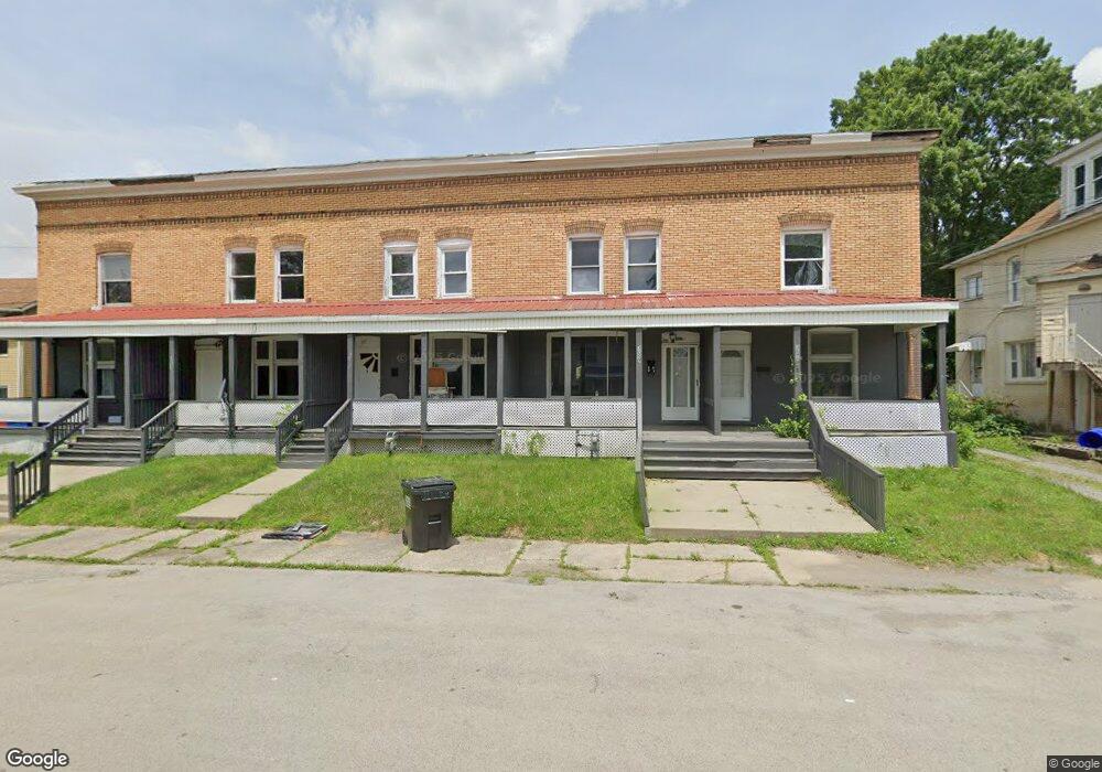
307 Phillips St New Castle, PA 16101
Estimated Value: $45,000 - $72,000
3
Beds
1
Bath
1,384
Sq Ft
$41/Sq Ft
Est. Value
About This Home
This home is located at 307 Phillips St, New Castle, PA 16101 and is currently estimated at $56,667, approximately $40 per square foot. 307 Phillips St is a home located in Lawrence County with nearby schools including Harry W. Lockley Early Learning Center, Washington Intermediate School, and New Castle Junior High School.
Ownership History
Date
Name
Owned For
Owner Type
Purchase Details
Closed on
Aug 12, 2023
Sold by
Reignbrook 3 Llc
Bought by
303 Phillips Llc
Current Estimated Value
Home Financials for this Owner
Home Financials are based on the most recent Mortgage that was taken out on this home.
Original Mortgage
$144,700
Interest Rate
7.23%
Mortgage Type
New Conventional
Purchase Details
Closed on
Dec 5, 2014
Sold by
Dicerbo Oreste and Dicerbo Shawnn
Bought by
Defloria Wayne
Create a Home Valuation Report for This Property
The Home Valuation Report is an in-depth analysis detailing your home's value as well as a comparison with similar homes in the area
Home Values in the Area
Average Home Value in this Area
Purchase History
| Date | Buyer | Sale Price | Title Company |
|---|---|---|---|
| 303 Phillips Llc | $180,900 | None Listed On Document | |
| Defloria Wayne | $19,800 | None Available |
Source: Public Records
Mortgage History
| Date | Status | Borrower | Loan Amount |
|---|---|---|---|
| Previous Owner | 303 Phillips Llc | $144,700 |
Source: Public Records
Tax History
| Year | Tax Paid | Tax Assessment Tax Assessment Total Assessment is a certain percentage of the fair market value that is determined by local assessors to be the total taxable value of land and additions on the property. | Land | Improvement |
|---|---|---|---|---|
| 2025 | $1,031 | $24,900 | $4,500 | $20,400 |
| 2024 | $1,016 | $24,900 | $4,500 | $20,400 |
| 2023 | $1,016 | $24,900 | $4,500 | $20,400 |
| 2022 | $1,015 | $24,900 | $4,500 | $20,400 |
| 2021 | $967 | $24,400 | $4,500 | $19,900 |
| 2020 | $967 | $24,400 | $4,500 | $19,900 |
| 2019 | $943 | $24,400 | $4,500 | $19,900 |
| 2018 | $943 | $24,400 | $4,500 | $19,900 |
| 2017 | $924 | $24,400 | $4,500 | $19,900 |
| 2016 | $434 | $24,400 | $4,500 | $19,900 |
| 2015 | $434 | $24,400 | $4,500 | $19,900 |
| 2014 | $434 | $24,400 | $4,500 | $19,900 |
Source: Public Records
Map
Nearby Homes
- 406 E Lutton St
- 1006 Shira St
- 302 E Home St
- 304 E Home St
- 420 E Lutton St
- 417 Uber St
- 1112 Pollock Ave
- 311 E Reynolds St
- 806 High St
- 221 Friendship St
- 422 E Division St
- 418 E Division St
- 506 E Division St
- 1103 Summit St
- 459 E Long Ave
- 107,109,111 E Long Ave
- 1106 Cunningham Ave
- 522 E Division St
- 602 E Lutton St
- 725 S Mill St
- 305 Phillips St Unit 1
- 305 Phillips St
- 309 Phillips St Unit 3
- 309 Phillips St Unit 2
- 309 Phillips St Unit 1
- 309 Phillips St
- 303 Marion Ct
- 303 1/2 Marion Ct
- 303 Phillips St
- 303 Phillips St
- 303 Phillips St Unit 1
- 301 Phillips St
- 1020 Pollock Ave
- 308 Phillips St
- 1022 Pollock Ave
- 317 Phillips St
- 1007 Agnew St
- 1024 Pollock Ave
- 1010 Pollock Ave
- 310 E Lutton St
Your Personal Tour Guide
Ask me questions while you tour the home.