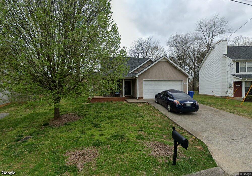
307 Sam Davis Dr Smyrna, TN 37167
Estimated Value: $309,829 - $360,000
Studio
3
Baths
1,321
Sq Ft
$262/Sq Ft
Est. Value
About This Home
This home is located at 307 Sam Davis Dr, Smyrna, TN 37167 and is currently estimated at $345,707, approximately $261 per square foot. 307 Sam Davis Dr is a home located in Rutherford County with nearby schools including Rocky Fork Elementary School, Stewarts Creek Middle School, and Stewarts Creek High School.
Ownership History
Date
Name
Owned For
Owner Type
Purchase Details
Closed on
May 30, 2003
Sold by
Clark J O Construction
Bought by
Woods Mary E
Current Estimated Value
Home Financials for this Owner
Home Financials are based on the most recent Mortgage that was taken out on this home.
Original Mortgage
$115,862
Interest Rate
5.79%
Create a Home Valuation Report for This Property
The Home Valuation Report is an in-depth analysis detailing your home's value as well as a comparison with similar homes in the area
Home Values in the Area
Average Home Value in this Area
Purchase History
| Date | Buyer | Sale Price | Title Company |
|---|---|---|---|
| Woods Mary E | $116,900 | -- |
Source: Public Records
Mortgage History
| Date | Status | Borrower | Loan Amount |
|---|---|---|---|
| Open | Woods Mary E | $87,898 | |
| Closed | Woods Mary E | $115,862 |
Source: Public Records
Tax History
| Year | Tax Paid | Tax Assessment Tax Assessment Total Assessment is a certain percentage of the fair market value that is determined by local assessors to be the total taxable value of land and additions on the property. | Land | Improvement |
|---|---|---|---|---|
| 2025 | $1,548 | $64,450 | $13,750 | $50,700 |
| 2024 | $1,548 | $64,450 | $13,750 | $50,700 |
| 2023 | $1,548 | $64,450 | $13,750 | $50,700 |
| 2022 | $1,381 | $64,450 | $13,750 | $50,700 |
| 2021 | $1,392 | $47,650 | $10,625 | $37,025 |
| 2020 | $1,392 | $47,650 | $10,625 | $37,025 |
| 2019 | $1,392 | $47,650 | $10,625 | $37,025 |
| 2018 | $1,334 | $47,650 | $0 | $0 |
| 2017 | $1,122 | $31,475 | $0 | $0 |
| 2016 | $1,122 | $31,475 | $0 | $0 |
| 2015 | $1,122 | $31,475 | $0 | $0 |
| 2014 | $783 | $31,475 | $0 | $0 |
| 2013 | -- | $32,175 | $0 | $0 |
Source: Public Records
Map
Nearby Homes
- 1002 Seven Oaks Blvd
- 919 Seven Oaks Blvd
- 907 Seven Oaks Blvd
- 112 General Forrest Ct
- 527 Hawk Cove
- 2074 Caladonia Way
- 2052 Caladonia Way
- 2044 Caladonia Way
- 2090 Caladonia Way
- 4019 Rhythm Dr
- 4074 Utica St
- 1056 Harold Lee Dr
- 3015 Utah St
- 2036 Alpental Rd
- 2022 Alpental Rd
- 904 Harold Lee Dr
- 517 Wildwood Dr
- 705 Celestial Ct
- 305 Wildwood Dr
- 0 Gambill Ln
- 305 Sam Davis Dr
- 309 Sam Davis Dr
- 904 Buckhaven Dr
- 906 Buckhaven Dr
- 303 Sam Davis Dr
- 311 Sam Davis Dr
- 902 Buckhaven Dr
- 908 Buckhaven Dr
- 304 Sam Davis Dr
- 302 Sam Davis Dr
- 301 Sam Davis Dr
- 306 Sam Davis Dr
- 910 Buckhaven Dr
- 900 Buckhaven Dr
- 1009 Montrose Dr
- 723 General Barksdale Dr
- 725 General Barksdale Dr
- 308 Sam Davis Dr
- 912 Buckhaven Dr
- 727 General Barksdale Dr
Your Personal Tour Guide
Ask me questions while you tour the home.