Estimated Value: $402,937 - $538,000
1
Bed
1
Bath
420
Sq Ft
$1,090/Sq Ft
Est. Value
About This Home
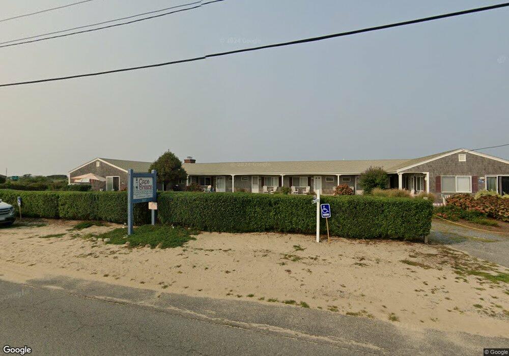
This home is located at 307 Shore Rd Unit 6, Truro, MA 2666 and is currently estimated at $457,984, approximately $1,090 per square foot. 307 Shore Rd Unit 6 is a home located in Barnstable County with nearby schools including Truro Central School.
Ownership History
Date
Name
Owned For
Owner Type
Purchase Details
Closed on
Jul 20, 2020
Sold by
Obrien Sheryl A
Bought by
Obrien Sheryl A and Obrien Joseph
Current Estimated Value
Purchase Details
Closed on
Dec 7, 2018
Sold by
Gold Tyler
Bought by
Obrien Sheryl A
Home Financials for this Owner
Home Financials are based on the most recent Mortgage that was taken out on this home.
Original Mortgage
$170,500
Interest Rate
4.8%
Mortgage Type
New Conventional
Purchase Details
Closed on
Nov 17, 2008
Sold by
Cabreeze Llc
Bought by
Gold Tyler
Home Financials for this Owner
Home Financials are based on the most recent Mortgage that was taken out on this home.
Original Mortgage
$180,000
Interest Rate
6.13%
Mortgage Type
Purchase Money Mortgage
Create a Home Valuation Report for This Property
The Home Valuation Report is an in-depth analysis detailing your home's value as well as a comparison with similar homes in the area
Home Values in the Area
Average Home Value in this Area
Purchase History
| Date | Buyer | Sale Price | Title Company |
|---|---|---|---|
| Obrien Sheryl A | -- | None Available | |
| Obrien Sheryl A | $265,000 | -- | |
| Gold Tyler | $200,000 | -- |
Source: Public Records
Mortgage History
| Date | Status | Borrower | Loan Amount |
|---|---|---|---|
| Previous Owner | Obrien Sheryl A | $170,500 | |
| Previous Owner | Gold Tyler | $180,000 |
Source: Public Records
Tax History Compared to Growth
Tax History
| Year | Tax Paid | Tax Assessment Tax Assessment Total Assessment is a certain percentage of the fair market value that is determined by local assessors to be the total taxable value of land and additions on the property. | Land | Improvement |
|---|---|---|---|---|
| 2025 | $2,372 | $383,800 | $0 | $383,800 |
| 2024 | $2,149 | $358,800 | $0 | $358,800 |
| 2023 | $2,042 | $312,300 | $0 | $312,300 |
| 2022 | $2,078 | $268,800 | $0 | $268,800 |
| 2021 | $1,964 | $266,100 | $0 | $266,100 |
| 2020 | $1,758 | $239,900 | $0 | $239,900 |
| 2019 | $1,714 | $230,100 | $0 | $230,100 |
| 2018 | $1,616 | $219,200 | $0 | $219,200 |
| 2017 | $1,516 | $217,200 | $0 | $217,200 |
| 2016 | $1,456 | $215,100 | $0 | $215,100 |
| 2015 | $1,079 | $162,800 | $0 | $162,800 |
Source: Public Records
Map
Nearby Homes
- 334 Shore Rd Unit 1
- 670 Shore Rd Unit 5
- 334 Shore Rd Unit 1
- 566 Shore Rd Unit 4
- 169 Shore Rd Unit 15
- 168 Shore Rd Unit 9
- 168 Shore Rd Unit 5
- 174 Shore Rd Unit 15
- 496 Shore Rd Unit 3
- 496 Shore Rd Unit 4
- 496 Shore Rd Unit 16
- 496 Shore Rd Unit 21
- 496 Shore Rd Unit 10
- 125 Shore Rd Unit 10
- 132 Shore Rd Unit 3
- 132 Shore Rd Unit 7
- 525 Shore Rd Unit 6
- 544 Shore Rd Unit 3
- 544 Shore Rd Unit 9
- 2 Pine Ridge End
- 307 Shore Rd
- 307 Shore Rd Unit 9 & SB2
- 307 Shore Rd Unit 12
- 307 Shore Rd Unit 1
- 307 Shore Rd Unit 11
- 307 Shore Rd Unit 7
- 307 Shore Rd Unit 2
- 307 Shore Rd Unit 4
- 307 Shore Rd Unit 8
- 307 Shore Rd Unit 10
- 307 Shore Rd Unit 3
- 307 Shore Rd Unit 5
- 307 Shore Rd Unit 9
- 307 Shore Rd Unit 9 & SB2
- 307 Shore Rd Unit 6
- 307 Shore Rd Unit 6
- 307 Shore Rd Unit 7
- 307 Shore Rd Unit 11
- 307 Shore Rd Unit 10
- 307 Shore Rd Unit 12