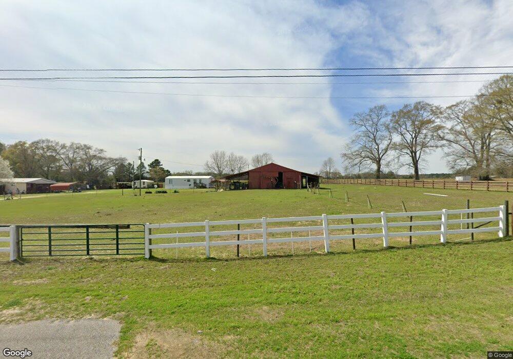
3070 State Highway 153 Samson, AL 36477
Estimated Value: $149,000 - $193,000
2
Beds
2
Baths
1,552
Sq Ft
$111/Sq Ft
Est. Value
About This Home
This home is located at 3070 State Highway 153, Samson, AL 36477 and is currently estimated at $172,504, approximately $111 per square foot. 3070 State Highway 153 is a home located in Geneva County.
Ownership History
Date
Name
Owned For
Owner Type
Purchase Details
Closed on
Dec 10, 2024
Sold by
Weyerhaeuser Company
Bought by
Weyerhaeuser Forest Holdings Inc
Current Estimated Value
Purchase Details
Closed on
Feb 6, 2013
Sold by
Hill James W
Bought by
Rhodes Jerrod D
Home Financials for this Owner
Home Financials are based on the most recent Mortgage that was taken out on this home.
Original Mortgage
$67,346
Interest Rate
3.43%
Mortgage Type
Stand Alone First
Create a Home Valuation Report for This Property
The Home Valuation Report is an in-depth analysis detailing your home's value as well as a comparison with similar homes in the area
Purchase History
| Date | Buyer | Sale Price | Title Company |
|---|---|---|---|
| Weyerhaeuser Forest Holdings Inc | $478,650 | First American Title | |
| Rhodes Jerrod D | -- | -- |
Source: Public Records
Mortgage History
| Date | Status | Borrower | Loan Amount |
|---|---|---|---|
| Previous Owner | Rhodes Jerrod D | $67,346 |
Source: Public Records
Tax History
| Year | Tax Paid | Tax Assessment Tax Assessment Total Assessment is a certain percentage of the fair market value that is determined by local assessors to be the total taxable value of land and additions on the property. | Land | Improvement |
|---|---|---|---|---|
| 2024 | $445 | $15,580 | $1,960 | $13,620 |
| 2023 | $445 | $26,340 | $3,360 | $22,980 |
| 2022 | $826 | $25,740 | $3,280 | $22,460 |
| 2021 | $768 | $23,920 | $3,140 | $20,780 |
| 2020 | $692 | $21,560 | $2,840 | $18,720 |
| 2019 | $661 | $20,580 | $2,700 | $17,880 |
| 2018 | $630 | $19,620 | $2,620 | $17,000 |
| 2017 | $625 | $19,480 | $2,620 | $16,860 |
| 2016 | $625 | $19,480 | $2,620 | $16,860 |
| 2015 | $636 | $19,800 | $2,720 | $17,080 |
| 2014 | $611 | $19,040 | $2,620 | $16,420 |
| 2013 | $340 | $10,580 | $1,900 | $8,680 |
Source: Public Records
Map
Nearby Homes
- 1116 Alabama 153
- 239 Aubie Rd
- 5343 Al-153
- 0 Co Rd 10
- 0 Cuthriell Rd
- 725 Dock Wilson Rd
- 16268 W State Highway 52
- 1638 Alabama 87
- 621 W Pullum St
- 227 Deere Dr
- 7257 State Highway 153
- N-8 Acres S St Hwy 87
- N-8 Acres S St Hwy 87
- M-8 Acres S St Hwy 87
- M-8 Acres S St Hwy 87
- S-8 Acres S St Hwy 87
- S-8 Acres S St Hwy 87
- 111 S Johnson St
- 0 Alabama 153
- 25.29 Acres Alabama 87
- 3070 State Highway 153
- 2986 State Highway 153
- 3163 State Highway 153
- 2940 State Highway 153
- 2932 State Highway 153
- 2875 State Highway 153
- 2875 Alabama 153
- 2949 State Highway 153
- 2854 State Highway 153
- 2764 State Highway 153
- 390 Iron Bridge Rd
- 4271 Columbus Holley Rd
- 2591 State Highway 153
- 5.6 AC Hwy 153
- 581 Iron Bridge Rd
- 3640 State Highway 153
- 3640 Hwy 153
- 2397 State Highway 153
- 2448 State Highway 153
- 403 Ganer Rd
Your Personal Tour Guide
Ask me questions while you tour the home.