3071 Lois Dr Unit 710 Anchorage, AK 99517
Spenard NeighborhoodEstimated Value: $139,264 - $140,000
1
Bed
1
Bath
580
Sq Ft
$241/Sq Ft
Est. Value
About This Home
This home is located at 3071 Lois Dr Unit 710, Anchorage, AK 99517 and is currently estimated at $139,632, approximately $240 per square foot. 3071 Lois Dr Unit 710 is a home located in Anchorage Municipality with nearby schools including Turnagain Elementary School, Romig Middle School, and West High School.
Ownership History
Date
Name
Owned For
Owner Type
Purchase Details
Closed on
Aug 14, 2008
Sold by
Johnson Patrick J
Bought by
Johnson Patricia A
Current Estimated Value
Purchase Details
Closed on
Apr 12, 2008
Sold by
Johnson Patricia A
Bought by
Johnson Patrick
Purchase Details
Closed on
Sep 17, 2007
Sold by
Johnson Patrick J
Bought by
Johnson Patricia A
Create a Home Valuation Report for This Property
The Home Valuation Report is an in-depth analysis detailing your home's value as well as a comparison with similar homes in the area
Home Values in the Area
Average Home Value in this Area
Purchase History
| Date | Buyer | Sale Price | Title Company |
|---|---|---|---|
| Johnson Patricia A | -- | None Available | |
| Johnson Patrick | -- | None Available | |
| Johnson Patricia A | -- | None Available |
Source: Public Records
Tax History Compared to Growth
Tax History
| Year | Tax Paid | Tax Assessment Tax Assessment Total Assessment is a certain percentage of the fair market value that is determined by local assessors to be the total taxable value of land and additions on the property. | Land | Improvement |
|---|---|---|---|---|
| 2025 | $1,587 | $135,300 | -- | $135,300 |
| 2024 | $1,587 | $98,300 | $0 | $98,300 |
| 2023 | $1,618 | $95,000 | $0 | $95,000 |
| 2022 | $1,457 | $86,500 | $0 | $86,500 |
| 2021 | $1,479 | $82,100 | $0 | $82,100 |
| 2020 | $1,805 | $106,200 | $0 | $106,200 |
| 2019 | $1,582 | $96,700 | $0 | $96,700 |
| 2018 | $1,561 | $95,200 | $0 | $95,200 |
| 2017 | $1,524 | $97,300 | $0 | $97,300 |
| 2016 | $1,392 | $90,200 | $0 | $90,200 |
| 2015 | $1,392 | $93,800 | $0 | $93,800 |
| 2014 | $1,392 | $98,400 | $0 | $98,400 |
Source: Public Records
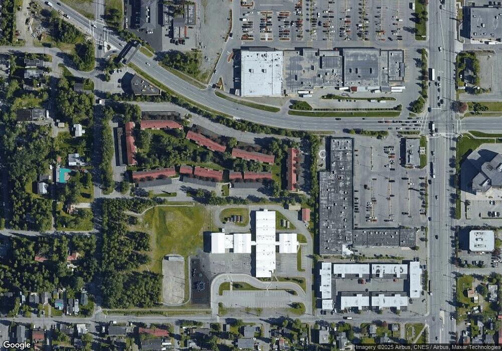
Map
Nearby Homes
- 2155 W 29th Ave Unit 2
- 1508 W 31st Ave
- 3311 Greenland Dr Unit B
- 000 Anchorage
- Tr A W Northern Lights Blvd
- 3406 Wyoming Dr
- 3409 Oregon Dr
- 1407 W 33rd Ave
- 1471 W 26th Ave
- 3507 Greenland Dr
- 1441 W 26th Ave Unit B3
- 3605 Oregon Dr Unit 7
- 3605 Oregon Dr Unit 4
- 2400 Belmont Dr
- 3201 Spenard Rd
- 1435 W 25th Ave
- 3103 Barbara St
- 2064 Belair Dr
- 1100 W 32nd Ave Unit 23
- 2502 W 34th Ave
- 3081 Lois Dr Unit 811
- 3081 Lois Dr Unit 810
- 3081 Lois Dr Unit 809
- 3081 Lois Dr Unit 808
- 3081 Lois Dr Unit 807
- 3081 Lois Dr Unit 806
- 3081 Lois Dr Unit 805
- 3081 Lois Dr Unit 804
- 3081 Lois Dr Unit 803
- 3081 Lois Dr Unit 802
- 3081 Lois Dr Unit 801
- 3071 Lois Dr Unit 713
- 3071 Lois Dr Unit 712
- 3071 Lois Dr Unit 711
- 3071 Lois Dr Unit 709
- 3071 Lois Dr Unit 708
- 3071 Lois Dr Unit 707
- 3071 Lois Dr Unit 706
- 3071 Lois Dr Unit 705
- 3071 Lois Dr Unit 704