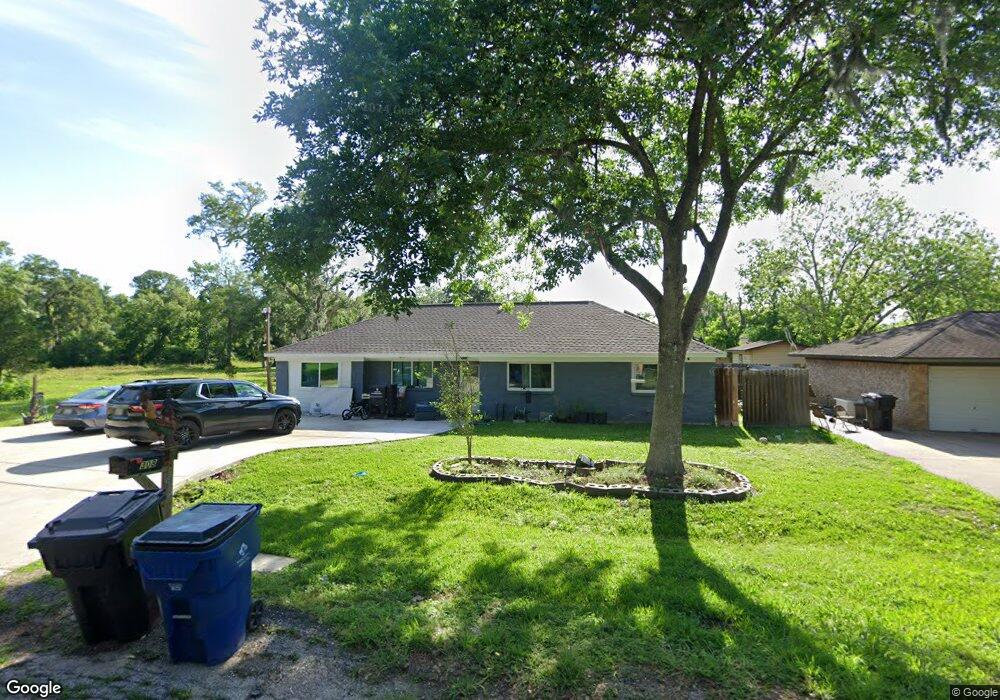
308 Avenue G Brazoria, TX 77422
Estimated Value: $203,000 - $234,000
3
Beds
2
Baths
1,580
Sq Ft
$137/Sq Ft
Est. Value
About This Home
This home is located at 308 Avenue G, Brazoria, TX 77422 and is currently estimated at $216,464, approximately $137 per square foot. 308 Avenue G is a home located in Brazoria County.
Ownership History
Date
Name
Owned For
Owner Type
Purchase Details
Closed on
May 8, 2012
Sold by
Secretary Of Housing & Urban Development
Bought by
Jordan Timothy Michael
Current Estimated Value
Home Financials for this Owner
Home Financials are based on the most recent Mortgage that was taken out on this home.
Original Mortgage
$61,800
Outstanding Balance
$44,003
Interest Rate
4.5%
Mortgage Type
Adjustable Rate Mortgage/ARM
Estimated Equity
$172,461
Purchase Details
Closed on
Jun 14, 2011
Sold by
Wells Fargo Bank Na
Bought by
The Secretary Of Housing & Urban Develop
Purchase Details
Closed on
Jun 7, 2011
Sold by
Buchanan Daniel W and Buchanan Jaime Beth
Bought by
Wells Fargo Bank Na
Purchase Details
Closed on
Feb 21, 2008
Sold by
Ricks Stephen W and Ricks Sara M
Bought by
Buchanan Daniel W and Buchanan Jamie Beth
Home Financials for this Owner
Home Financials are based on the most recent Mortgage that was taken out on this home.
Original Mortgage
$112,610
Interest Rate
5.88%
Mortgage Type
Purchase Money Mortgage
Purchase Details
Closed on
Feb 24, 2004
Sold by
Hud
Bought by
Ricks Stephen W and Ricks Sara M
Home Financials for this Owner
Home Financials are based on the most recent Mortgage that was taken out on this home.
Original Mortgage
$52,000
Interest Rate
5.65%
Mortgage Type
Purchase Money Mortgage
Purchase Details
Closed on
Jul 1, 2003
Sold by
Washington Mutual Bank Fa
Bought by
Hud
Purchase Details
Closed on
Aug 21, 1996
Sold by
Beard Daniel Carter and Beard Willie Mae
Bought by
Sweeny Melvin Ray and Sweeny Joyce E
Home Financials for this Owner
Home Financials are based on the most recent Mortgage that was taken out on this home.
Original Mortgage
$68,800
Interest Rate
8.42%
Mortgage Type
FHA
Purchase Details
Closed on
Aug 26, 1994
Sold by
Winborn Mary Alice
Bought by
Beard Daniel C and Beard Willie M
Home Financials for this Owner
Home Financials are based on the most recent Mortgage that was taken out on this home.
Original Mortgage
$7,000
Interest Rate
8.69%
Create a Home Valuation Report for This Property
The Home Valuation Report is an in-depth analysis detailing your home's value as well as a comparison with similar homes in the area
Home Values in the Area
Average Home Value in this Area
Purchase History
| Date | Buyer | Sale Price | Title Company |
|---|---|---|---|
| Jordan Timothy Michael | -- | First American Title | |
| The Secretary Of Housing & Urban Develop | -- | None Available | |
| Wells Fargo Bank Na | $131,714 | None Available | |
| Buchanan Daniel W | -- | Alamo Title | |
| Ricks Stephen W | -- | -- | |
| Hud | -- | -- | |
| Washington Mutual Bank Fa | $69,596 | -- | |
| Sweeny Melvin Ray | -- | -- | |
| Beard Daniel C | -- | -- |
Source: Public Records
Mortgage History
| Date | Status | Borrower | Loan Amount |
|---|---|---|---|
| Open | Jordan Timothy Michael | $61,800 | |
| Previous Owner | Buchanan Daniel W | $112,610 | |
| Previous Owner | Ricks Stephen W | $52,000 | |
| Previous Owner | Sweeny Melvin Ray | $68,800 | |
| Previous Owner | Beard Daniel C | $7,000 |
Source: Public Records
Tax History Compared to Growth
Tax History
| Year | Tax Paid | Tax Assessment Tax Assessment Total Assessment is a certain percentage of the fair market value that is determined by local assessors to be the total taxable value of land and additions on the property. | Land | Improvement |
|---|---|---|---|---|
| 2025 | $2,390 | $198,838 | $16,780 | $189,450 |
| 2023 | $2,390 | $164,329 | $15,100 | $199,390 |
| 2022 | $3,374 | $149,390 | $13,320 | $136,070 |
| 2021 | $3,442 | $146,050 | $11,540 | $134,510 |
| 2020 | $3,401 | $137,500 | $10,660 | $126,840 |
| 2019 | $3,475 | $136,120 | $8,440 | $127,680 |
| 2018 | $3,297 | $128,450 | $8,440 | $120,010 |
| 2017 | $3,410 | $128,450 | $8,440 | $120,010 |
| 2016 | $3,410 | $128,450 | $8,440 | $120,010 |
| 2014 | $2,180 | $81,220 | $8,440 | $72,780 |
Source: Public Records
Map
Nearby Homes
- 307 Avenue G
- 523 Lazy Ln
- 229 Yaupon Dr
- 232 Magnolia St
- 409 Carlton St
- 0 Pecan Dr
- 706 E New York St
- 549 E New York St
- 4773 County Road 652
- 230 E New York St
- 1208 S Brooks St
- 34654 Fm 521 Rd
- 8922 Fm 521 Rd
- 338 County Road 912a
- 310 E Texas St
- 401 E Texas St
- 0 Cr-747a
- TBD Cr-318
- 320 Cr-320
- 0 Cr-318 Unit 18304666