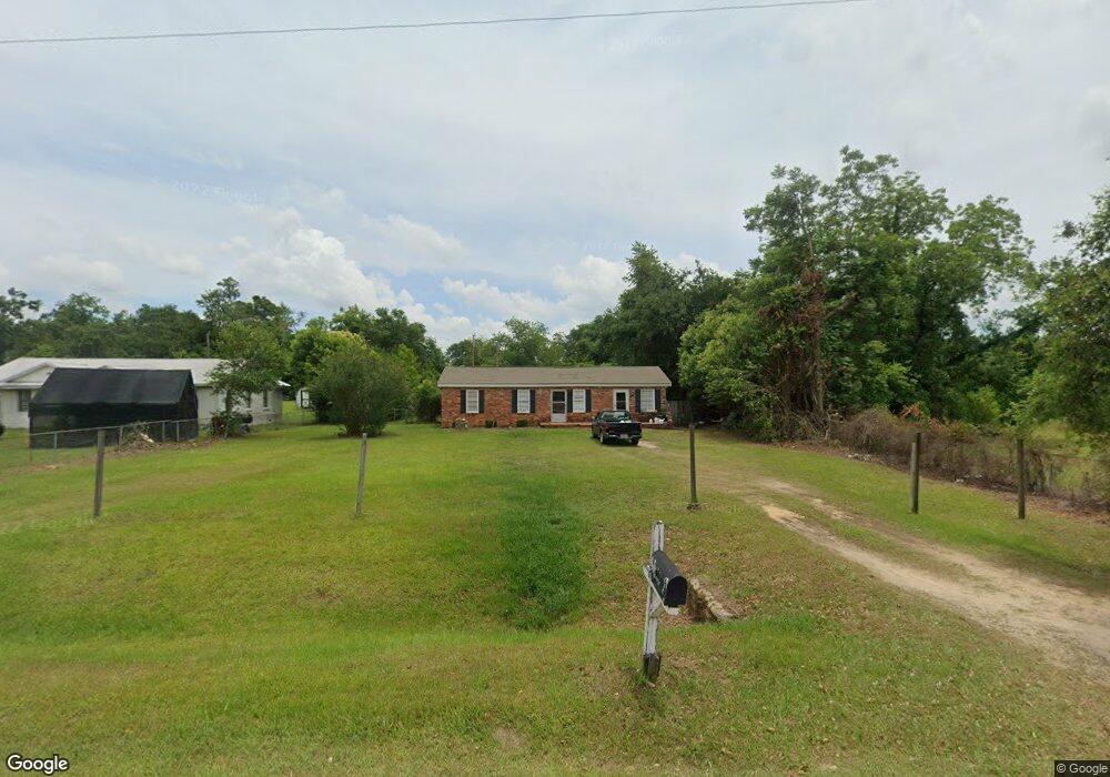
308 Branch Rd Albany, GA 31705
Estimated Value: $62,000 - $98,000
3
Beds
1
Bath
1,151
Sq Ft
$70/Sq Ft
Est. Value
About This Home
This home is located at 308 Branch Rd, Albany, GA 31705 and is currently estimated at $80,290, approximately $69 per square foot. 308 Branch Rd is a home located in Dougherty County with nearby schools including Turner Elementary School, Albany Middle School, and Radium Springs Middle School.
Ownership History
Date
Name
Owned For
Owner Type
Purchase Details
Closed on
Sep 8, 2006
Sold by
Andrews Markets Inc
Bought by
Gregory Steve
Current Estimated Value
Purchase Details
Closed on
Oct 20, 1998
Sold by
Andrews Jim H
Bought by
Andrew'S Markets Inc
Purchase Details
Closed on
Oct 14, 1994
Sold by
Childers Suzanne M
Bought by
Andrews Jim H
Purchase Details
Closed on
Mar 6, 1992
Sold by
Norris Sherwood S
Bought by
Norris Norris and Norris Childers
Purchase Details
Closed on
Oct 5, 1989
Sold by
Mcguire Patrick
Bought by
Norris Sherwood S
Purchase Details
Closed on
Apr 11, 1989
Sold by
Tillman Lee Frances
Bought by
Mcguire Patrick Etal
Create a Home Valuation Report for This Property
The Home Valuation Report is an in-depth analysis detailing your home's value as well as a comparison with similar homes in the area
Home Values in the Area
Average Home Value in this Area
Purchase History
| Date | Buyer | Sale Price | Title Company |
|---|---|---|---|
| Gregory Steve | $50,000 | -- | |
| Andrew'S Markets Inc | -- | -- | |
| Andrews Jim H | $25,000 | -- | |
| Norris Norris | -- | -- | |
| Norris Sherwood S | $35,000 | -- | |
| Mcguire Patrick Etal | $39,000 | -- |
Source: Public Records
Tax History Compared to Growth
Tax History
| Year | Tax Paid | Tax Assessment Tax Assessment Total Assessment is a certain percentage of the fair market value that is determined by local assessors to be the total taxable value of land and additions on the property. | Land | Improvement |
|---|---|---|---|---|
| 2024 | $802 | $17,360 | $5,040 | $12,320 |
| 2023 | $803 | $17,360 | $5,040 | $12,320 |
| 2022 | $804 | $17,360 | $5,040 | $12,320 |
| 2021 | $745 | $17,360 | $5,040 | $12,320 |
| 2020 | $746 | $17,360 | $5,040 | $12,320 |
| 2019 | $748 | $17,360 | $5,040 | $12,320 |
| 2018 | $750 | $17,360 | $5,040 | $12,320 |
| 2017 | $697 | $17,360 | $5,040 | $12,320 |
| 2016 | $698 | $17,360 | $5,040 | $12,320 |
| 2015 | $699 | $17,360 | $5,040 | $12,320 |
| 2014 | $689 | $17,360 | $5,040 | $12,320 |
Source: Public Records
Map
Nearby Homes
- 3431 Gladys Ct
- 3606 Radial Ave
- 3620 Radial Ave
- 3704 Parr Rd
- 405 Pine Bluff Rd
- 100 Gurr Dr
- 2802 Banks Ave
- 148 Force Dr
- 2731 Yorktown Ave
- 308 Forrestal Ln
- 513 Johnson Rd
- 3625 Sylvester Rd
- 2529 Cherokee Dr
- 410 Johnson Rd
- 2523 Cherokee Dr
- 5108 Cypress Ave
- 234 Cone St
- 306 Elsom St
- 414 Pine Glen Dr
- 307 Acorn St
- 310 Branch Rd
- 312 Branch Rd
- 3403 Sylvester Rd
- 3407 Sylvester Rd
- 314 Branch Rd
- 107 Holton Ln
- 3409 Sylvester Rd
- 316 Branch Rd
- 3411 Sylvester Rd
- 111 Holton Ln
- 406 Branch Rd
- 3415 Sylvester Hwy
- 408 Branch Rd
- 402 Branch Rd
- 412 Branch Rd
- 414 Branch Rd
- 3327 Sylvester Rd
- 418 Branch Rd
- 3323 Sylvester Hwy
- 3323 Sylvester Rd