Estimated Value: $183,000 - $230,000
3
Beds
2
Baths
1,794
Sq Ft
$111/Sq Ft
Est. Value
About This Home
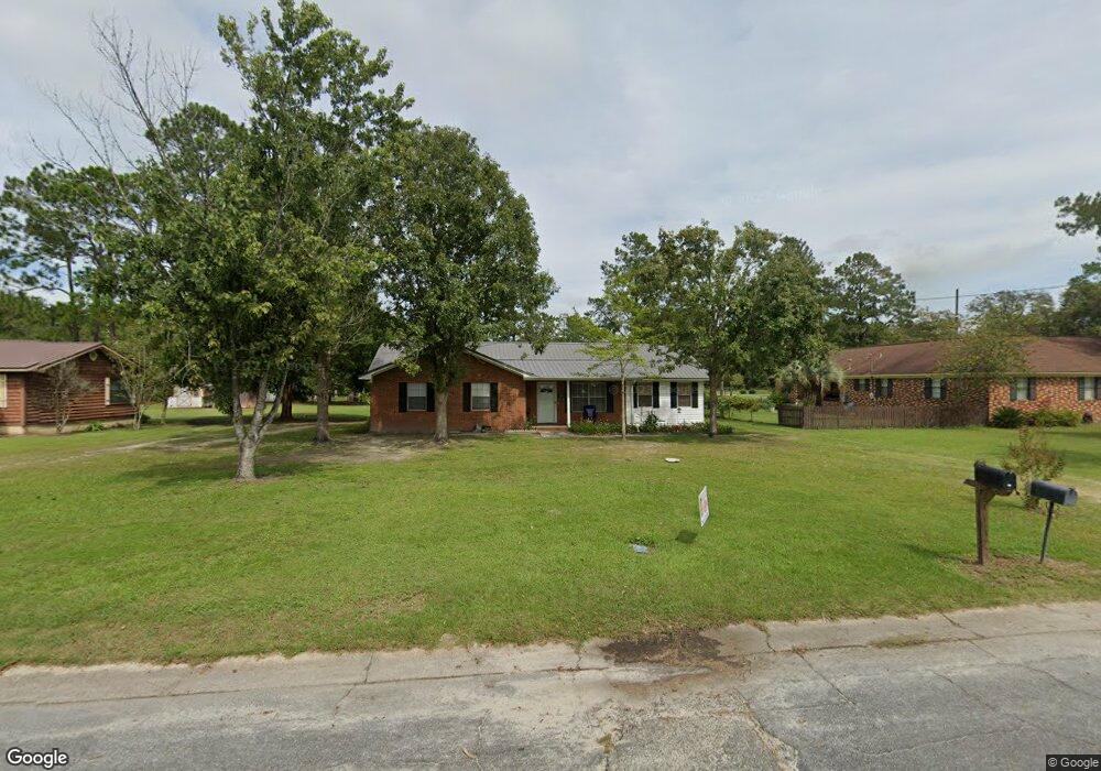
This home is located at 308 Crosby Rd, Alma, GA 31510 and is currently estimated at $199,609, approximately $111 per square foot. 308 Crosby Rd is a home located in Bacon County with nearby schools including Bacon County Primary School, Bacon County Elementary School, and Bacon County Middle School.
Ownership History
Date
Name
Owned For
Owner Type
Purchase Details
Closed on
Sep 30, 2022
Sold by
Clay Thomas
Bought by
Rivera Leasly Michelle and Vargas Ezequiel
Current Estimated Value
Home Financials for this Owner
Home Financials are based on the most recent Mortgage that was taken out on this home.
Original Mortgage
$158,650
Outstanding Balance
$152,255
Interest Rate
5.66%
Mortgage Type
New Conventional
Estimated Equity
$47,354
Purchase Details
Closed on
Apr 10, 2002
Sold by
Burkett Scotty E
Bought by
Clay Thomas
Purchase Details
Closed on
Feb 7, 2000
Sold by
Deloach Jackie
Bought by
Burkett Scotty E
Create a Home Valuation Report for This Property
The Home Valuation Report is an in-depth analysis detailing your home's value as well as a comparison with similar homes in the area
Home Values in the Area
Average Home Value in this Area
Purchase History
| Date | Buyer | Sale Price | Title Company |
|---|---|---|---|
| Rivera Leasly Michelle | $167,000 | -- | |
| Clay Thomas | $55,000 | -- | |
| Burkett Scotty E | -- | -- |
Source: Public Records
Mortgage History
| Date | Status | Borrower | Loan Amount |
|---|---|---|---|
| Open | Rivera Leasly Michelle | $158,650 |
Source: Public Records
Tax History Compared to Growth
Tax History
| Year | Tax Paid | Tax Assessment Tax Assessment Total Assessment is a certain percentage of the fair market value that is determined by local assessors to be the total taxable value of land and additions on the property. | Land | Improvement |
|---|---|---|---|---|
| 2024 | $2,324 | $63,976 | $1,520 | $62,456 |
| 2023 | $2,213 | $57,416 | $1,520 | $55,896 |
| 2022 | $988 | $30,000 | $1,520 | $28,480 |
| 2021 | $807 | $29,760 | $1,520 | $28,240 |
| 2020 | $880 | $26,219 | $1,408 | $24,811 |
| 2019 | $880 | $26,219 | $1,408 | $24,811 |
| 2018 | $874 | $26,134 | $1,408 | $24,726 |
| 2017 | $1,052 | $26,134 | $1,408 | $24,726 |
| 2016 | $875 | $26,134 | $1,408 | $24,726 |
| 2015 | $866 | $25,879 | $1,572 | $24,307 |
| 2014 | $878 | $25,879 | $1,572 | $24,307 |
| 2013 | $878 | $22,938 | $1,572 | $21,365 |
Source: Public Records
Map
Nearby Homes
- 611 S Bead St
- 403 S Ware St
- 117 Grace Loop Unit 1
- 118 Grace Loop Unit 1
- 122 Grace Loop Unit 1
- 9TH E 417
- 314 W 16th St
- 1348 U S 1
- 113 Brite Blue Dr
- 198 Meadow Rd
- 166 Grace Loop Unit 1
- 907 N Pierce St
- 224 Meadow Rd
- 0 Oriole Rd Unit 1654653
- 0 Oriole Rd Unit 10543585
- 0 Oriole Rd Unit 25773381
- 0 Oriole Rd Unit 160930
- 401 Lee St
- 118 Morris Dr
- 1109 W 4th Street Extension
- 310 Crosby Rd
- 304 Crosby Rd
- 511 Radio Station Rd
- 0 Townsend Ln
- 305 Crosby Rd
- 309 Crosby Rd
- 506 Townsend Ln
- 603 Radio Station Rd
- 507 Townsend Ln
- 507 Radio Station Rd
- 108 Mccrea Ave
- 303 Crosby Rd
- 607 Radio Station Rd
- 510 Radio Station Rd
- 505 Townsend Ln
- 310 Taylor Rd
- 202 Mccrea Ave
- 308 Taylor Rd
- 501 Radio Station Rd
- 613 Radio Station Rd