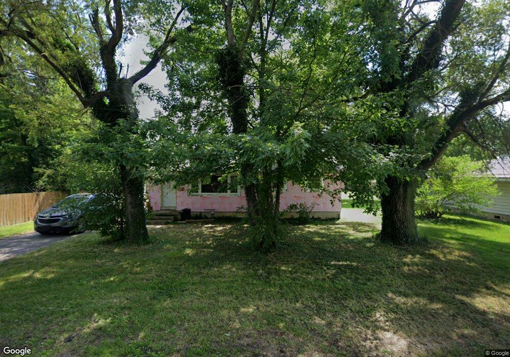
308 Elwood Ave Fostoria, OH 44830
Estimated Value: $86,000 - $132,000
3
Beds
1
Bath
960
Sq Ft
$111/Sq Ft
Est. Value
About This Home
This home is located at 308 Elwood Ave, Fostoria, OH 44830 and is currently estimated at $106,776, approximately $111 per square foot. 308 Elwood Ave is a home located in Hancock County with nearby schools including Fostoria Intermediate Elementary School and Fostoria Junior/Senior High School.
Ownership History
Date
Name
Owned For
Owner Type
Purchase Details
Closed on
Apr 28, 2017
Sold by
G P Properties Llc
Bought by
Birmire Rental Properties Llc
Current Estimated Value
Purchase Details
Closed on
Dec 4, 2015
Bought by
G P Properties Llc
Home Financials for this Owner
Home Financials are based on the most recent Mortgage that was taken out on this home.
Interest Rate
3.93%
Purchase Details
Closed on
Feb 17, 1987
Bought by
Franks Janet G
Purchase Details
Closed on
Apr 27, 1984
Bought by
Enright Beth A
Create a Home Valuation Report for This Property
The Home Valuation Report is an in-depth analysis detailing your home's value as well as a comparison with similar homes in the area
Home Values in the Area
Average Home Value in this Area
Purchase History
| Date | Buyer | Sale Price | Title Company |
|---|---|---|---|
| Birmire Rental Properties Llc | -- | None Available | |
| G P Properties Llc | -- | -- | |
| Franks Janet G | $36,500 | -- | |
| Enright Beth A | $24,000 | -- |
Source: Public Records
Mortgage History
| Date | Status | Borrower | Loan Amount |
|---|---|---|---|
| Previous Owner | G P Properties Llc | -- |
Source: Public Records
Tax History Compared to Growth
Tax History
| Year | Tax Paid | Tax Assessment Tax Assessment Total Assessment is a certain percentage of the fair market value that is determined by local assessors to be the total taxable value of land and additions on the property. | Land | Improvement |
|---|---|---|---|---|
| 2024 | $984 | $19,320 | $5,150 | $14,170 |
| 2023 | $981 | $19,320 | $5,150 | $14,170 |
| 2022 | $1,069 | $19,320 | $5,150 | $14,170 |
| 2021 | $904 | $15,720 | $5,420 | $10,300 |
| 2020 | $908 | $15,720 | $5,420 | $10,300 |
| 2019 | $904 | $15,720 | $5,420 | $10,300 |
| 2018 | $807 | $13,690 | $4,710 | $8,980 |
| 2017 | $806 | $13,690 | $4,710 | $8,980 |
| 2016 | $803 | $13,690 | $4,710 | $8,980 |
| 2015 | $878 | $15,590 | $4,710 | $10,880 |
| 2014 | $878 | $15,590 | $4,710 | $10,880 |
| 2012 | $1,897 | $17,980 | $4,710 | $13,270 |
Source: Public Records
Map
Nearby Homes
- 461 W Lytle St
- 461 W Lytle St Unit 145
- 461 W Lytle St Unit 106
- 411 Monticello Dr
- 351 W South St
- 509 College Ave
- 348 W South St
- 418 W Ridge Dr
- 425 W Ridge Dr
- 203 N Union St
- 1401 Van Buren St
- 603 N Vine St
- 0 W South Route 12
- 520 N Union St
- 723 N Union St
- 211 Summit St
- 901 Central Ave
- 321 Mcdougal St
- 435 Park Ave
- 931 N Union St
- 310 Elwood Ave
- 415 Independence Ave
- 312 Elwood Ave
- 315 Elwood Ave
- 409 Independence Ave
- 317 Elwood Ave
- 300 Elwood Ave
- 425 Independence Ave
- 316 Elwood Ave
- 301 Elwood Ave
- 319 Elwood Ave
- 101 Atkins Ave
- 320 Elwood Ave
- 310 Watson Ave
- 240 Elwood Ave
- 334 Watson Ave
- 211 Atkins Ave
- 313 Independence Ave
- 239 Elwood Ave
- 412 Independence Ave