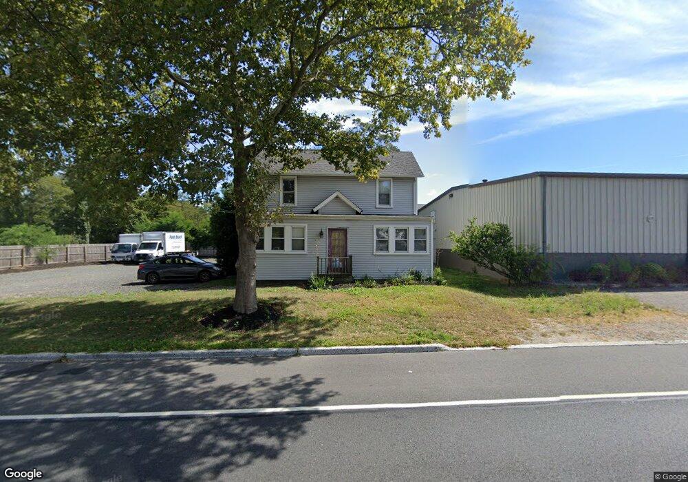
308 Hawthorne Ave Point Pleasant Beach, NJ 08742
Point Pleasant Beach NeighborhoodEstimated Value: $725,000 - $1,196,000
5
Beds
2
Baths
2,020
Sq Ft
$427/Sq Ft
Est. Value
About This Home
This home is located at 308 Hawthorne Ave, Point Pleasant Beach, NJ 08742 and is currently estimated at $863,326, approximately $427 per square foot. 308 Hawthorne Ave is a home located in Ocean County with nearby schools including G Harold Antrim Elementary School, Point Pleasant Beach High School, and St. Peter School.
Ownership History
Date
Name
Owned For
Owner Type
Purchase Details
Closed on
Apr 23, 2002
Sold by
E & S Partnership
Bought by
Bonsper Paul
Current Estimated Value
Purchase Details
Closed on
Jul 19, 1995
Sold by
Ferrari Emma
Bought by
E & S Partnership
Home Financials for this Owner
Home Financials are based on the most recent Mortgage that was taken out on this home.
Original Mortgage
$100,000
Interest Rate
7.48%
Create a Home Valuation Report for This Property
The Home Valuation Report is an in-depth analysis detailing your home's value as well as a comparison with similar homes in the area
Home Values in the Area
Average Home Value in this Area
Purchase History
| Date | Buyer | Sale Price | Title Company |
|---|---|---|---|
| Bonsper Paul | $295,000 | -- | |
| E & S Partnership | $173,000 | -- |
Source: Public Records
Mortgage History
| Date | Status | Borrower | Loan Amount |
|---|---|---|---|
| Previous Owner | E & S Partnership | $100,000 |
Source: Public Records
Tax History Compared to Growth
Tax History
| Year | Tax Paid | Tax Assessment Tax Assessment Total Assessment is a certain percentage of the fair market value that is determined by local assessors to be the total taxable value of land and additions on the property. | Land | Improvement |
|---|---|---|---|---|
| 2025 | $5,827 | $339,200 | $200,000 | $139,200 |
| 2024 | $5,651 | $339,200 | $200,000 | $139,200 |
| 2023 | $5,492 | $339,200 | $200,000 | $139,200 |
| 2022 | $5,492 | $339,200 | $200,000 | $139,200 |
| 2021 | $5,370 | $339,200 | $200,000 | $139,200 |
| 2020 | $5,363 | $339,200 | $200,000 | $139,200 |
| 2019 | $5,288 | $339,200 | $200,000 | $139,200 |
| 2018 | $5,207 | $339,200 | $200,000 | $139,200 |
| 2017 | $5,125 | $339,200 | $200,000 | $139,200 |
| 2016 | $5,149 | $339,200 | $200,000 | $139,200 |
| 2015 | $5,108 | $339,200 | $200,000 | $139,200 |
| 2014 | $5,085 | $339,200 | $200,000 | $139,200 |
Source: Public Records
Map
Nearby Homes
- 325 Hawthorne Ave Unit 327
- 303 Cooks Ln
- 326 Curtis Ave Unit Lot 27
- 328 Curtis Ave Unit Lot 28
- 109 Griffiths Ave
- 204 Curtis Ave
- 305 Chicago Ave
- 37 Arnold Ave
- 202 Yale Ave
- 728 Arnold Ave
- 606 Bay Ave Unit 2
- 607 Richmond Ave Unit 4
- 845 Arnold Ave Unit 3
- 25 Niblick St
- 503 Atlantic Ave
- 807 Trenton Ave
- 615 Atlantic Ave
- 704 Forman Ave
- 201 Forman Ave
- 842 Arnold Ave Unit 2
- 309 Hawthorne Ave
- 311 Hawthorne Ave
- 308 Richmond Ave
- 310 Richmond Ave
- 306 Richmond Ave Unit 2 Floor
- 306 Richmond Ave Unit A
- 314 Richmond Ave
- 316 Richmond Ave
- 210 Osprey Ave
- 323 Hawthorne Ave
- 321 Hawthorne Ave
- 321 Hawthorne Ave Unit 1
- 321 Hawthorne Ave Unit 2
- 318 Richmond Ave
- 208 Osprey Ave
- 320 Richmond Ave
- 433 Yale Ave
- 206 Osprey Ave
- 322 Richmond Ave
- 431 Yale Ave