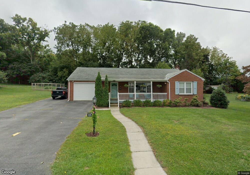
308 Jopa Rd Greencastle, PA 17225
Estimated Value: $263,000 - $286,578
2
Beds
1
Bath
1,225
Sq Ft
$222/Sq Ft
Est. Value
About This Home
This home is located at 308 Jopa Rd, Greencastle, PA 17225 and is currently estimated at $272,395, approximately $222 per square foot. 308 Jopa Rd is a home located in Franklin County with nearby schools including Greencastle-Antrim Primary School, Greencastle-Antrim Elementary School, and Greencastle-Antrim Middle School.
Ownership History
Date
Name
Owned For
Owner Type
Purchase Details
Closed on
Jul 8, 2016
Sold by
Evans Margaret P
Bought by
Kennedy Kathryn A and Stahl Mark A
Current Estimated Value
Home Financials for this Owner
Home Financials are based on the most recent Mortgage that was taken out on this home.
Original Mortgage
$127,920
Outstanding Balance
$102,053
Interest Rate
3.56%
Mortgage Type
New Conventional
Estimated Equity
$170,342
Create a Home Valuation Report for This Property
The Home Valuation Report is an in-depth analysis detailing your home's value as well as a comparison with similar homes in the area
Home Values in the Area
Average Home Value in this Area
Purchase History
| Date | Buyer | Sale Price | Title Company |
|---|---|---|---|
| Kennedy Kathryn A | $159,900 | None Available |
Source: Public Records
Mortgage History
| Date | Status | Borrower | Loan Amount |
|---|---|---|---|
| Open | Kennedy Kathryn A | $127,920 |
Source: Public Records
Tax History Compared to Growth
Tax History
| Year | Tax Paid | Tax Assessment Tax Assessment Total Assessment is a certain percentage of the fair market value that is determined by local assessors to be the total taxable value of land and additions on the property. | Land | Improvement |
|---|---|---|---|---|
| 2025 | $3,386 | $19,750 | $2,020 | $17,730 |
| 2024 | $3,313 | $19,750 | $2,020 | $17,730 |
| 2023 | $3,278 | $19,750 | $2,020 | $17,730 |
| 2022 | $3,258 | $19,750 | $2,020 | $17,730 |
| 2021 | $3,201 | $19,750 | $2,020 | $17,730 |
| 2020 | $3,125 | $19,750 | $2,020 | $17,730 |
| 2019 | $3,061 | $19,750 | $2,020 | $17,730 |
| 2018 | $3,031 | $19,750 | $2,020 | $17,730 |
| 2017 | $2,674 | $17,950 | $2,020 | $15,930 |
| 2016 | $514 | $17,950 | $2,020 | $15,930 |
| 2015 | $479 | $17,950 | $2,020 | $15,930 |
| 2014 | $479 | $17,950 | $2,020 | $15,930 |
Source: Public Records
Map
Nearby Homes
- 239 Orchard Cir
- 271 E Baltimore St
- 431 Leitersburg St
- 129 E Franklin St
- 674 Lohman Ave
- 148 E Madison St
- 34.77 Acres Red Oak Estate S
- 602 Brookview Dr
- 227 Tyrone St
- 231 N Allison St Unit 1
- 45 W Dahlgren St
- 101 N Carlisle St
- 148 N Carlisle St
- 480 S Carlisle St
- 823 Buchanan Trail E
- 560 Meadowview Cir
- 341 W Baltimore St
- 375 Carolle St
- 12 Edward Dr
- 382 Teaberry Dr