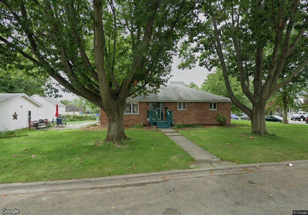
308 W Latimer St Abingdon, IL 61410
Estimated Value: $130,125 - $150,000
Studio
--
Bath
1,728
Sq Ft
$80/Sq Ft
Est. Value
About This Home
This home is located at 308 W Latimer St, Abingdon, IL 61410 and is currently estimated at $138,281, approximately $80 per square foot. 308 W Latimer St is a home located in Knox County with nearby schools including Hedding Grade School, Avon Elementary School, and Abingdon-Avon Middle School.
Ownership History
Date
Name
Owned For
Owner Type
Purchase Details
Closed on
Feb 22, 2018
Sold by
Dare David F
Bought by
Davis Robert F and Davis Janice K
Current Estimated Value
Home Financials for this Owner
Home Financials are based on the most recent Mortgage that was taken out on this home.
Original Mortgage
$35,000
Outstanding Balance
$29,679
Interest Rate
4.04%
Mortgage Type
New Conventional
Estimated Equity
$108,602
Create a Home Valuation Report for This Property
The Home Valuation Report is an in-depth analysis detailing your home's value as well as a comparison with similar homes in the area
Home Values in the Area
Average Home Value in this Area
Purchase History
| Date | Buyer | Sale Price | Title Company |
|---|---|---|---|
| Davis Robert F | $105,000 | Attorney Only |
Source: Public Records
Mortgage History
| Date | Status | Borrower | Loan Amount |
|---|---|---|---|
| Open | Davis Robert F | $35,000 |
Source: Public Records
Tax History
| Year | Tax Paid | Tax Assessment Tax Assessment Total Assessment is a certain percentage of the fair market value that is determined by local assessors to be the total taxable value of land and additions on the property. | Land | Improvement |
|---|---|---|---|---|
| 2024 | $2,312 | $45,980 | $2,560 | $43,420 |
| 2023 | $2,312 | $41,500 | $2,310 | $39,190 |
| 2022 | $2,495 | $39,370 | $2,200 | $37,170 |
| 2021 | $2,411 | $37,860 | $2,120 | $35,740 |
| 2020 | $2,292 | $36,410 | $2,040 | $34,370 |
| 2019 | $2,346 | $36,050 | $2,020 | $34,030 |
| 2018 | $2,977 | $31,730 | $1,960 | $29,770 |
| 2017 | $2,950 | $31,110 | $1,920 | $29,190 |
| 2015 | -- | $30,500 | $1,880 | $28,620 |
| 2013 | $1,907 | $30,200 | $1,860 | $28,340 |
Source: Public Records
Map
Nearby Homes
- 103 N Swarts St
- 500 N Monroe St
- 407 W Martin St
- 110 W Jackson St
- 106 E Jackson St
- 207 E Meek St
- 905 W Palmer St
- 614 S East St
- 1196 160th St
- 1015 Sunny Knoll Dr
- 409 Knox Highway 26
- 999 Breezy Bluff Dr
- Lot 11 Spoden Ln
- Lot 2 Spoden Ln
- Lot 3 Spoden Ln
- Lot 1 Spoden Ln
- Lot 6 Spoden Ln
- Lot 12 Spoden Ln
- 1077 Knox Road 500 E
- 224 Academy St
- 305 N Swarts Ave
- 303 N Swarts Ave
- 306 N Monroe St
- 309 W Pearl St
- 307 W Pearl St
- 302 N Monroe St
- 306 N Swarts Ave
- 304 N Swarts Ave
- 302 N Swarts Ave
- 300 N Monroe St
- 300 N Swarts Ave
- 207 N Swarts Ave
- 406 W Latimer St
- 307 N Monroe St
- 401 N Monroe St
- 206 N Swarts St
- 409 W Pearl St
- 209 W Pearl St
- 205 N Swarts Ave
- 206 N Swarts Ave
Your Personal Tour Guide
Ask me questions while you tour the home.