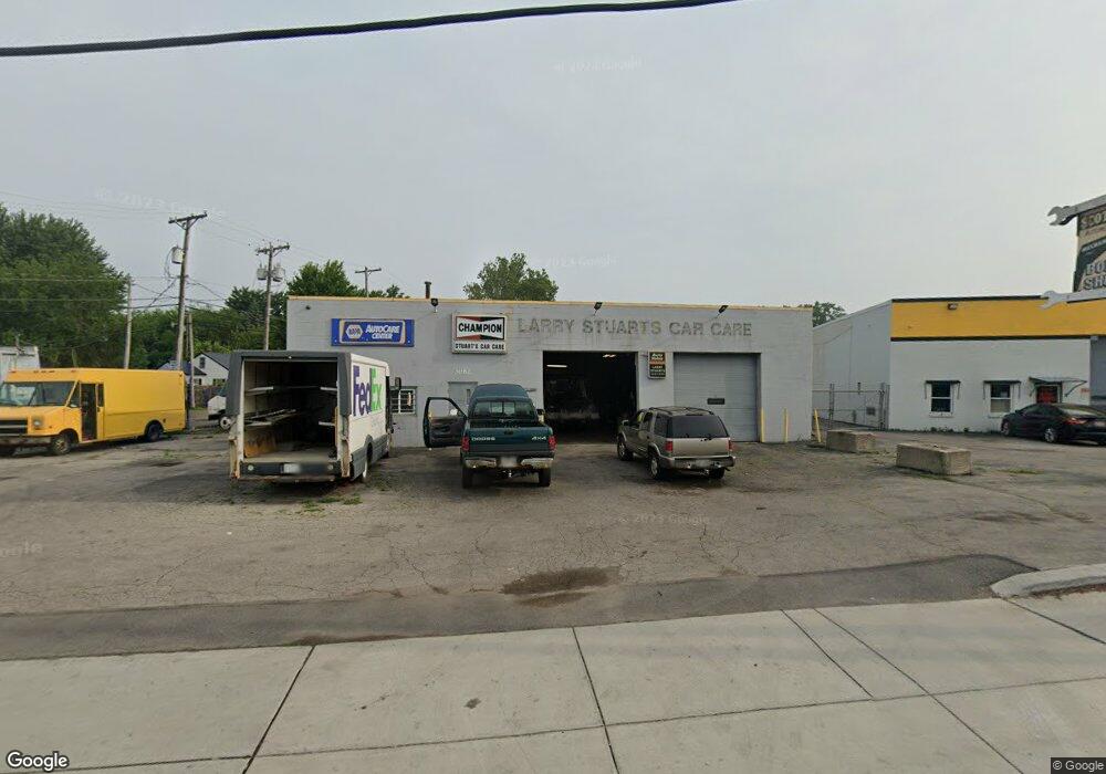
3082 Airport Hwy Toledo, OH 43609
Southside Neighborhood
--
Bed
--
Bath
3,676
Sq Ft
0.55
Acres
About This Home
This home is located at 3082 Airport Hwy, Toledo, OH 43609. 3082 Airport Hwy is a home located in Lucas County with nearby schools including Reynolds Elementary School, Rogers High School, and Explorers Academy of Science and Technology.
Ownership History
Date
Name
Owned For
Owner Type
Purchase Details
Closed on
Mar 25, 2022
Sold by
Alexander Castillo
Bought by
Premier Lepsing And Repair Llc
Home Financials for this Owner
Home Financials are based on the most recent Mortgage that was taken out on this home.
Original Mortgage
$2,860,000
Outstanding Balance
$1,974,493
Interest Rate
3.63%
Mortgage Type
New Conventional
Purchase Details
Closed on
Jan 16, 2015
Sold by
Stuart Lawrence E and Stuart Diane
Bought by
Castillo Alexander
Create a Home Valuation Report for This Property
The Home Valuation Report is an in-depth analysis detailing your home's value as well as a comparison with similar homes in the area
Home Values in the Area
Average Home Value in this Area
Purchase History
| Date | Buyer | Sale Price | Title Company |
|---|---|---|---|
| Premier Lepsing And Repair Llc | $150,000 | Eastman & Smith Ltd | |
| Castillo Alexander | $137,500 | None Available |
Source: Public Records
Mortgage History
| Date | Status | Borrower | Loan Amount |
|---|---|---|---|
| Open | Premier Lepsing And Repair Llc | $2,860,000 |
Source: Public Records
Tax History Compared to Growth
Tax History
| Year | Tax Paid | Tax Assessment Tax Assessment Total Assessment is a certain percentage of the fair market value that is determined by local assessors to be the total taxable value of land and additions on the property. | Land | Improvement |
|---|---|---|---|---|
| 2024 | $2,491 | $48,685 | $4,445 | $44,240 |
| 2023 | $5,293 | $48,440 | $4,130 | $44,310 |
| 2022 | $5,258 | $48,440 | $4,130 | $44,310 |
| 2021 | $5,390 | $48,440 | $4,130 | $44,310 |
| 2020 | $4,944 | $40,320 | $11,830 | $28,490 |
| 2019 | $4,773 | $40,320 | $11,830 | $28,490 |
| 2018 | $4,978 | $40,320 | $11,830 | $28,490 |
| 2017 | $4,596 | $38,395 | $11,165 | $27,230 |
| 2016 | $4,703 | $109,700 | $31,900 | $77,800 |
| 2015 | $5,110 | $109,700 | $31,900 | $77,800 |
| 2014 | $3,414 | $38,400 | $11,170 | $27,230 |
| 2013 | $3,414 | $38,400 | $11,170 | $27,230 |
Source: Public Records
Map
Nearby Homes
- 728 Foredale Ave
- 638 Foredale Ave
- 546 Elmdale Rd
- 560 Williamsville Ave
- 2828 South Ave
- 552 Wyman St
- 710 Durango Dr
- 576 Bronx Dr
- 556 Apple Ave
- 1351 Bensch Dr
- 3546 Denise Dr
- 1302 E Beverly Hills Dr
- 1553 Charmaine Dr
- 2126 Airport Hwy
- 304 Mayberry St
- 321 Mayberry St
- 3042 Schneider Rd
- 440 Somerset St
- 1421 Corry Ave
- 2921 Schneider Rd
- 704 Elmdale Rd
- 658 Elmdale Rd
- 713 Brysen Ave
- 3119 Mercer St
- 663 Brysen Ave
- 654 Elmdale Rd
- 657 Brysen Ave
- 653 Brysen Ave
- 647 Brysen Ave
- 644 Elmdale Rd
- 3132 Airport Hwy
- 714 Brysen Ave
- 708 Brysen Ave
- 702 Brysen Ave
- 637 Brysen Ave
- 637 Elmdale Rd
- 660 Brysen Ave
- 634 Elmdale Rd
- 658 Brysen Ave
- 3142 Airport Hwy