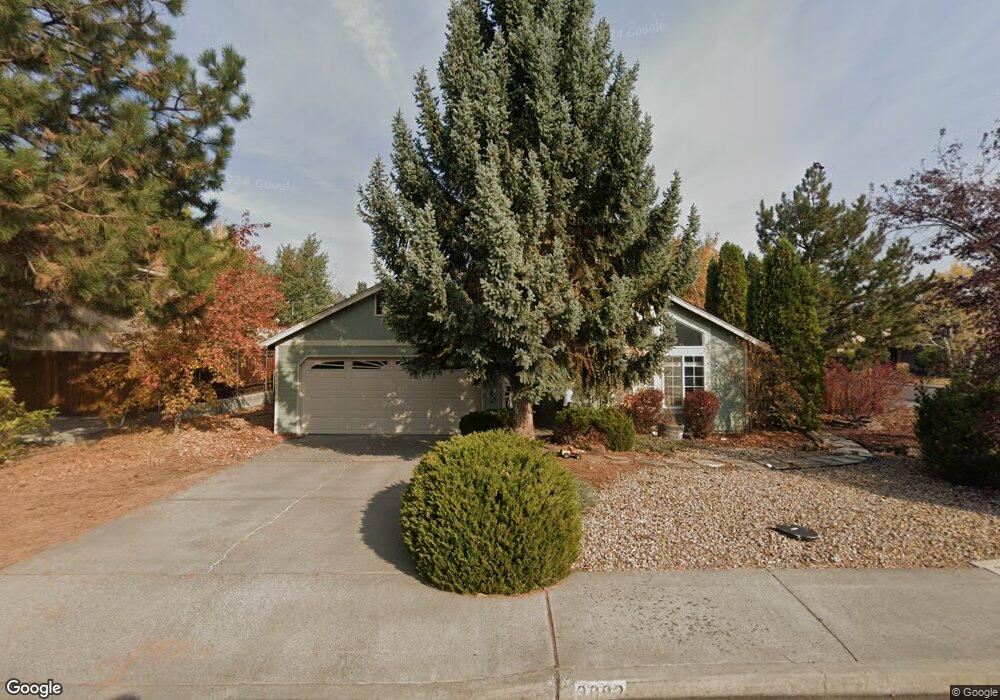
3082 NE Royal Ct Bend, OR 97701
Mountain View NeighborhoodEstimated Value: $535,000 - $576,000
3
Beds
2
Baths
1,574
Sq Ft
$351/Sq Ft
Est. Value
About This Home
This home is located at 3082 NE Royal Ct, Bend, OR 97701 and is currently estimated at $551,780, approximately $350 per square foot. 3082 NE Royal Ct is a home located in Deschutes County with nearby schools including Buckingham Elementary School, Pilot Butte Middle School, and Mountain View Senior High School.
Ownership History
Date
Name
Owned For
Owner Type
Purchase Details
Closed on
Feb 11, 2011
Sold by
Patterson William C and Patterson Betty C
Bought by
Lowrey Evans Blake B and Lowrey Evans Tina M
Current Estimated Value
Home Financials for this Owner
Home Financials are based on the most recent Mortgage that was taken out on this home.
Original Mortgage
$130,625
Outstanding Balance
$89,311
Interest Rate
4.84%
Mortgage Type
New Conventional
Estimated Equity
$462,469
Create a Home Valuation Report for This Property
The Home Valuation Report is an in-depth analysis detailing your home's value as well as a comparison with similar homes in the area
Home Values in the Area
Average Home Value in this Area
Purchase History
| Date | Buyer | Sale Price | Title Company |
|---|---|---|---|
| Lowrey Evans Blake B | $137,500 | Amerititle |
Source: Public Records
Mortgage History
| Date | Status | Borrower | Loan Amount |
|---|---|---|---|
| Open | Lowrey Evans Blake B | $130,625 |
Source: Public Records
Tax History Compared to Growth
Tax History
| Year | Tax Paid | Tax Assessment Tax Assessment Total Assessment is a certain percentage of the fair market value that is determined by local assessors to be the total taxable value of land and additions on the property. | Land | Improvement |
|---|---|---|---|---|
| 2025 | $3,676 | $217,540 | -- | -- |
| 2024 | $3,536 | $211,210 | -- | -- |
| 2023 | $3,278 | $205,060 | $0 | $0 |
| 2022 | $3,059 | $193,300 | $0 | $0 |
| 2021 | $3,063 | $187,670 | $0 | $0 |
| 2020 | $2,906 | $187,670 | $0 | $0 |
| 2019 | $2,825 | $182,210 | $0 | $0 |
| 2018 | $2,746 | $176,910 | $0 | $0 |
| 2017 | $2,665 | $171,760 | $0 | $0 |
| 2016 | $2,542 | $166,760 | $0 | $0 |
| 2015 | $2,471 | $161,910 | $0 | $0 |
| 2014 | $2,399 | $157,200 | $0 | $0 |
Source: Public Records
Map
Nearby Homes
- 3151 NE Barrington Ct
- 1188 NE 27th St Unit 71
- 1188 NE 27th St Unit 82
- 1297 NE Dawson Dr Unit A&B
- 2876 NE Forum Dr
- 3318 NE Hoona Dr
- 3325 NE Mendenhall Dr
- 3336 NE Hoona Dr
- 3362 NE Collier Ct
- 2741 NE Laramie Way
- 62453 Eagle Rd
- 62085 Wolcott Place
- 21323 Oconnor Way
- 21489 Oconnor Way Unit 17
- 21493 Oconnor Way Unit 15
- 21491 Oconnor Way Unit 16
- 21495 Oconnor Way Unit 14
- 1938 NE Curtis Dr
- 62466 Eagle Rd
- 21426 Livingston Dr Unit 18
- 3068 NE Royal Ct
- 3075 NE Royal Ct
- 3044 NE Royal Ct
- 3085 NE Raleigh Ct
- 3063 NE Raleigh Ct
- 3053 NE Royal Ct
- 3049 NE Raleigh Ct
- 1180 NE Providence Dr
- 1170 NE Providence Dr
- 3039 NE Royal Ct
- 3035 NE Raleigh Ct
- 1230 NE Providence Dr
- 1158 NE Providence Dr
- 3120 NE Manchester Ave
- 1252 NE Providence Dr
- 3028 NE Royal Ct
- 1283 NE Providence Dr
- 3048 NE Raleigh Ct
- 3031 NE Royal Ct