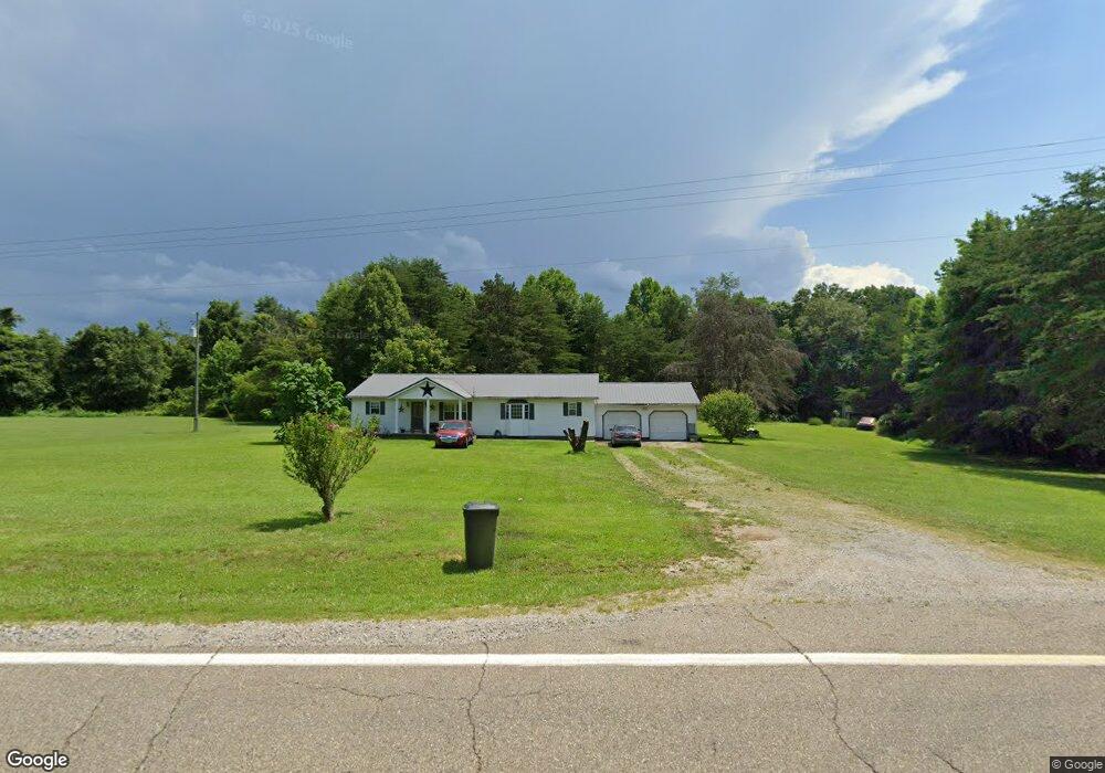
30848 State Route 325 Langsville, OH 45741
Estimated Value: $132,000 - $213,044
--
Bed
2
Baths
1,920
Sq Ft
$97/Sq Ft
Est. Value
About This Home
This home is located at 30848 State Route 325, Langsville, OH 45741 and is currently estimated at $186,511, approximately $97 per square foot. 30848 State Route 325 is a home located in Meigs County with nearby schools including Meigs Primary School, Meigs Intermediate School, and Meigs Middle School.
Ownership History
Date
Name
Owned For
Owner Type
Purchase Details
Closed on
Aug 31, 2018
Sold by
Farmersd Bank And Savings Co
Bought by
Shipley Shelby L
Current Estimated Value
Home Financials for this Owner
Home Financials are based on the most recent Mortgage that was taken out on this home.
Original Mortgage
$48,985
Outstanding Balance
$42,630
Interest Rate
4.5%
Mortgage Type
Adjustable Rate Mortgage/ARM
Estimated Equity
$143,881
Purchase Details
Closed on
Jun 6, 2016
Sold by
Ogdin Del L and Ogdin Linda C
Bought by
Farmers Bank And Savings Company
Purchase Details
Closed on
Jul 12, 1996
Bought by
Ogdin Linda C Ogdin Del L
Create a Home Valuation Report for This Property
The Home Valuation Report is an in-depth analysis detailing your home's value as well as a comparison with similar homes in the area
Home Values in the Area
Average Home Value in this Area
Purchase History
| Date | Buyer | Sale Price | Title Company |
|---|---|---|---|
| Shipley Shelby L | $50,500 | Varsity Title Services Llc | |
| Farmers Bank And Savings Company | $65,026 | None Available | |
| Ogdin Linda C Ogdin Del L | $8,000 | -- |
Source: Public Records
Mortgage History
| Date | Status | Borrower | Loan Amount |
|---|---|---|---|
| Open | Shipley Shelby L | $48,985 |
Source: Public Records
Tax History Compared to Growth
Tax History
| Year | Tax Paid | Tax Assessment Tax Assessment Total Assessment is a certain percentage of the fair market value that is determined by local assessors to be the total taxable value of land and additions on the property. | Land | Improvement |
|---|---|---|---|---|
| 2024 | $1,860 | $56,730 | $6,780 | $49,950 |
| 2023 | $1,860 | $56,730 | $6,780 | $49,950 |
| 2022 | $1,953 | $56,730 | $6,780 | $49,950 |
| 2021 | $1,632 | $40,150 | $5,030 | $35,120 |
| 2020 | $1,520 | $40,150 | $5,030 | $35,120 |
| 2019 | $1,499 | $40,150 | $5,030 | $35,120 |
| 2018 | $1,241 | $33,550 | $2,970 | $30,580 |
| 2017 | $1,241 | $33,550 | $2,970 | $30,580 |
| 2016 | $1,229 | $33,550 | $2,970 | $30,580 |
| 2014 | $1,000 | $30,580 | $2,970 | $27,610 |
| 2013 | $1,000 | $30,580 | $2,970 | $27,610 |
Source: Public Records
Map
Nearby Homes
- 31166 Edmundson Rd
- 31152 Edmundson Rd
- 0 Briar Ridge Rd Unit 11562403
- 30286 Briar Ridge Rd
- 32319 Red Hill Rd Unit (Overlook Cabin at B
- 31845 Red Hill Rd
- 0 Briar Ridge Rd Unit 11566708
- 0 Briar Ridge Rd Unit 24580053
- 0 Briar Ridge Rd Unit 24580050
- 0 Edmundson Rd Unit 23607169
- 0 Edmundson Rd Unit (Tract 2 at Big Timb
- 0 Edmundson Rd Unit 23597084
- 0 Edmundson Rd Unit 23463048
- 0 Edmundson Rd Unit (Tract 5 at Big Timb
- 0 Edmundson Rd Unit (Tract 6 at Big Timb
- 0 Edmundson Rd Unit 2429533
- 0 Red Hill Rd Unit 22347212
- 0 Edmundson Rd Unit Tract 1 Phase 2 Big
- 3229 Painter Ridge Rd
- 31428 Will Vance Rd
- 30854 State Route 325
- 30774 State Route 325
- 30920 State Route 325
- 29554 Sanford Davis Rd
- 30976 State Route 325
- 30976 State Route 325
- 29560 Sanford Davis Rd
- 30360 Joe Boring Rd
- 30982 State Route 325
- 30986 State Route 325
- 30305 Joe Boring Rd
- 29727 Briar Ridge Rd
- 30996 State Route 325
- 31121 Red Hill Rd
- 29645 Briar Ridge Rd
- 29673 Briar Ridge Rd
- 31004 State Route 325
- 31015 State Route 325
- 29757 Briar Ridge Rd
- 31032 State Route 325