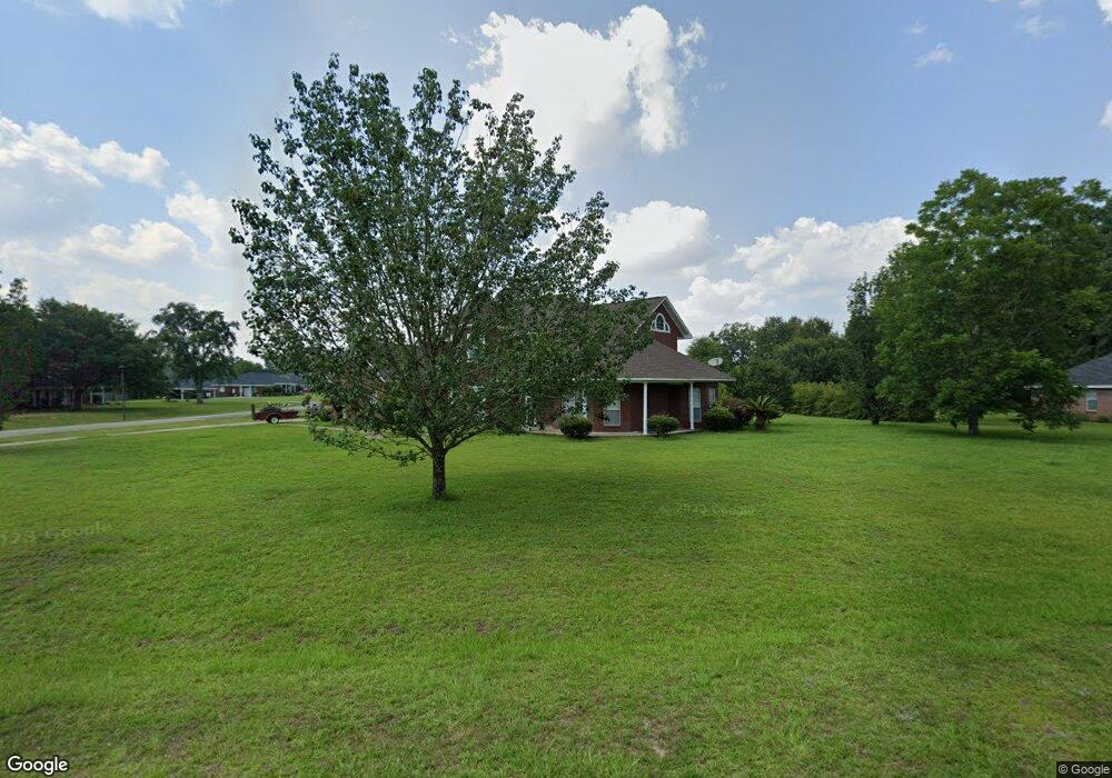
3085 Branson Rd W Mobile, AL 36695
Outer West Mobile NeighborhoodEstimated Value: $311,212 - $426,000
3
Beds
3
Baths
2,747
Sq Ft
$133/Sq Ft
Est. Value
About This Home
This home is located at 3085 Branson Rd W, Mobile, AL 36695 and is currently estimated at $364,303, approximately $132 per square foot. 3085 Branson Rd W is a home located in Mobile County with nearby schools including Hutchens Elementary School, Dawes Intermediate School, and Bernice J Causey Middle School.
Ownership History
Date
Name
Owned For
Owner Type
Purchase Details
Closed on
Aug 27, 2004
Sold by
Tri Investments Llc
Bought by
Touchstone Properties Llc
Current Estimated Value
Home Financials for this Owner
Home Financials are based on the most recent Mortgage that was taken out on this home.
Original Mortgage
$159,200
Outstanding Balance
$77,666
Interest Rate
5.97%
Mortgage Type
Unknown
Estimated Equity
$286,637
Purchase Details
Closed on
Nov 16, 1999
Sold by
Bay South Ltd
Bought by
Stallworth Aretha L and Stallworth Michael
Home Financials for this Owner
Home Financials are based on the most recent Mortgage that was taken out on this home.
Original Mortgage
$197,850
Interest Rate
7.81%
Mortgage Type
VA
Purchase Details
Closed on
Apr 28, 1999
Sold by
Coastal Enterprises Inc
Bought by
Bay South Ltd
Create a Home Valuation Report for This Property
The Home Valuation Report is an in-depth analysis detailing your home's value as well as a comparison with similar homes in the area
Home Values in the Area
Average Home Value in this Area
Purchase History
| Date | Buyer | Sale Price | Title Company |
|---|---|---|---|
| Touchstone Properties Llc | -- | -- | |
| Stallworth Aretha L | -- | -- | |
| Bay South Ltd | -- | -- |
Source: Public Records
Mortgage History
| Date | Status | Borrower | Loan Amount |
|---|---|---|---|
| Open | Touchstone Properties Llc | $159,200 | |
| Previous Owner | Stallworth Aretha L | $197,850 |
Source: Public Records
Tax History
| Year | Tax Paid | Tax Assessment Tax Assessment Total Assessment is a certain percentage of the fair market value that is determined by local assessors to be the total taxable value of land and additions on the property. | Land | Improvement |
|---|---|---|---|---|
| 2025 | $1,566 | $32,200 | $4,000 | $28,200 |
| 2024 | $1,566 | $29,810 | $4,000 | $25,810 |
| 2023 | $1,449 | $26,410 | $4,000 | $22,410 |
| 2022 | $1,123 | $24,540 | $4,000 | $20,540 |
| 2021 | $1,137 | $24,810 | $4,000 | $20,810 |
| 2020 | $1,085 | $23,750 | $4,000 | $19,750 |
| 2019 | $1,048 | $22,980 | $0 | $0 |
| 2018 | $1,059 | $23,220 | $0 | $0 |
| 2017 | $1,129 | $23,220 | $0 | $0 |
| 2016 | $1,070 | $23,440 | $0 | $0 |
| 2013 | $1,228 | $25,740 | $0 | $0 |
Source: Public Records
Map
Nearby Homes
- 0 Newman Rd Unit 25399577
- 0 Newman Rd Unit 7652668
- 0 Newman Rd Unit 7670125
- 0 Newman Rd Unit 25537843
- 2978 Branson Park Ct
- 3137 Busby Rd
- 12171 Yancey Glen Dr
- 0 Lakefront Dr Unit 7716851
- 3221 Deer Crest Ct
- 13346 Deer Crest Ln
- 12240 Dogwood Cir
- 13045 Oak Forge Dr
- 3761 Lakefront Dr
- 13163 Buckthorn Ct
- 3770 Lakefront Dr
- #77 Deer Crest Dr
- 3397 Deer Crest Dr
- 3835 Lakefront Dr W
- 2865 Barlett Dr
- 13046 Tara Point Dr
- 3090 Branson Rd W
- 12440 Branson Rd
- 12451 Branson Rd
- 12441 Branson Rd
- 3070 Branson Rd W
- 3055 Branson Rd W
- 12461 Branson Rd
- 12540 Branson Rd Unit 21
- 3050 Branson Rd W
- 12431 Branson Rd
- 12400 Branson Rd
- 3170 Newman Rd
- 3045 Branson Ct W
- 3070 Branson Ct W
- 3030 Branson Rd W
- 12401 Branson Rd
- 7 Branson Ln Unit 7
- 3015 Branson Rd W
- 3048 Branson Park Ct
- 3038 Branson Park Ct
Your Personal Tour Guide
Ask me questions while you tour the home.