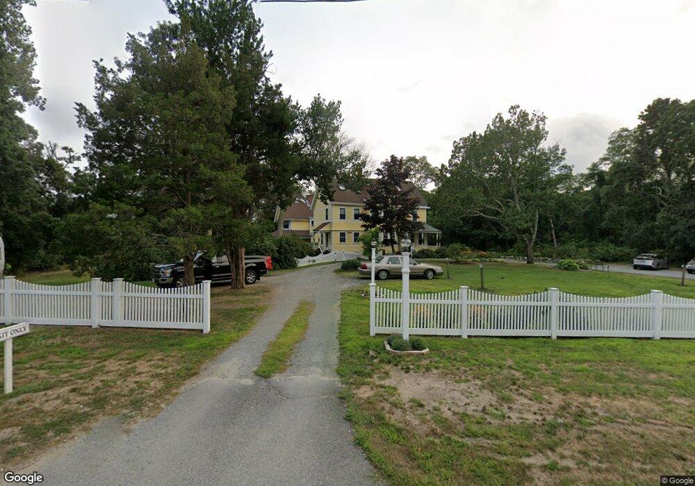
3085 State Hwy Eastham, MA 02642
Estimated Value: $1,594,011
13
Beds
16
Baths
4,963
Sq Ft
$321/Sq Ft
Est. Value
About This Home
This home is located at 3085 State Hwy, Eastham, MA 02642 and is currently priced at $1,594,011, approximately $321 per square foot. 3085 State Hwy is a home located in Barnstable County with nearby schools including Eastham Elementary School, Nauset Regional Middle School, and Nauset Regional High School.
Ownership History
Date
Name
Owned For
Owner Type
Purchase Details
Closed on
Jun 7, 2019
Sold by
Oaks Of Cape Cod Props
Bought by
Edson Cape Inn Llc
Current Estimated Value
Home Financials for this Owner
Home Financials are based on the most recent Mortgage that was taken out on this home.
Original Mortgage
$750,000
Outstanding Balance
$655,308
Interest Rate
4.2%
Mortgage Type
Purchase Money Mortgage
Purchase Details
Closed on
Sep 13, 2013
Sold by
Inn Wind Llc
Bought by
Oaks Of Cape Cod Props
Home Financials for this Owner
Home Financials are based on the most recent Mortgage that was taken out on this home.
Original Mortgage
$550,000
Interest Rate
4.43%
Mortgage Type
Commercial
Purchase Details
Closed on
Oct 9, 2001
Sold by
Overlook Inn Rt
Bought by
Inn Wind Llc
Create a Home Valuation Report for This Property
The Home Valuation Report is an in-depth analysis detailing your home's value as well as a comparison with similar homes in the area
Home Values in the Area
Average Home Value in this Area
Purchase History
| Date | Buyer | Sale Price | Title Company |
|---|---|---|---|
| Edson Cape Inn Llc | $969,500 | -- | |
| Oaks Of Cape Cod Props | $1,099,000 | -- | |
| Inn Wind Llc | $802,600 | -- |
Source: Public Records
Mortgage History
| Date | Status | Borrower | Loan Amount |
|---|---|---|---|
| Open | Edson Cape Inn Llc | $750,000 | |
| Previous Owner | Oaks Of Cape Cod Props | $550,000 | |
| Previous Owner | Oaks Of Cape Cod Props | $385,000 | |
| Previous Owner | Oaks Of Cape Cod Props | $400,000 | |
| Previous Owner | Inn Wind Llc | $288,000 |
Source: Public Records
Tax History
| Year | Tax Paid | Tax Assessment Tax Assessment Total Assessment is a certain percentage of the fair market value that is determined by local assessors to be the total taxable value of land and additions on the property. | Land | Improvement |
|---|---|---|---|---|
| 2025 | $8,714 | $1,130,200 | $387,800 | $742,400 |
| 2024 | $7,749 | $1,105,400 | $376,400 | $729,000 |
| 2023 | $7,838 | $1,082,600 | $365,900 | $716,700 |
| 2022 | $8,387 | $977,500 | $326,600 | $650,900 |
| 2021 | $8,883 | $967,600 | $317,200 | $650,400 |
| 2020 | $9,673 | $1,109,300 | $323,700 | $785,600 |
| 2019 | $9,101 | $1,103,200 | $323,700 | $779,500 |
| 2018 | $9,019 | $1,080,100 | $314,200 | $765,900 |
| 2017 | $8,303 | $1,051,000 | $309,100 | $741,900 |
| 2016 | $7,726 | $1,038,500 | $307,000 | $731,500 |
| 2015 | $6,696 | $943,100 | $303,900 | $639,200 |
Source: Public Records
Map
Nearby Homes
- 21 Locust Rd Unit 21
- 2705 State Hwy
- 2705 State Hwy Unit 1-8
- 300 School House Rd
- 50 Surrey Dr
- 82 Old Orchard Rd
- 70 Deerfield Ln
- 600 Kingsbury Beach Rd
- 20 Stone Ct
- 255 Massasoit Rd
- 10 Bradford Ln
- 20 Oak Rd
- 55 Grandfathers Way
- 85 Huckleberry Ln
- 330 Hay Rd
- 60 Smith Heights Way
- 18 Jay Dee Ln
- 1061 State Hwy Unit 4
- 1061 State Hwy Unit 1061
- 10 Cartway N
- 10 Walters Way
- 5 Walters Way
- 3098 State Rte 6 Hwy
- 2 Melinda Ln
- 49 Salt Pond Rd
- 49 Salt Pond Rd Unit 1,2,3
- 49 Salt Pond Rd Unit 1-3
- 3073 State Hwy
- 15 Walters Way
- 3150 State Hwy
- 3100 State Hwy
- 3100 State Hwy Unit 1 & 2
- 3090 State Hwy
- 150 Locust Rd
- 210 Locust Rd
- 55 Salt Pond Rd
- 1 Preservation Way
- 230 Locust Rd
- 3120 State Hwy
- 45 Salt Pond Rd
Your Personal Tour Guide
Ask me questions while you tour the home.