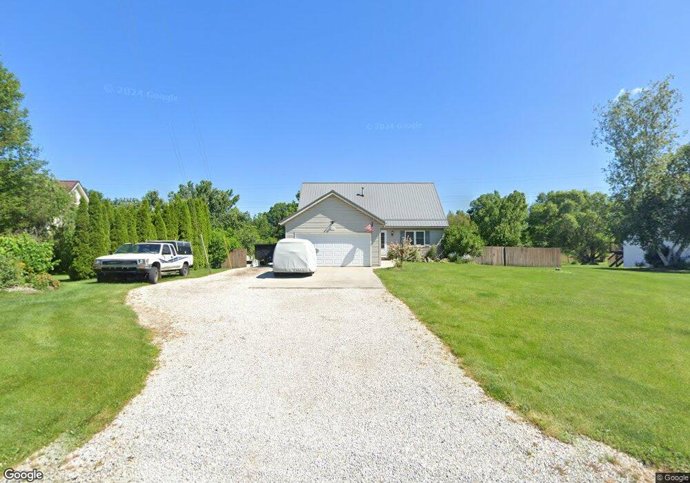
3085 Summit Rd Ravenna, OH 44266
Estimated Value: $299,685 - $324,000
3
Beds
3
Baths
1,920
Sq Ft
$164/Sq Ft
Est. Value
About This Home
This home is located at 3085 Summit Rd, Ravenna, OH 44266 and is currently estimated at $314,921, approximately $164 per square foot. 3085 Summit Rd is a home located in Portage County with nearby schools including Willyard Elementary School, West Park Elementary School, and Brown Middle School.
Ownership History
Date
Name
Owned For
Owner Type
Purchase Details
Closed on
Apr 14, 2006
Sold by
Pittman Gail L and Pittman Roger C
Bought by
Pittman Roger C and Pittman Gail L
Current Estimated Value
Purchase Details
Closed on
Nov 15, 1999
Sold by
Toth William J
Bought by
Toth Gail L
Purchase Details
Closed on
Feb 18, 1998
Sold by
Shumar James
Bought by
Toth William J and Toth Gail L
Home Financials for this Owner
Home Financials are based on the most recent Mortgage that was taken out on this home.
Original Mortgage
$118,000
Outstanding Balance
$17,518
Interest Rate
6.99%
Mortgage Type
New Conventional
Estimated Equity
$297,403
Create a Home Valuation Report for This Property
The Home Valuation Report is an in-depth analysis detailing your home's value as well as a comparison with similar homes in the area
Home Values in the Area
Average Home Value in this Area
Purchase History
| Date | Buyer | Sale Price | Title Company |
|---|---|---|---|
| Pittman Roger C | -- | None Available | |
| Toth Gail L | -- | -- | |
| Toth William J | $127,000 | -- |
Source: Public Records
Mortgage History
| Date | Status | Borrower | Loan Amount |
|---|---|---|---|
| Open | Toth William J | $118,000 |
Source: Public Records
Tax History
| Year | Tax Paid | Tax Assessment Tax Assessment Total Assessment is a certain percentage of the fair market value that is determined by local assessors to be the total taxable value of land and additions on the property. | Land | Improvement |
|---|---|---|---|---|
| 2025 | $5,090 | $101,230 | $10,890 | $90,340 |
| 2024 | $4,433 | $101,230 | $10,890 | $90,340 |
| 2023 | $3,638 | $70,780 | $10,470 | $60,310 |
| 2022 | $3,619 | $70,780 | $10,470 | $60,310 |
| 2021 | $3,606 | $70,780 | $10,470 | $60,310 |
| 2020 | $2,996 | $51,810 | $8,720 | $43,090 |
| 2019 | $2,998 | $51,810 | $8,720 | $43,090 |
| 2018 | $2,967 | $48,760 | $8,720 | $40,040 |
| 2017 | $2,967 | $48,760 | $8,720 | $40,040 |
| 2016 | $2,715 | $48,760 | $8,720 | $40,040 |
| 2015 | $2,718 | $48,760 | $8,720 | $40,040 |
| 2014 | $2,594 | $46,140 | $8,720 | $37,420 |
| 2013 | $2,579 | $46,140 | $8,720 | $37,420 |
Source: Public Records
Map
Nearby Homes
- 3120 Shearwater Cir
- 3137 Shearwater Cir
- 3143 Shearwater Cir
- 3169 Waxwing Cir
- 5271 Aspen Meadow Dr
- 5403 Winding Creek Dr
- 3366 Hommon Rd
- 5343 Winding Creek Dr
- 5100 Misty Glen
- 3238 Menough Rd
- 2978 Sandy Lake Rd
- 2326 Orchard Cir
- 2277 Orchard Cir
- 2671 Wintergreen Ln
- 1077 S Diamond St
- 4140 Sandy Lake Rd
- 668 Westbrook Ct
- 1065 Shadowlawn Dr
- 5242 Glen Park Dr
- 3925 Summit Rd
- 3099 Summit Rd
- 3079 Summit Rd
- 3105 Summit Rd
- 3065 Summit Rd
- 3065 Summit Rd Unit 12
- 3077 Hodgson Dr
- 3115 Summit Rd
- 3055 Summit Rd
- 3122 Summit Rd
- 3125 Summit Rd
- 3132 Summit Rd
- 5512 Lakewood Rd
- 3090 Summit Rd
- 5502 Lakewood Rd
- 3135 Summit Rd
- 3142 Summit Rd
- 5488 Lakewood Rd
- 3121 Hodgson Dr
- 3145 Summit Rd
- 5478 Lakewood Rd
Your Personal Tour Guide
Ask me questions while you tour the home.