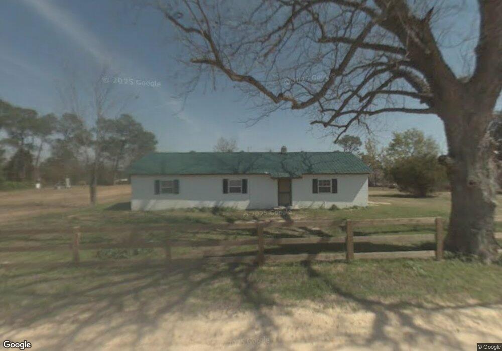
3088 Nessmith Rd Statesboro, GA 30458
Estimated Value: $215,000 - $307,000
3
Beds
1
Bath
2,232
Sq Ft
$116/Sq Ft
Est. Value
About This Home
This home is located at 3088 Nessmith Rd, Statesboro, GA 30458 and is currently estimated at $258,428, approximately $115 per square foot. 3088 Nessmith Rd is a home located in Bulloch County with nearby schools including Julia P. Bryant Elementary School, Statesboro High School, and William James Middle School.
Ownership History
Date
Name
Owned For
Owner Type
Purchase Details
Closed on
Jul 20, 2016
Sold by
Deloach John C
Bought by
Deloach Dane and Deloach Krystal
Current Estimated Value
Purchase Details
Closed on
Feb 1, 2007
Sold by
Not Provided
Bought by
Deloach John C
Home Financials for this Owner
Home Financials are based on the most recent Mortgage that was taken out on this home.
Original Mortgage
$55,007
Interest Rate
6.08%
Mortgage Type
New Conventional
Purchase Details
Closed on
Jul 12, 2006
Sold by
Not Provided
Bought by
Deloach John C
Purchase Details
Closed on
Mar 7, 2006
Sold by
Not Provided
Bought by
Deloach John C
Purchase Details
Closed on
Sep 1, 1982
Bought by
White George H
Create a Home Valuation Report for This Property
The Home Valuation Report is an in-depth analysis detailing your home's value as well as a comparison with similar homes in the area
Home Values in the Area
Average Home Value in this Area
Purchase History
| Date | Buyer | Sale Price | Title Company |
|---|---|---|---|
| Deloach Dane | $58,200 | -- | |
| Deloach John C | $40,000 | -- | |
| Deloach John C | $16,500 | -- | |
| Deloach John C | -- | -- | |
| White George H | -- | -- |
Source: Public Records
Mortgage History
| Date | Status | Borrower | Loan Amount |
|---|---|---|---|
| Previous Owner | Deloach John C | $55,007 |
Source: Public Records
Tax History Compared to Growth
Tax History
| Year | Tax Paid | Tax Assessment Tax Assessment Total Assessment is a certain percentage of the fair market value that is determined by local assessors to be the total taxable value of land and additions on the property. | Land | Improvement |
|---|---|---|---|---|
| 2024 | $1,166 | $53,040 | $8,880 | $44,160 |
| 2023 | $1,131 | $47,080 | $7,120 | $39,960 |
| 2022 | $884 | $40,419 | $5,935 | $34,484 |
| 2021 | $790 | $35,244 | $5,935 | $29,309 |
| 2020 | $377 | $16,724 | $2,420 | $14,304 |
| 2019 | $287 | $12,664 | $2,420 | $10,244 |
| 2018 | $351 | $14,873 | $2,016 | $12,857 |
| 2017 | $345 | $14,494 | $2,016 | $12,478 |
| 2016 | $330 | $13,526 | $2,016 | $11,510 |
| 2015 | $321 | $13,106 | $2,016 | $11,090 |
| 2014 | $297 | $13,106 | $2,016 | $11,090 |
Source: Public Records
Map
Nearby Homes
- 7268 Banks Dairy Rd
- 8435 Banks Dairy Rd
- 8433 Banks Dairy Rd
- 682 Eugene Deal Rd
- LOT 24 Plantation Cir
- 296 Tavern Ln
- 292 Tavern Ln
- 237 Tavern Ln
- 114 Emit Deal Rd
- 1900 Erin Way
- 4008 Carolina Trail
- 2055 Blankenbaker Rd
- 16 Woodrum Place
- 12 Woodrum Place
- 1211 Pulaski Rd
- 11 Myrtle Ln
- 733 Hillwood Dr
- 2538 Westover Dr
- 25 Golf Club Cir
- 116 Evergreen Dr
- 7006 Banks Dairy Rd
- 3070 Nessmith Rd
- 3048 Nessmith Rd
- 273 Banks Dairy Rd Unit LOT 9
- 273 Banks Dairy Rd
- 6319 Banks Dairy Rd
- 7150 Banks Dairy Rd
- 2962 Nessmith Rd
- 6330 Banks Dairy Rd
- 2962 Nesmith Rd
- 7200 Banks Dairy Rd
- 3291 Nessmith Rd
- 7244 Banks Dairy Rd
- 6326 Banks Dairy Rd
- 7254 Banks Dairy Rd
- 6325 Banks Dairy Rd
- 0 Banks Dairy Rd and Nessmith Rd Unit 7137075
- 950 Iron Horse Rd
- 7322 Banks Dairy Rd
- 10999 Johnny Brannen Rd