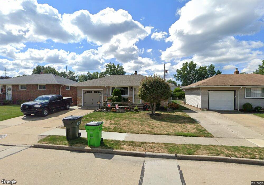
30884 Harrison Rd Wickliffe, OH 44092
Estimated Value: $175,000 - $213,000
3
Beds
2
Baths
980
Sq Ft
$196/Sq Ft
Est. Value
About This Home
This home is located at 30884 Harrison Rd, Wickliffe, OH 44092 and is currently estimated at $191,933, approximately $195 per square foot. 30884 Harrison Rd is a home located in Lake County with nearby schools including Wickliffe Elementary School, Wickliffe Middle School, and Wickliffe High School.
Ownership History
Date
Name
Owned For
Owner Type
Purchase Details
Closed on
Nov 4, 1998
Sold by
Darling Paul J and Brown Ronna B
Bought by
Skiba Anthony M and Skiba Deanna L
Current Estimated Value
Home Financials for this Owner
Home Financials are based on the most recent Mortgage that was taken out on this home.
Original Mortgage
$104,850
Outstanding Balance
$23,148
Interest Rate
6.72%
Estimated Equity
$168,785
Purchase Details
Closed on
Oct 4, 1993
Bought by
Darling Paul J
Create a Home Valuation Report for This Property
The Home Valuation Report is an in-depth analysis detailing your home's value as well as a comparison with similar homes in the area
Home Values in the Area
Average Home Value in this Area
Purchase History
| Date | Buyer | Sale Price | Title Company |
|---|---|---|---|
| Skiba Anthony M | $116,500 | Executive Title Agency Corp | |
| Darling Paul J | $92,500 | -- |
Source: Public Records
Mortgage History
| Date | Status | Borrower | Loan Amount |
|---|---|---|---|
| Open | Skiba Anthony M | $104,850 |
Source: Public Records
Tax History Compared to Growth
Tax History
| Year | Tax Paid | Tax Assessment Tax Assessment Total Assessment is a certain percentage of the fair market value that is determined by local assessors to be the total taxable value of land and additions on the property. | Land | Improvement |
|---|---|---|---|---|
| 2024 | -- | $49,450 | $15,460 | $33,990 |
| 2023 | $4,831 | $39,280 | $13,370 | $25,910 |
| 2022 | $2,915 | $39,280 | $13,370 | $25,910 |
| 2021 | $2,829 | $39,280 | $13,370 | $25,910 |
| 2020 | $3,413 | $31,420 | $10,690 | $20,730 |
| 2019 | $3,559 | $31,420 | $10,690 | $20,730 |
| 2018 | $3,179 | $31,260 | $11,840 | $19,420 |
| 2017 | $3,119 | $31,260 | $11,840 | $19,420 |
| 2016 | $3,115 | $31,260 | $11,840 | $19,420 |
| 2015 | $2,150 | $31,260 | $11,840 | $19,420 |
| 2014 | $1,894 | $31,260 | $11,840 | $19,420 |
| 2013 | $1,893 | $31,260 | $11,840 | $19,420 |
Source: Public Records
Map
Nearby Homes
- 5510 Wildwood Ct Unit 81-A
- 30705 Grant St
- 5463 Millwood Ln Unit 42C
- 1648 Douglas Rd
- 5520 Bretton Ct Unit A
- 5551 Ivy Ct
- 30530 Grant St
- 1711 Rush Rd
- 1737 Drenik Dr
- 34840 Aspen Wood Ln
- 1569 Douglas Rd
- 1590 Dennis Dr
- 1560 Douglas Rd
- 5218 Liberty Ln Unit A
- 1847 Eldon Dr
- 1842 Eldon Dr
- 5131 Liberty Ln Unit B
- 5085 Shepherds Glen
- 5084 Shepherds Glen
- 5171 Jude Ct
- 30892 Harrison Rd
- 30876 Harrison Rd
- 30883 Roosevelt Rd
- 30887 Roosevelt Rd
- 30879 Roosevelt Rd
- 30875 Roosevelt Rd
- 30883 Harrison Rd
- 30891 Roosevelt Rd
- 30887 Harrison Rd
- 30896 Harrison Rd
- 30872 Harrison Rd
- 30879 Harrison Rd
- 30891 Harrison Rd
- 30875 Harrison Rd
- 30871 Roosevelt Rd
- 30895 Roosevelt Rd
- 30900 Harrison Rd
- 30868 Harrison Rd
- 30867 Roosevelt Rd
- 30899 Roosevelt Rd