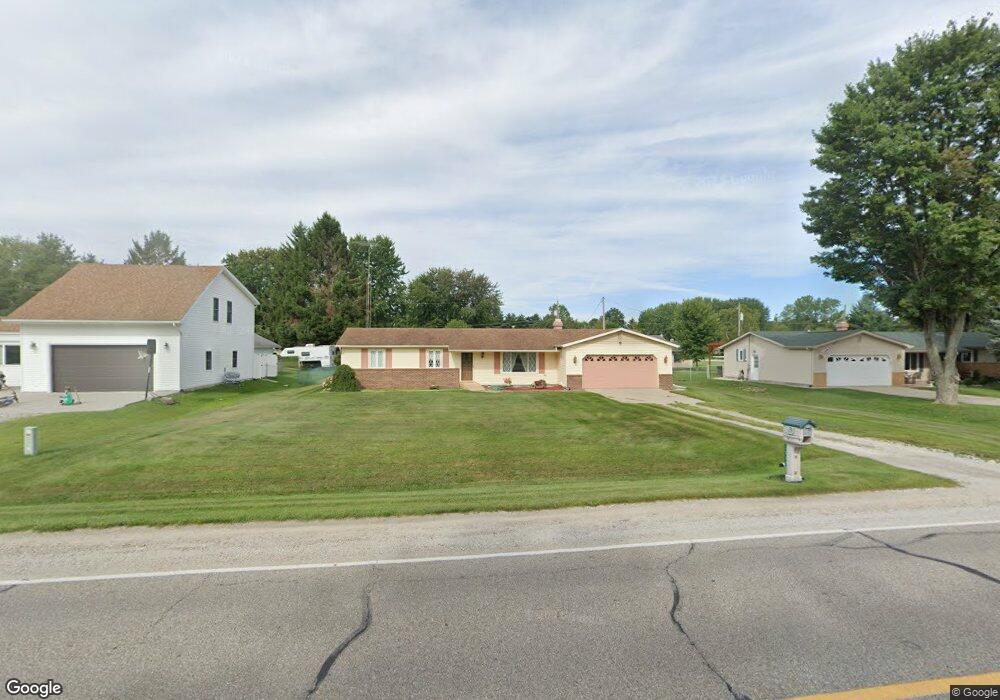
3089 Range Rd Port Huron, MI 48060
Estimated Value: $234,000 - $266,000
3
Beds
2
Baths
1,453
Sq Ft
$173/Sq Ft
Est. Value
About This Home
This home is located at 3089 Range Rd, Port Huron, MI 48060 and is currently estimated at $251,947, approximately $173 per square foot. 3089 Range Rd is a home located in St. Clair County with nearby schools including Michigamme Elementary School, Central Middle School, and Port Huron High School.
Create a Home Valuation Report for This Property
The Home Valuation Report is an in-depth analysis detailing your home's value as well as a comparison with similar homes in the area
Home Values in the Area
Average Home Value in this Area
Tax History
| Year | Tax Paid | Tax Assessment Tax Assessment Total Assessment is a certain percentage of the fair market value that is determined by local assessors to be the total taxable value of land and additions on the property. | Land | Improvement |
|---|---|---|---|---|
| 2025 | $1,038 | $99,000 | $0 | $0 |
| 2024 | $1,008 | $93,100 | $0 | $0 |
| 2023 | $930 | $80,400 | $0 | $0 |
| 2022 | $1,718 | $70,200 | $0 | $0 |
| 2020 | $1,649 | $62,100 | $0 | $62,100 |
| 2019 | $1,622 | $56,000 | $0 | $0 |
| 2018 | $1,588 | $56,000 | $0 | $0 |
| 2017 | $1,557 | $54,500 | $0 | $0 |
| 2016 | $763 | $54,500 | $0 | $0 |
| 2015 | -- | $47,800 | $0 | $47,800 |
| 2014 | -- | $44,100 | $44,100 | $0 |
| 2013 | -- | $42,300 | $0 | $0 |
Source: Public Records
Map
Nearby Homes
- 3101 Range Rd
- 4459 Cambridge Dr
- 3115 Spruce Dr
- 000 Atkins Rd Atkins Rd
- 0000 Atkins Atkins Rd
- 4224 Atkins Rd
- 4911 Castlewood Dr
- 3345 Beach Rd
- 4570 Atkins Rd
- 4380 Lapeer Rd
- 0 Lapeer Rd Unit 50137357
- 3075 Westcott Dr
- 3971 N River Rd
- 4167 N River Rd
- 0000 W Water St
- 3559 Lightle Rd
- 3625 Angus Rd
- 3639 Teeple Ave
- Lot #9 Thornton Dr
- 2940 Westland Dr
Your Personal Tour Guide
Ask me questions while you tour the home.