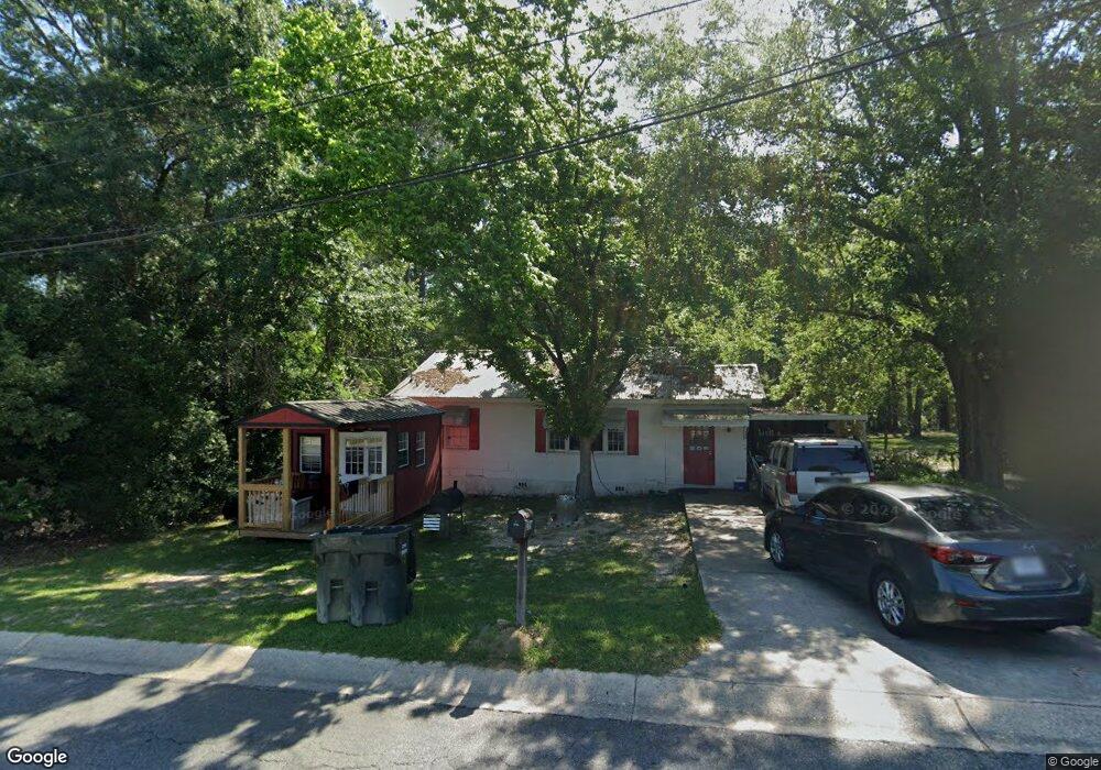
309 10th St SE Moultrie, GA 31768
Estimated Value: $56,657 - $112,000
--
Bed
1
Bath
720
Sq Ft
$117/Sq Ft
Est. Value
About This Home
This home is located at 309 10th St SE, Moultrie, GA 31768 and is currently estimated at $84,164, approximately $116 per square foot. 309 10th St SE is a home located in Colquitt County with nearby schools including Cox Elementary School, Willie J. Williams Middle School, and C.A. Gray Junior High School.
Ownership History
Date
Name
Owned For
Owner Type
Purchase Details
Closed on
Dec 31, 2014
Sold by
Bvg Properties Llc
Bought by
Packer Properties Llc
Current Estimated Value
Purchase Details
Closed on
Jun 28, 2011
Sold by
Browning Bobby W and Bruce Vines A
Bought by
Bvg Properties Llc
Purchase Details
Closed on
May 22, 1998
Bought by
Browning Bobby W
Purchase Details
Closed on
Apr 24, 1997
Bought by
Thompson Daphne G
Create a Home Valuation Report for This Property
The Home Valuation Report is an in-depth analysis detailing your home's value as well as a comparison with similar homes in the area
Home Values in the Area
Average Home Value in this Area
Purchase History
| Date | Buyer | Sale Price | Title Company |
|---|---|---|---|
| Packer Properties Llc | $555,000 | -- | |
| Bvg Properties Llc | -- | -- | |
| Browning Bobby W | $20,000 | -- | |
| Thompson Daphne G | -- | -- |
Source: Public Records
Tax History Compared to Growth
Tax History
| Year | Tax Paid | Tax Assessment Tax Assessment Total Assessment is a certain percentage of the fair market value that is determined by local assessors to be the total taxable value of land and additions on the property. | Land | Improvement |
|---|---|---|---|---|
| 2024 | $348 | $13,773 | $1,650 | $12,123 |
| 2023 | $416 | $11,382 | $1,650 | $9,732 |
| 2022 | $356 | $10,641 | $1,650 | $8,991 |
| 2021 | $355 | $10,465 | $1,650 | $8,815 |
| 2020 | $324 | $9,410 | $1,650 | $7,760 |
| 2019 | $365 | $9,410 | $1,650 | $7,760 |
| 2018 | $376 | $9,410 | $1,650 | $7,760 |
| 2017 | $361 | $9,410 | $1,650 | $7,760 |
| 2016 | $376 | $9,410 | $1,650 | $7,760 |
| 2015 | $377 | $9,410 | $1,650 | $7,760 |
| 2014 | $370 | $9,021 | $1,650 | $7,371 |
| 2013 | -- | $9,021 | $1,650 | $7,371 |
Source: Public Records
Map
Nearby Homes
- 1013 6th Ave SE
- 717 5th Ave SE
- 1406 3rd Ave SE
- 521 5th Ave SE Unit 4
- 515 5th Ave SE Unit 4
- 619 E Central Ave
- 1117 11th Ave SE
- 1021 11th Ave SE
- 407 1st Ave SE
- 1716 5th Ave SE
- 600 1st St SE
- 902 2nd St SE
- 209 7th Ave SW
- LL261 Rowland Dr
- 704 3rd St SW
- 310 1st Ave SW
- 210 13th Ave SE
- 00 1st Ave SW
- 1312 Overlook Dr
- 503 2nd St NW
- 313 10th St SE
- 317 10th St SE
- 308 10th St SE
- 312 10th St SE
- 304 10th St SE
- 321 10th St SE
- 316 10th St SE
- 325 10th St SE
- 320 10th St SE
- 1105 4th Ave SE
- 324 10th St SE
- 1109 4th Ave SE
- 1012 4th Ave SE
- 1100 4th Ave SE
- 1104 4th Ave SE
- 1000 4th Ave SE
- 1108 4th Ave SE
- 912 4th Ave SE
- 1112 4th Ave SE
- 908 4th Ave SE