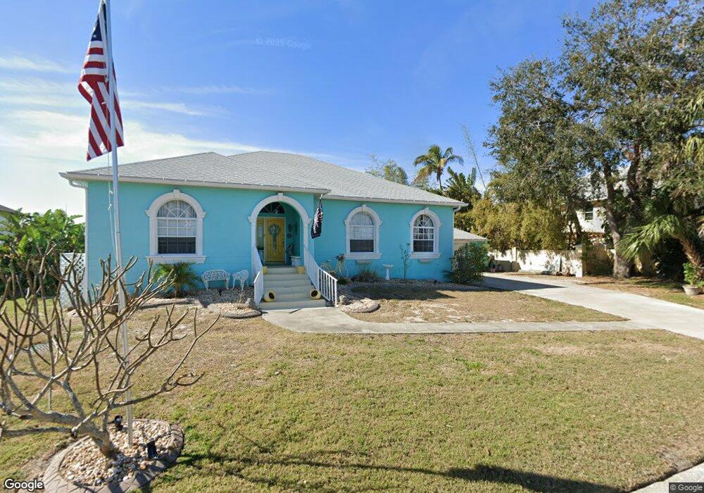
309 14th St SW Ruskin, FL 33570
Estimated Value: $518,000 - $658,000
3
Beds
3
Baths
3,795
Sq Ft
$155/Sq Ft
Est. Value
About This Home
This home is located at 309 14th St SW, Ruskin, FL 33570 and is currently estimated at $588,409, approximately $155 per square foot. 309 14th St SW is a home located in Hillsborough County with nearby schools including Ruskin Elementary School, Shields Middle School, and Lennard High School.
Ownership History
Date
Name
Owned For
Owner Type
Purchase Details
Closed on
Dec 31, 2009
Sold by
Romero Francis A
Bought by
Smith Dallas K and Smith Jill A
Current Estimated Value
Home Financials for this Owner
Home Financials are based on the most recent Mortgage that was taken out on this home.
Original Mortgage
$297,618
Outstanding Balance
$198,356
Interest Rate
5.25%
Mortgage Type
FHA
Estimated Equity
$390,053
Purchase Details
Closed on
Sep 6, 2001
Sold by
Ruskin Builders C
Bought by
Romero Francis
Create a Home Valuation Report for This Property
The Home Valuation Report is an in-depth analysis detailing your home's value as well as a comparison with similar homes in the area
Home Values in the Area
Average Home Value in this Area
Purchase History
| Date | Buyer | Sale Price | Title Company |
|---|---|---|---|
| Smith Dallas K | $339,000 | Commerce Title Services Inc | |
| Romero Francis | -- | -- |
Source: Public Records
Mortgage History
| Date | Status | Borrower | Loan Amount |
|---|---|---|---|
| Open | Smith Dallas K | $297,618 | |
| Previous Owner | Romero Francis | $136,750 |
Source: Public Records
Tax History Compared to Growth
Tax History
| Year | Tax Paid | Tax Assessment Tax Assessment Total Assessment is a certain percentage of the fair market value that is determined by local assessors to be the total taxable value of land and additions on the property. | Land | Improvement |
|---|---|---|---|---|
| 2024 | $4,176 | $243,007 | -- | -- |
| 2023 | $4,023 | $235,929 | $0 | $0 |
| 2022 | $3,734 | $223,778 | $0 | $0 |
| 2021 | $3,675 | $217,260 | $0 | $0 |
| 2020 | $3,583 | $214,260 | $0 | $0 |
| 2019 | $3,474 | $209,443 | $0 | $0 |
| 2018 | $3,378 | $205,538 | $0 | $0 |
| 2017 | $3,331 | $267,369 | $0 | $0 |
| 2016 | $3,290 | $197,169 | $0 | $0 |
| 2015 | $3,326 | $195,798 | $0 | $0 |
| 2014 | $3,300 | $194,244 | $0 | $0 |
| 2013 | -- | $196,981 | $0 | $0 |
Source: Public Records
Map
Nearby Homes
- 304 14th St SW
- 105 12th St SW
- 0 Sable Cove Unit MFRTB8439435
- 404 12th St SW
- 701 Madison St SW
- 0 11th St SW Unit MFRTB8366394
- 105 E North Branch Rd
- 102 W North Branch Rd
- 106 W North Branch Rd
- 100 18th St NW
- 119 18th St NW
- 1800 Kofresi Ct
- 1112 W Shell Point Rd Unit 207
- 1112 W Shell Point Rd Unit 107
- 1112 W Shell Point Rd Unit 511
- 1112 W Shell Point Rd Unit 504
- 602 10th St SW
- 828 Blue Heron Blvd
- 821 White Heron Blvd
- 1603 W Shell Point Rd
- 311 14th St SW
- 1404 Deirdre Dr
- 1402 Deirdre Dr
- 1406 Deirdre Dr
- 1411 Deirdre Dr
- 313 14th St SW
- 310 14th St SW
- 1408 Deirdre Dr
- 308 14th St SW
- 312 14th St SW
- 1410 Deirdre Dr
- 306 14th St SW
- 1405 Deirdre Dr
- 402 14th St SW
- 1412 Deirdre Dr
- 1407 W College Ave
- 413 14th St SW
- 1407 Deirdre Dr
- 1409 Deirdre Dr
- 1209 Chesterfield Ave