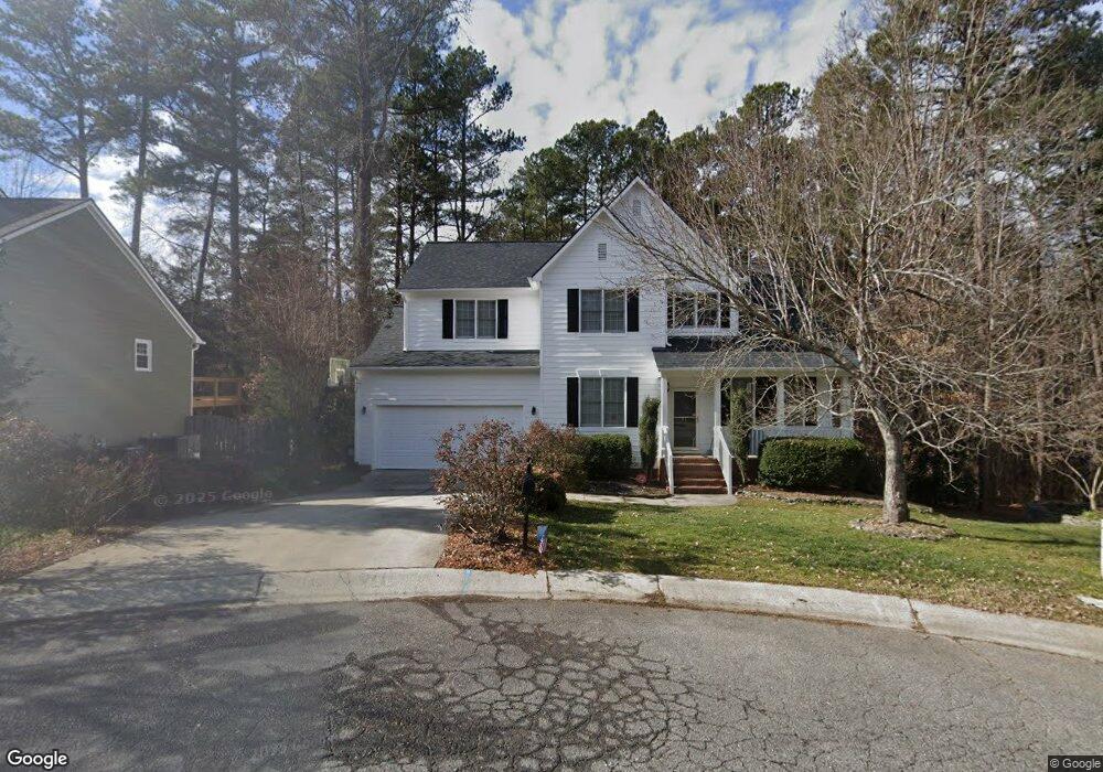
309 Alumni Ave Durham, NC 27713
South Durham NeighborhoodEstimated Value: $579,000 - $598,000
4
Beds
3
Baths
2,118
Sq Ft
$277/Sq Ft
Est. Value
About This Home
This home is located at 309 Alumni Ave, Durham, NC 27713 and is currently estimated at $586,125, approximately $276 per square foot. 309 Alumni Ave is a home located in Durham County with nearby schools including Lowe's Grove Middle, Hillside High School, and Southpoint Academy.
Ownership History
Date
Name
Owned For
Owner Type
Purchase Details
Closed on
May 24, 2002
Sold by
Johnson Melissa D and Johnson Mark Alan
Bought by
Young James L and Young Vivian B
Current Estimated Value
Home Financials for this Owner
Home Financials are based on the most recent Mortgage that was taken out on this home.
Original Mortgage
$175,900
Outstanding Balance
$74,224
Interest Rate
6.92%
Estimated Equity
$511,901
Purchase Details
Closed on
Feb 8, 1999
Sold by
Solaris Development Corp
Bought by
Johnson Mark Alan and Johnson Melissa D
Home Financials for this Owner
Home Financials are based on the most recent Mortgage that was taken out on this home.
Original Mortgage
$163,685
Interest Rate
6.73%
Create a Home Valuation Report for This Property
The Home Valuation Report is an in-depth analysis detailing your home's value as well as a comparison with similar homes in the area
Home Values in the Area
Average Home Value in this Area
Purchase History
| Date | Buyer | Sale Price | Title Company |
|---|---|---|---|
| Young James L | $220,000 | -- | |
| Johnson Mark Alan | $205,000 | -- |
Source: Public Records
Mortgage History
| Date | Status | Borrower | Loan Amount |
|---|---|---|---|
| Open | Young James L | $175,900 | |
| Previous Owner | Johnson Mark Alan | $163,685 |
Source: Public Records
Tax History
| Year | Tax Paid | Tax Assessment Tax Assessment Total Assessment is a certain percentage of the fair market value that is determined by local assessors to be the total taxable value of land and additions on the property. | Land | Improvement |
|---|---|---|---|---|
| 2025 | $5,587 | $563,632 | $195,225 | $368,407 |
| 2024 | $4,348 | $311,717 | $85,875 | $225,842 |
| 2023 | $4,083 | $311,717 | $85,875 | $225,842 |
| 2022 | $3,990 | $311,717 | $85,875 | $225,842 |
| 2021 | $3,971 | $311,717 | $85,875 | $225,842 |
| 2020 | $3,877 | $311,717 | $85,875 | $225,842 |
| 2019 | $3,877 | $311,717 | $85,875 | $225,842 |
| 2018 | $3,690 | $272,041 | $58,395 | $213,646 |
| 2017 | $3,663 | $272,041 | $58,395 | $213,646 |
| 2016 | $3,540 | $272,041 | $58,395 | $213,646 |
| 2015 | $3,835 | $277,068 | $67,283 | $209,785 |
| 2014 | $3,835 | $277,068 | $67,283 | $209,785 |
Source: Public Records
Map
Nearby Homes
- 1104 Scholastic Cir
- 1009 Chancellors Ridge Dr
- 102 College Ave
- 115 Chancellors Ridge Dr
- 1355 Southpoint Trail
- 1604 Timber Wolf Dr
- 208 Education Ave
- 1221 Bradburn Dr
- 408 Intern Way
- 822 Watercolor Way
- 204 S Bend Dr
- 202 S Bend Dr
- 7 Bobcat Ct
- 7907 Massey Chapel Rd
- 946 Watercolor Way
- 7502 Hedfield Way
- 1406 Excelsior Grand Ave
- 1008 Whistler St
- 139 Callowhill Ln
- 1009 Terrabella Way
- 311 Alumni Ave
- 307 Alumni Ave
- 206 Graduate Ct
- 204 Graduate Ct
- 303 Alumni Ave
- 310 Alumni Ave
- 208 Graduate Ct
- 308 Alumni Ave
- 306 Alumni Ave
- 217 Alumni Ave
- 304 Alumni Ave
- 302 Alumni Ave
- 210 Graduate Ct
- 215 Alumni Ave
- 216 Alumni Ave
- 108 Graduate Ct
- 214 Graduate Ct
- 211 Alumni Ave
- 210 Alumni Ave
- 104 Graduate Ct
Your Personal Tour Guide
Ask me questions while you tour the home.