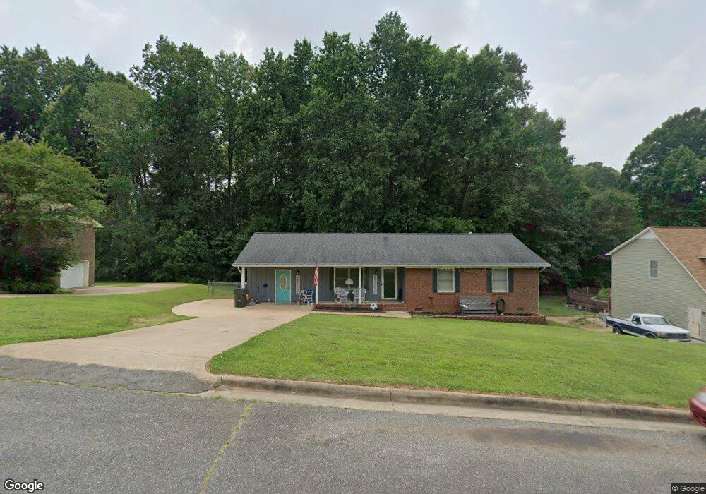
309 Amhurst Dr Kings Mountain, NC 28086
Estimated Value: $230,000 - $302,000
--
Bed
--
Bath
1,415
Sq Ft
$191/Sq Ft
Est. Value
About This Home
This home is located at 309 Amhurst Dr, Kings Mountain, NC 28086 and is currently estimated at $269,866, approximately $190 per square foot. 309 Amhurst Dr is a home located in Cleveland County with nearby schools including West Elementary School, Kings Mountain Middle, and Kings Mountain Intermediate School.
Ownership History
Date
Name
Owned For
Owner Type
Purchase Details
Closed on
Oct 9, 2012
Sold by
Morris Matthew C and Morris Kerri B
Bought by
Deaver Charles R and Deaver Tracy F
Current Estimated Value
Home Financials for this Owner
Home Financials are based on the most recent Mortgage that was taken out on this home.
Original Mortgage
$106,534
Outstanding Balance
$76,788
Interest Rate
4.4%
Mortgage Type
FHA
Estimated Equity
$193,078
Purchase Details
Closed on
Dec 29, 2005
Sold by
Latorre Albert and Latorre Mllena
Bought by
Morris Matthew C
Home Financials for this Owner
Home Financials are based on the most recent Mortgage that was taken out on this home.
Original Mortgage
$87,500
Interest Rate
6.28%
Mortgage Type
New Conventional
Purchase Details
Closed on
Jan 10, 2005
Sold by
Sizemore Sharon G
Bought by
Loorre Albert
Home Financials for this Owner
Home Financials are based on the most recent Mortgage that was taken out on this home.
Original Mortgage
$64,750
Interest Rate
6.12%
Mortgage Type
Adjustable Rate Mortgage/ARM
Create a Home Valuation Report for This Property
The Home Valuation Report is an in-depth analysis detailing your home's value as well as a comparison with similar homes in the area
Home Values in the Area
Average Home Value in this Area
Purchase History
| Date | Buyer | Sale Price | Title Company |
|---|---|---|---|
| Deaver Charles R | $108,500 | None Available | |
| Morris Matthew C | $87,500 | None Available | |
| Loorre Albert | $77,000 | None Available |
Source: Public Records
Mortgage History
| Date | Status | Borrower | Loan Amount |
|---|---|---|---|
| Open | Deaver Charles R | $106,534 | |
| Previous Owner | Morris Matthew C | $87,500 | |
| Previous Owner | Loorre Albert | $64,750 |
Source: Public Records
Tax History Compared to Growth
Tax History
| Year | Tax Paid | Tax Assessment Tax Assessment Total Assessment is a certain percentage of the fair market value that is determined by local assessors to be the total taxable value of land and additions on the property. | Land | Improvement |
|---|---|---|---|---|
| 2025 | $2,352 | $229,491 | $28,305 | $201,186 |
| 2024 | $2,011 | $170,122 | $22,644 | $147,478 |
| 2023 | $2,001 | $170,122 | $22,644 | $147,478 |
| 2022 | $1,916 | $170,122 | $22,644 | $147,478 |
| 2021 | $1,926 | $170,122 | $22,644 | $147,478 |
| 2020 | $1,531 | $131,250 | $15,850 | $115,400 |
| 2019 | $1,349 | $115,376 | $15,850 | $99,526 |
| 2018 | $1,348 | $115,376 | $15,850 | $99,526 |
| 2017 | $1,341 | $115,376 | $15,850 | $99,526 |
| 2016 | $1,345 | $115,376 | $15,850 | $99,526 |
| 2015 | $1,192 | $104,777 | $13,020 | $91,757 |
| 2014 | $1,192 | $104,777 | $13,020 | $91,757 |
Source: Public Records
Map
Nearby Homes
- 0 Southridge Dr Unit CAR4298120
- 804 Lee St
- 112 Fulton Dr
- 245 Paige Rd
- 230 Paige Rd
- 218 Paige Rd
- 149 Parker Claire Ln
- 227 Paige Rd
- 212 Paige Rd
- 123 Parker Claire Ln
- 430 Fulton Dr
- 143 Parker Claire Ln
- 137 Parker Claire Ln
- 157 Parker Claire Ln
- 104 Parker Claire Ln
- 207 Parker Claire Ln
- 219 Parker Claire Ln
- 419 Brinkley Dr
- Belhaven Plan at Brinkley Ridge
- Freeport Plan at Brinkley Ridge
- 307 Amhurst Dr
- 311 Amhurst Dr
- 308 Pinehurst Dr
- 305 Amhurst Dr
- 306 Pinehurst Dr
- 308 Amhurst Dr
- 310 Pinehurst Dr
- 306 Amhurst Dr
- 310 Amhurst Dr
- 805 Kingswood Ct
- 304 Pinehurst Dr
- 809 Kingswood Ct
- 809 Kingswood Ct Unit 37 & 38
- 304 Amhurst Dr
- 312 Amhurst Dr
- 303 Amhurst Dr
- 302 Amhurst Dr
- 307 Somerset Dr
- 309 Somerset Dr
- 314 Amhurst Dr