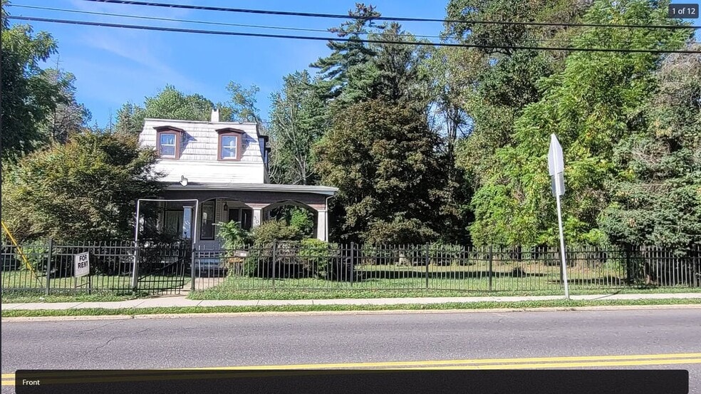


309 Branch Ave Little Silver, NJ 07739
About This Home
Welcome to your new home in charming Little Silver, NJ! This inviting property is perfectly situated minutes away from a variety of delightful restaurants and only six minutes from HMH Riverview Medical Center and new Netflix studios at Fort Monmouth. Enjoy the convenience of nearby Count Basie Park, ideal for outdoor activities and relaxation.
Key property features include convenient central heating and cooling, ensuring your comfort all year round. The space also offers air conditioning and ceiling fan options for those warmer days.
Flexible floor plan, perfect for those working from home with a private home office.
Please note that utilities such as gas, electricity, cable, internet, water, heating, and yard maintenance are not included in the rent. This allows you the flexibility to tailor services to your preferences.
Don't miss out on this fantastic opportunity to live in a desirable location! Contact us today to schedule a viewing and see for yourself what makes this property a perfect fit for you.

Map
- 32 Woodbine Ave
- 199 Pinckney Rd
- 1 George St
- 30 Crest Dr
- 87 Rumson Rd
- 82 Little Silver Pkwy
- 55 Cheshire Square
- 40 Brookside Ln
- 33 Willow Dr
- 36 Maple Ave
- 85 Tower Hill Dr Unit 608
- 50 Willow Dr
- 172 Woods End Dr
- 83 Tower Hill Dr
- 26 Prince Place
- 4 Manor Dr
- 104 Garden Rd
- 132 Harrison Ave
- 70 Hudson Ave
- 58 Hudson Ave
- 183 Branch Ave
- 65 Little Silver Pkwy
- 142 South St Unit 10-B
- 137 E Bergen Place
- 180 Hudson Ave Unit 182
- 127-131 Hudson Ave
- 82 Manor Dr Unit 803
- 139 Manor Dr
- 169 Manor Dr
- 32 Manor Dr Unit 303
- 64 Harding Rd
- 35 Birch Ave
- 208 E Bergen Place
- 223 Maple Ave Unit 2
- 106 Wallace St Unit B
- 50 Waverly Place
- 50 Peters Place
- 24 Mechanic St Unit 208
- 24 Mechanic St
- 87 Maple Ave Unit 2