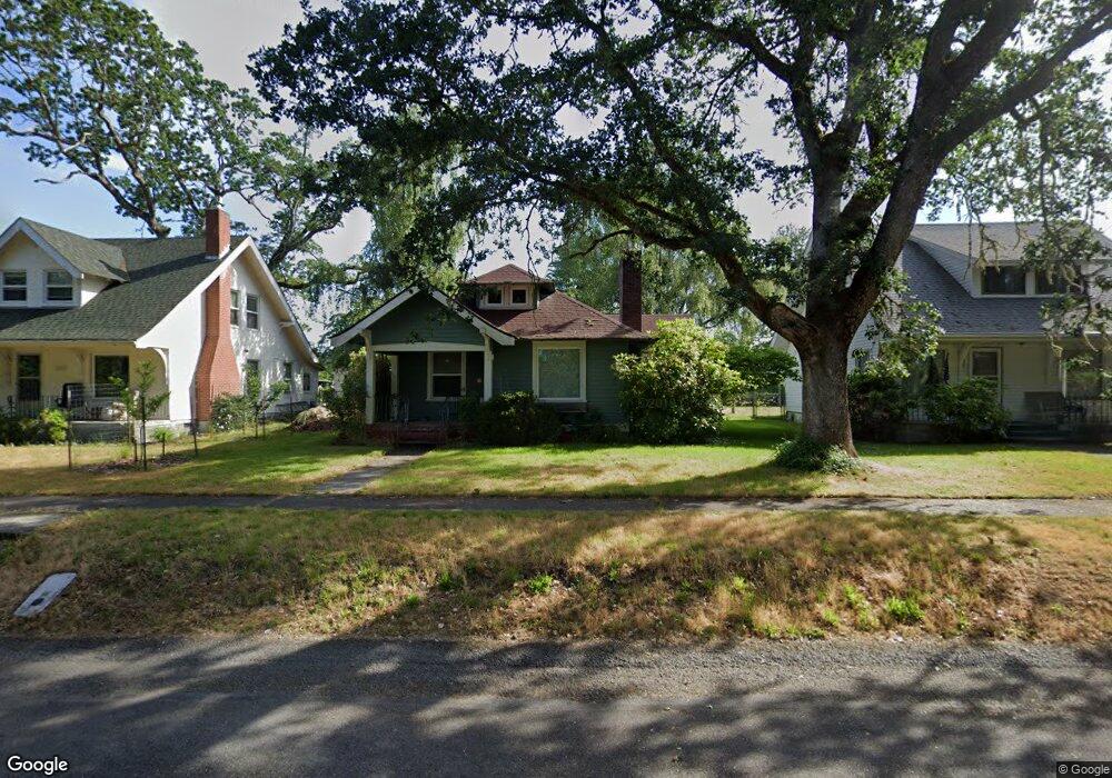
309 Brandywine Ave Dupont, WA 98327
Estimated Value: $350,000 - $506,000
4
Beds
2
Baths
1,321
Sq Ft
$319/Sq Ft
Est. Value
About This Home
This home is located at 309 Brandywine Ave, Dupont, WA 98327 and is currently estimated at $421,787, approximately $319 per square foot. 309 Brandywine Ave is a home located in Pierce County with nearby schools including Chloe Clark Elementary School, Saltars Point Elementary School, and Pioneer Middle School.
Ownership History
Date
Name
Owned For
Owner Type
Purchase Details
Closed on
Jun 24, 2002
Sold by
Grant Robert W
Bought by
Wyant Steven B and Wyant Crystal L
Current Estimated Value
Home Financials for this Owner
Home Financials are based on the most recent Mortgage that was taken out on this home.
Original Mortgage
$106,000
Interest Rate
6.86%
Mortgage Type
Balloon
Purchase Details
Closed on
May 19, 1995
Sold by
Grant Harriet A
Bought by
Grant Robert W and The Grant Family Irrevocable Trust
Create a Home Valuation Report for This Property
The Home Valuation Report is an in-depth analysis detailing your home's value as well as a comparison with similar homes in the area
Home Values in the Area
Average Home Value in this Area
Purchase History
| Date | Buyer | Sale Price | Title Company |
|---|---|---|---|
| Wyant Steven B | $106,000 | -- | |
| Grant Robert W | -- | -- |
Source: Public Records
Mortgage History
| Date | Status | Borrower | Loan Amount |
|---|---|---|---|
| Closed | Wyant Steven B | $106,000 |
Source: Public Records
Tax History Compared to Growth
Tax History
| Year | Tax Paid | Tax Assessment Tax Assessment Total Assessment is a certain percentage of the fair market value that is determined by local assessors to be the total taxable value of land and additions on the property. | Land | Improvement |
|---|---|---|---|---|
| 2025 | $2,715 | $399,600 | $188,800 | $210,800 |
| 2024 | $2,715 | $391,800 | $184,700 | $207,100 |
| 2023 | $2,715 | $336,900 | $160,200 | $176,700 |
| 2022 | $2,581 | $350,900 | $167,500 | $183,400 |
| 2021 | $2,779 | $275,700 | $120,700 | $155,000 |
| 2019 | $2,148 | $239,200 | $97,300 | $141,900 |
| 2018 | $2,254 | $209,700 | $83,800 | $125,900 |
| 2017 | $1,910 | $192,800 | $75,600 | $117,200 |
| 2016 | $1,777 | $156,000 | $59,900 | $96,100 |
| 2014 | $1,793 | $157,600 | $59,900 | $97,700 |
| 2013 | $1,793 | $140,700 | $61,100 | $79,600 |
Source: Public Records
Map
Nearby Homes
- 208 Barksdale Ave
- 604 Dupont Ave
- 1451 Thompson Cir Unit 4A
- 1613 Palisade Blvd
- 1625 Palisade Blvd
- 1607 Kincaid St Unit E-8
- 2104 Palisade Blvd Unit B-7
- 1449 Bobs Hollow Ln
- 2147 Hammond Ave Unit B10
- 1856 Spencer Ct Unit 12F
- 2176 Palisade Blvd Unit F-3
- 2160 Anderson Ave
- 2198 Palisade Blvd Unit C2
- 2176 McDonald Ave
- 1151 Griggs St
- 1187 Griggs St Unit 1187
- 2237 Tolmie St
- 2696 Erwin Ave Unit 2696
- 1331 Rowan Ct Unit 1331
- 1263 Hudson St
- 307 Brandywine Ave
- 311 Brandywine Ave
- 305 Brandywine Ave
- 310 Barksdale Ave
- 306 Barksdale Ave
- 401 Brandywine Ave
- 302 Barksdale Ave
- 301 Brandywine Ave
- 400 Barksdale Ave
- 300 Barksdale Ave
- 402 Barksdale Ave
- 404 Barksdale Ave
- 211 Brandywine Ave
- 309 Barksdale Ave
- 406 Barksdale Ave
- 311 Barksdale Ave
- 210 Barksdale Ave
- 305 Barksdale Ave
- 210 Brandywine Ave
- 209 Brandywine Ave