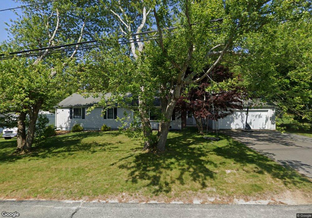
309 Buckskin Path Centerville, MA 02632
Centerville NeighborhoodEstimated Value: $616,000 - $652,000
3
Beds
2
Baths
1,473
Sq Ft
$426/Sq Ft
Est. Value
About This Home
This home is located at 309 Buckskin Path, Centerville, MA 02632 and is currently estimated at $627,263, approximately $425 per square foot. 309 Buckskin Path is a home located in Barnstable County with nearby schools including Centerville Elementary School, Barnstable United Elementary School, and Barnstable Intermediate School.
Ownership History
Date
Name
Owned For
Owner Type
Purchase Details
Closed on
Sep 30, 2011
Sold by
Sullivan Christopher J and Mccurdy Kathleen
Bought by
Harron Philip L
Current Estimated Value
Home Financials for this Owner
Home Financials are based on the most recent Mortgage that was taken out on this home.
Original Mortgage
$204,676
Outstanding Balance
$140,603
Interest Rate
4.25%
Mortgage Type
FHA
Estimated Equity
$486,660
Purchase Details
Closed on
Jan 18, 2011
Sold by
Mccurdy Dona E and Mccurdy Richard G
Bought by
Mccurdy Kathleen
Create a Home Valuation Report for This Property
The Home Valuation Report is an in-depth analysis detailing your home's value as well as a comparison with similar homes in the area
Home Values in the Area
Average Home Value in this Area
Purchase History
| Date | Buyer | Sale Price | Title Company |
|---|---|---|---|
| Harron Philip L | $210,000 | -- | |
| Mccurdy Kathleen | -- | -- |
Source: Public Records
Mortgage History
| Date | Status | Borrower | Loan Amount |
|---|---|---|---|
| Open | Harron Philip L | $204,676 |
Source: Public Records
Tax History
| Year | Tax Paid | Tax Assessment Tax Assessment Total Assessment is a certain percentage of the fair market value that is determined by local assessors to be the total taxable value of land and additions on the property. | Land | Improvement |
|---|---|---|---|---|
| 2025 | $4,611 | $570,000 | $151,900 | $418,100 |
| 2024 | $4,424 | $566,400 | $151,900 | $414,500 |
| 2023 | $4,176 | $500,700 | $138,100 | $362,600 |
| 2022 | $4,019 | $416,900 | $102,300 | $314,600 |
| 2021 | $3,778 | $360,200 | $102,300 | $257,900 |
| 2020 | $3,681 | $335,900 | $102,300 | $233,600 |
| 2019 | $3,513 | $311,400 | $102,300 | $209,100 |
| 2018 | $3,118 | $277,900 | $107,700 | $170,200 |
| 2017 | $2,907 | $270,200 | $107,700 | $162,500 |
| 2016 | $2,954 | $271,000 | $108,500 | $162,500 |
| 2015 | $2,848 | $262,500 | $105,100 | $157,400 |
Source: Public Records
Map
Nearby Homes
- 296 Buckskin Path
- 315 Prince Hinckley Rd
- 900 Old Stage Rd
- 82 Yacht Club Rd
- 66 Tern Ln
- 62 Three Ponds Dr
- 87 Foxglove Rd
- 51 Larch Ln
- 19 Marrick Ct
- 324 Patriot Way
- 1028 Old Falmouth Rd
- 53 Meadow Farm Rd
- 52 Meadow Farm Rd
- 103 Pine Tree Dr
- 200 Lumbert Mill Rd
- 7 Ebenezer
- 74 Saddler Ln
- 40 Sachem Dr
- 481 Lakeside Dr W
- 83 Lake Dr
- 297 Buckskin Path
- 319 Buckskin Path
- 142 Skunknet Rd
- 152 Skunknet Rd
- 306 Buckskin Path
- 132 Skunknet Rd
- 287 Buckskin Path
- 316 Buckskin Path
- 162 Skunknet Rd
- 331 Buckskin Path
- 326 Buckskin Path
- 122 Skunknet Rd
- 286 Buckskin Path
- 172 Skunknet Rd
- 277 Buckskin Path
- 343 Buckskin Path
- 336 Buckskin Path
- 87 Thoreau Dr
- 97 Thoreau Dr
- 112 Skunknet Rd
Your Personal Tour Guide
Ask me questions while you tour the home.