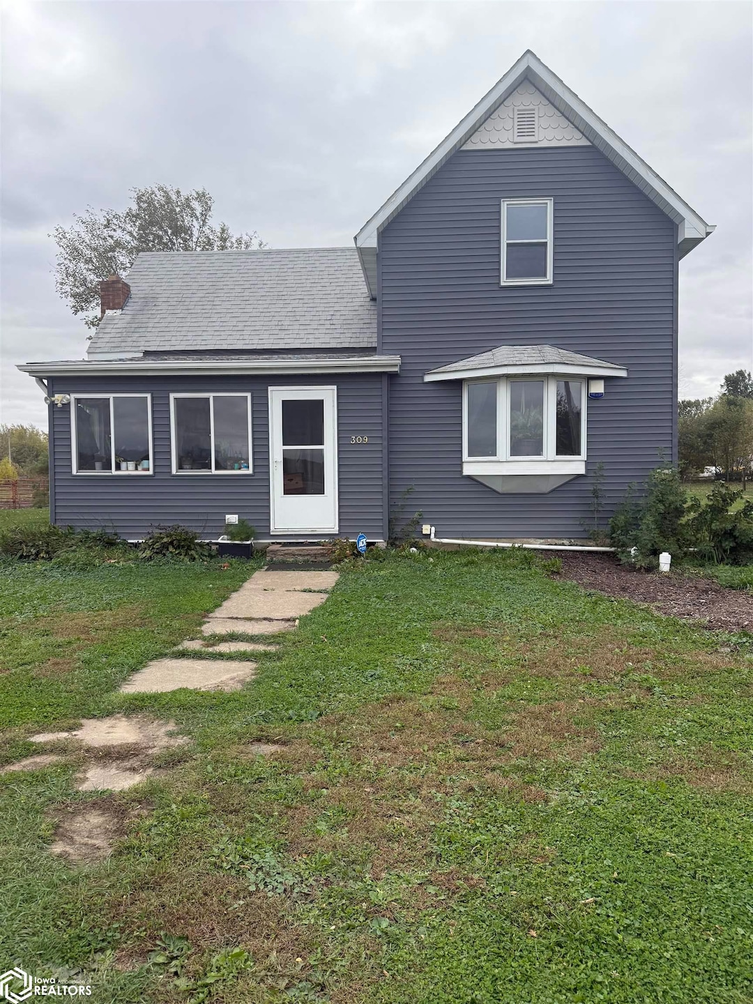


309 E Jacob St Montour, IA 50173
Estimated payment $1,430/month
About This Lot
In-Town Acreage on Over 4 Acres – A Rare Find! Discover the perfect blend of space, privacy, and convenience with this unique 1 1⁄2 story home nestled on over 4 scenic acres right in town, offering the best of both worlds. The home features 3 to 4 bedrooms and 1 full bathroom, with original character and plenty of potential to make it your own. The cozy main level includes a bright kitchen, inviting living area. Step outside to enjoy peaceful mornings and quiet evenings on the deck. Two outbuildings provide excellent storage, workshop space, or hobby areas – ideal for those with equipment, animals, or entrepreneurial dreams. Whether you're looking for a mini homestead, a place to garden and grow, or just room to roam without sacrificing location, this rare in-town acreage has it all
Property Details
Property Type
- Land
Year Built
- Built in 1900
Parking
- 2
Additional Features
- Partial Basement
- Lot Dimensions are 99x150
- Forced Air Heating System
Map
Tax History
We collect this data history from publicly available records. To have your information removed, we recommend requesting removal directly through your county’s website.
| Year | Tax Paid | Tax Assessment Tax Assessment Total Assessment is a certain percentage of the fair market value that is determined by local assessors to be the total taxable value of land and additions on the property. | Land | Improvement |
|---|---|---|---|---|
| 2025 | $1,648 | $112,630 | $31,050 | $81,580 |
| 2024 | $1,752 | $109,760 | $31,050 | $78,710 |
| 2023 | $2,170 | $109,760 | $31,050 | $78,710 |
| 2022 | $1,882 | $109,210 | $31,050 | $78,160 |
| 2021 | $1,878 | $98,780 | $11,310 | $87,470 |
| 2020 | $14 | $92,990 | $11,310 | $81,680 |
| 2019 | $1,368 | $68,290 | $10,110 | $58,180 |
| 2018 | $1,290 | $68,290 | $10,110 | $58,180 |
| 2017 | $1,290 | $68,290 | $10,110 | $58,180 |
| 2016 | $1,484 | $71,020 | $10,110 | $60,910 |
| 2015 | $1,444 | $71,020 | $10,110 | $60,910 |
| 2014 | $1,444 | $69,070 | $10,110 | $58,960 |
Property History
We collect this data history from publicly available records. To have your information removed, we recommend requesting removal directly through your county’s website.
| Date | Event | Price | List to Sale | Price per Sq Ft |
|---|---|---|---|---|
| 05/19/2026 05/19/26 | Pending | -- | -- | -- |
| 10/21/2025 10/21/25 | For Sale | $239,900 | -- | $127 / Sq Ft |
Purchase History
We collect this data history from publicly available records. To have your information removed, we recommend requesting removal directly through your county’s website.
| Date | Type | Sale Price | Title Company |
|---|---|---|---|
| Warranty Deed | $190,000 | None Listed On Document |
Source: NoCoast MLS
MLS Number: NOC6333021
APN: 13.21.484.005
Disclaimer: Certain information contained herein is derived from information provided by parties other than Homes.com. All information provided is deemed reliable, but is not guaranteed to be accurate and should be independently verified.
![]() All data is obtained from various sources and may not have been verified by broker or MLS GRID. Supplied Open House Information is subject to change without notice. All information should be independently reviewed and verified for accuracy. Properties may or may not be listed by the office/agent presenting the information. Some IDX listings have been excluded from this website. IDX information is provided exclusively for personal, non-commercial use, and may not be used for any purpose other than to identify prospective properties consumers may be interested in purchasing.
All data is obtained from various sources and may not have been verified by broker or MLS GRID. Supplied Open House Information is subject to change without notice. All information should be independently reviewed and verified for accuracy. Properties may or may not be listed by the office/agent presenting the information. Some IDX listings have been excluded from this website. IDX information is provided exclusively for personal, non-commercial use, and may not be used for any purpose other than to identify prospective properties consumers may be interested in purchasing.
Information is deemed reliable but not guaranteed.
Listings courtesy of NoCoast MLS as distributed by MLS GRID.
Based on information submitted to the MLS GRID
- 3434 Highway T47
- 502 1/2 Crestview Dr
- 3615 Highway T47
- 1735 305th St
- 1010 W 13th St Unit TA
- 1307 Country Club Dr
- 301 W 13th St
- 1308 Washington St
- 1311 Harding St
- 1407 Grant St
- 1608 Grant St
- 207 W State St
- 207 W Madison St
- 608 S Broadway St
- 801 Siegel St Unit TA
- 606 Siegel St
- 1511 State St
- 201 E Ohio St
- 1010 State St
- 301 N Church St

Ask me questions while you tour the home.