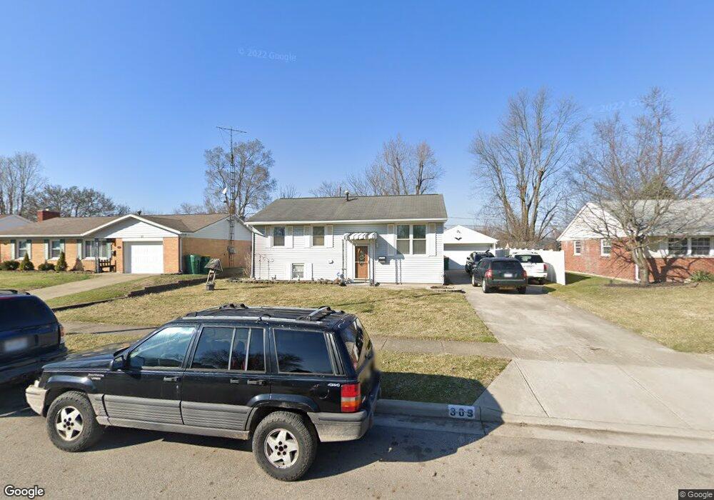
309 Flora Ave New Carlisle, OH 45344
Estimated Value: $142,000 - $168,927
3
Beds
2
Baths
999
Sq Ft
$158/Sq Ft
Est. Value
About This Home
This home is located at 309 Flora Ave, New Carlisle, OH 45344 and is currently estimated at $157,982, approximately $158 per square foot. 309 Flora Ave is a home located in Clark County with nearby schools including New Carlisle Elementary School, Park Layne Elementary School, and Donnelsville Elementary School.
Ownership History
Date
Name
Owned For
Owner Type
Purchase Details
Closed on
Feb 26, 2021
Sold by
Dilley Virginia Sue and Estate Of Estate Of Mary C Whi
Bought by
Dilley James F
Current Estimated Value
Home Financials for this Owner
Home Financials are based on the most recent Mortgage that was taken out on this home.
Original Mortgage
$2,125
Outstanding Balance
$1,908
Interest Rate
3.05%
Mortgage Type
New Conventional
Estimated Equity
$156,074
Purchase Details
Closed on
Oct 1, 1985
Sold by
Smith Betty L
Bought by
Whiting Roger W and Whiting Mary C
Create a Home Valuation Report for This Property
The Home Valuation Report is an in-depth analysis detailing your home's value as well as a comparison with similar homes in the area
Home Values in the Area
Average Home Value in this Area
Purchase History
| Date | Buyer | Sale Price | Title Company |
|---|---|---|---|
| Dilley James F | $85,000 | None Available | |
| Whiting Roger W | $45,500 | -- |
Source: Public Records
Mortgage History
| Date | Status | Borrower | Loan Amount |
|---|---|---|---|
| Open | Dilley James F | $2,125 | |
| Open | Dilley James F | $85,858 |
Source: Public Records
Tax History Compared to Growth
Tax History
| Year | Tax Paid | Tax Assessment Tax Assessment Total Assessment is a certain percentage of the fair market value that is determined by local assessors to be the total taxable value of land and additions on the property. | Land | Improvement |
|---|---|---|---|---|
| 2024 | $1,820 | $36,230 | $6,930 | $29,300 |
| 2023 | $1,820 | $36,230 | $6,930 | $29,300 |
| 2022 | $1,823 | $36,230 | $6,930 | $29,300 |
| 2021 | $1,698 | $29,820 | $5,460 | $24,360 |
| 2020 | $1,702 | $29,820 | $5,460 | $24,360 |
| 2019 | $1,235 | $29,820 | $5,460 | $24,360 |
| 2018 | $1,062 | $25,550 | $6,450 | $19,100 |
| 2017 | $989 | $27,213 | $6,451 | $20,762 |
| 2016 | $983 | $27,213 | $6,451 | $20,762 |
| 2015 | $930 | $26,471 | $6,451 | $20,020 |
| 2014 | $921 | $26,471 | $6,451 | $20,020 |
| 2013 | $923 | $26,471 | $6,451 | $20,020 |
Source: Public Records
Map
Nearby Homes
- 315 Fenwick Dr
- 202 Fenwick Dr
- 805 Brookfield Dr
- 211 N Clay St
- 906 N Scott St
- 1204 N Scott St
- 315 N Main St
- 210 Zimmerman St
- 203 Monroe Way
- 1212 N Scott St
- 1206 N Scott St
- 1205 N Scott St
- 1209 N Scott St
- 1210 N Scott St
- Spruce Plan at Monroe Meadows
- Norway Plan at Monroe Meadows
- 201 Monroe Way
- Cooper Plan at Monroe Meadows
- Chestnut Plan at Monroe Meadows
- Ashton Plan at Monroe Meadows