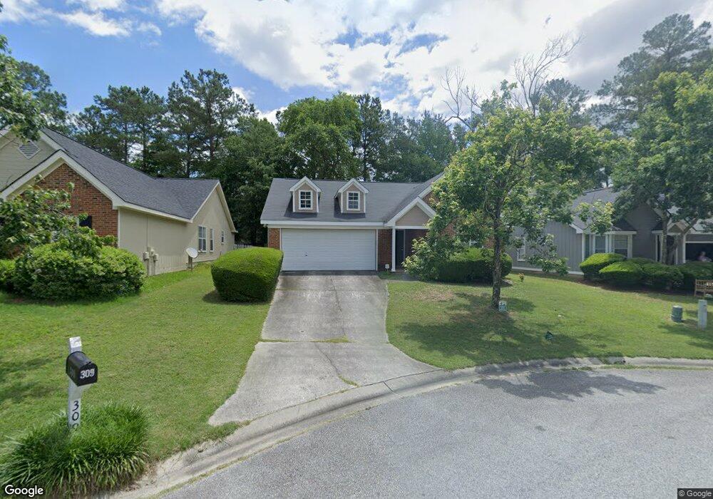
309 Foxcroft Ln Macon, GA 31220
Estimated Value: $198,180 - $228,000
3
Beds
2
Baths
1,439
Sq Ft
$149/Sq Ft
Est. Value
About This Home
This home is located at 309 Foxcroft Ln, Macon, GA 31220 and is currently estimated at $214,795, approximately $149 per square foot. 309 Foxcroft Ln is a home located in Bibb County with nearby schools including Union Elementary School, Weaver Middle School, and Westside High School.
Ownership History
Date
Name
Owned For
Owner Type
Purchase Details
Closed on
Sep 26, 2005
Sold by
Thompson Buffie Patrice
Bought by
King Marquette
Current Estimated Value
Home Financials for this Owner
Home Financials are based on the most recent Mortgage that was taken out on this home.
Original Mortgage
$23,600
Outstanding Balance
$12,485
Interest Rate
5.77%
Mortgage Type
Stand Alone Second
Estimated Equity
$202,310
Purchase Details
Closed on
Feb 19, 1997
Create a Home Valuation Report for This Property
The Home Valuation Report is an in-depth analysis detailing your home's value as well as a comparison with similar homes in the area
Purchase History
| Date | Buyer | Sale Price | Title Company |
|---|---|---|---|
| King Marquette | $118,000 | None Available | |
| -- | $97,900 | -- |
Source: Public Records
Mortgage History
| Date | Status | Borrower | Loan Amount |
|---|---|---|---|
| Open | King Marquette | $23,600 |
Source: Public Records
Tax History
| Year | Tax Paid | Tax Assessment Tax Assessment Total Assessment is a certain percentage of the fair market value that is determined by local assessors to be the total taxable value of land and additions on the property. | Land | Improvement |
|---|---|---|---|---|
| 2025 | $1,415 | $64,583 | $13,000 | $51,583 |
| 2024 | $1,462 | $64,583 | $13,000 | $51,583 |
| 2023 | $1,706 | $64,583 | $13,000 | $51,583 |
| 2022 | $1,739 | $57,241 | $9,200 | $48,041 |
| 2021 | $1,559 | $48,034 | $8,000 | $40,034 |
| 2020 | $1,593 | $48,034 | $8,000 | $40,034 |
| 2019 | $1,606 | $48,034 | $8,000 | $40,034 |
| 2018 | $2,640 | $48,034 | $8,000 | $40,034 |
| 2017 | $1,800 | $48,034 | $8,000 | $40,034 |
| 2016 | $1,662 | $48,034 | $8,000 | $40,034 |
| 2015 | $2,352 | $48,034 | $8,000 | $40,034 |
| 2014 | $2,356 | $48,034 | $8,000 | $40,034 |
Source: Public Records
Map
Nearby Homes
- 305 Foxcroft Ln
- 313 Foxcroft Ln
- 301 Foxcroft Ln
- 405 Simsbury Ridge
- 409 Simsbury Ridge
- 401 Simsbury Ridge
- 413 Simsbury Ridge
- 312 Foxcroft Ln
- 304 Foxcroft Ln
- 308 Foxcroft Ln
- 300 Foxcroft Ln
- 145 Simsbury Ln
- 141 Simsbury Ln Unit 119
- 137 Simsbury Ln
- 149 Simsbury Ln
- 133 Simsbury Ln
- 408 Simsbury Ridge
- 400 Simsbury Ridge
- 412 Simsbury Ridge
- 129 Simsbury Ln
Your Personal Tour Guide
Ask me questions while you tour the home.