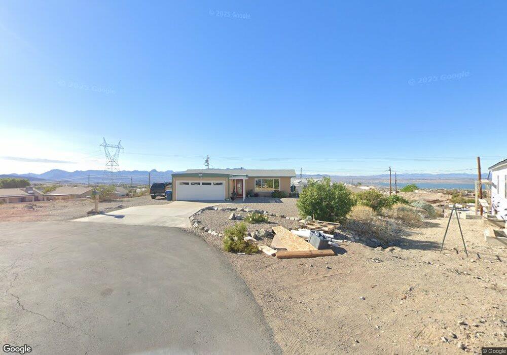
309 Hound Cir Lake Havasu City, AZ 86404
Estimated Value: $230,000 - $367,000
2
Beds
1
Bath
1,152
Sq Ft
$265/Sq Ft
Est. Value
About This Home
This home is located at 309 Hound Cir, Lake Havasu City, AZ 86404 and is currently estimated at $304,995, approximately $264 per square foot. 309 Hound Cir is a home located in Mohave County with nearby schools including Havasupai Elementary School, Thunderbolt Middle School, and Lake Havasu High School.
Ownership History
Date
Name
Owned For
Owner Type
Purchase Details
Closed on
Mar 5, 2010
Sold by
Wells Fargo Bank Na
Bought by
Mellinger Gwen and Coppola Phil
Current Estimated Value
Purchase Details
Closed on
Dec 10, 2009
Sold by
Wood Rosemarie
Bought by
Wachovia Mortgage Fsb
Purchase Details
Closed on
Apr 25, 2007
Sold by
Wood Michael W M
Bought by
Wood Rosemarie
Home Financials for this Owner
Home Financials are based on the most recent Mortgage that was taken out on this home.
Original Mortgage
$126,750
Interest Rate
6.11%
Mortgage Type
Stand Alone Refi Refinance Of Original Loan
Purchase Details
Closed on
Mar 27, 2003
Sold by
Hartsuiker Julia A
Bought by
Wood Michael W M and Wood Rosemarie
Create a Home Valuation Report for This Property
The Home Valuation Report is an in-depth analysis detailing your home's value as well as a comparison with similar homes in the area
Home Values in the Area
Average Home Value in this Area
Purchase History
| Date | Buyer | Sale Price | Title Company |
|---|---|---|---|
| Mellinger Gwen | $78,000 | Pioneer Title Agency Inc | |
| Wachovia Mortgage Fsb | $92,000 | Fidelity Natl Title Ins Co | |
| Wood Rosemarie | -- | Grand Canyon Title Agency | |
| Wood Michael W M | $114,000 | Transnation Title Insurance |
Source: Public Records
Mortgage History
| Date | Status | Borrower | Loan Amount |
|---|---|---|---|
| Previous Owner | Wood Rosemarie | $126,750 |
Source: Public Records
Tax History Compared to Growth
Tax History
| Year | Tax Paid | Tax Assessment Tax Assessment Total Assessment is a certain percentage of the fair market value that is determined by local assessors to be the total taxable value of land and additions on the property. | Land | Improvement |
|---|---|---|---|---|
| 2026 | -- | -- | -- | -- |
| 2025 | $795 | $25,154 | $0 | $0 |
| 2024 | $795 | $25,911 | $0 | $0 |
| 2023 | $795 | $21,950 | $0 | $0 |
| 2022 | $760 | $13,768 | $0 | $0 |
| 2021 | $912 | $12,901 | $0 | $0 |
| 2019 | $870 | $9,225 | $0 | $0 |
| 2018 | $843 | $9,075 | $0 | $0 |
| 2017 | $836 | $7,864 | $0 | $0 |
| 2016 | $764 | $7,593 | $0 | $0 |
| 2015 | $735 | $6,391 | $0 | $0 |
Source: Public Records
Map
Nearby Homes
- 3410 Kiowa Blvd S
- 3461 Antelope Dr
- 3351 Kiowa Blvd S
- 3501 Amberwood Place
- 3550 Tecumseh Dr
- 3493 Mitchell Ln
- 3390 Amberwood Ave
- 3446 S Amberwood Bay
- 3306 Kiowa Blvd S
- 3210 Crestview Dr
- 3525 Kiowa Blvd S
- 3504 Pioneer Dr
- 3381 El Dorado Ave N
- 3180 Maracaibo Dr
- 3410 El Dorado Ave N
- 3098 Wrangler Ln S
- 3118 Maverick Dr
- 3196 Oakwood Dr
- 3425 Palo Verde Blvd S
- 3250 El Dorado Ave N