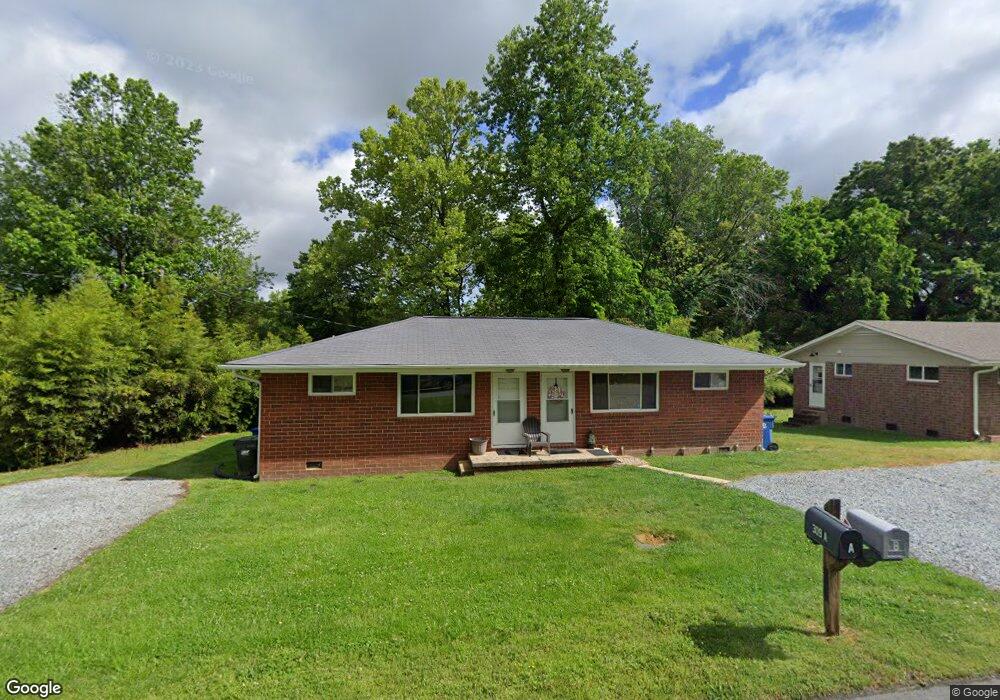
309 Kersey Dr Archdale, NC 27263
Estimated Value: $124,000 - $214,000
--
Bed
2
Baths
1,248
Sq Ft
$124/Sq Ft
Est. Value
About This Home
This home is located at 309 Kersey Dr, Archdale, NC 27263 and is currently estimated at $154,194, approximately $123 per square foot. 309 Kersey Dr is a home located in Randolph County with nearby schools including Archdale Elementary School, Wheatmore Middle School, and Trinity High School.
Ownership History
Date
Name
Owned For
Owner Type
Purchase Details
Closed on
Apr 8, 2004
Sold by
Riffe Michael Darren and Riffe Kimberley Eller
Bought by
Griggs John L and Petree Joseph M
Current Estimated Value
Home Financials for this Owner
Home Financials are based on the most recent Mortgage that was taken out on this home.
Original Mortgage
$68,400
Outstanding Balance
$31,698
Interest Rate
5.55%
Mortgage Type
Purchase Money Mortgage
Estimated Equity
$122,496
Create a Home Valuation Report for This Property
The Home Valuation Report is an in-depth analysis detailing your home's value as well as a comparison with similar homes in the area
Home Values in the Area
Average Home Value in this Area
Purchase History
| Date | Buyer | Sale Price | Title Company |
|---|---|---|---|
| Griggs John L | $72,000 | -- |
Source: Public Records
Mortgage History
| Date | Status | Borrower | Loan Amount |
|---|---|---|---|
| Open | Griggs John L | $68,400 |
Source: Public Records
Tax History Compared to Growth
Tax History
| Year | Tax Paid | Tax Assessment Tax Assessment Total Assessment is a certain percentage of the fair market value that is determined by local assessors to be the total taxable value of land and additions on the property. | Land | Improvement |
|---|---|---|---|---|
| 2025 | $1,592 | $92,740 | $18,500 | $74,240 |
| 2024 | $1,576 | $92,740 | $18,500 | $74,240 |
| 2023 | $1,576 | $92,740 | $18,500 | $74,240 |
| 2022 | $778 | $65,640 | $14,400 | $51,240 |
| 2021 | $778 | $65,640 | $14,400 | $51,240 |
| 2020 | $760 | $65,640 | $14,400 | $51,240 |
| 2019 | $760 | $65,640 | $14,400 | $51,240 |
| 2018 | $588 | $49,530 | $9,580 | $39,950 |
| 2016 | $577 | $49,531 | $9,580 | $39,951 |
| 2015 | $578 | $49,531 | $9,580 | $39,951 |
| 2014 | $578 | $49,531 | $9,580 | $39,951 |
Source: Public Records
Map
Nearby Homes
- 10844 N Main St
- 10812, 10822, 10828 N Main St
- 706 E Fairfield Rd
- 600 E Fairfield Rd
- 302 Brittany Way
- 3813 Salisbury St
- 512 Dale St
- 327 Wynnewood Dr
- 1020 Westbrook Ct
- 3820 David St
- 112 Havenwood Dr
- 1103 Pegram Ave
- 2716 Allen Jay Rd
- 2708 Ernest St
- 1009 Harb Dr
- 1011 Harb Dr
- 926 Norton St
- 1010 Harb Dr
- 1846 Sechrest Cir
- 102 Quakerwood Dr
- 305 Kersey Dr
- 311 Kersey Dr
- 313 Kersey Dr Unit B
- 304 Kersey Dr
- 302 Kersey Dr Unit A
- 302 Kersey Dr
- 301 Kersey Dr
- 306 Hayworth St
- 216 Kersey Dr
- 315 Kersey Dr
- 310 Hayworth St
- 227 Liberty Rd
- 310 Stratford Rd
- 305 Liberty Rd
- 312 Stratford Rd
- 324 Stratford Rd
- 307 Liberty Rd
- 328 Stratford Rd
- 0 Kersey Dr
- 308 Stratford Rd